 with our Megalithic Portal iPhone app")

<< Image Pages >> Eridu - Ancient Village or Settlement in Iraq
Submitted by AlexHunger on Saturday, 04 November 2006 Page Views: 11377
Multi-periodSite Name: Eridu Alternative Name: Eridug, Urudug, UnugCountry: Iraq
NOTE: This site is 271.311 km away from the location you searched for.
Type: Ancient Village or Settlement
Nearest Town: An Nasiriyah Nearest Village: Abu Shahrein
Latitude: 30.816751N Longitude: 45.985681E
Condition:
| 5 | Perfect |
| 4 | Almost Perfect |
| 3 | Reasonable but with some damage |
| 2 | Ruined but still recognisable as an ancient site |
| 1 | Pretty much destroyed, possibly visible as crop marks |
| 0 | No data. |
| -1 | Completely destroyed |
| 5 | Superb |
| 4 | Good |
| 3 | Ordinary |
| 2 | Not Good |
| 1 | Awful |
| 0 | No data. |
| 5 | Can be driven to, probably with disabled access |
| 4 | Short walk on a footpath |
| 3 | Requiring a bit more of a walk |
| 2 | A long walk |
| 1 | In the middle of nowhere, a nightmare to find |
| 0 | No data. |
| 5 | co-ordinates taken by GPS or official recorded co-ordinates |
| 4 | co-ordinates scaled from a detailed map |
| 3 | co-ordinates scaled from a bad map |
| 2 | co-ordinates of the nearest village |
| 1 | co-ordinates of the nearest town |
| 0 | no data |
Be the first person to rate this site - see the 'Contribute!' box in the right hand menu.
Internal Links:
External Links:
")
Eridu is considered to be one of the very first urban settlements in Sumeria, dating to the fourth or fifth millennium BCE when it began as a village and is about 10 Km southwest of Ur, also one of the oldest citis in Mesopotamia. Eridu was most likely closer to the Persian Gulf near the mouth of the Euphrates River, but is now further away due to the accumulation of silt at the shoreline over the last 7 millennia. Eridu was the site of Enki's (the Sumerian version of the Akkadian water-god Ea) temple called E-abzu ("the abzu temple") as it was located at the edge of a swamp, or apsû. The mudbrick and reed houses urban settlement was centered on a mudbrick temple complex including the unfinished Ziggurat of Amar-Sin. By about 2050 BCE the city had gone into permanebt declined as there is little evidence of occupation after that date. The site was first excavated between 1946 and 1949 by the Iraq Antiquities Department. The German Archeologist Von Oppenheim discoveed that, "Eventually the entire south lapsed into stagnation, abandoning the political initiative to the rulers of the northern cities," In the Sumerian king list, Eridu is named as the city of the first kings when kingship descended from heaven In Eridu. When Eridu fell, the kingship was taken to Bad-tibira. The king list names long lived kings who ruled before the "flood." Adapa U-an, called the first man, or prototype for the biblical Adam, was a half-god half-man, with the title of Abgallu (Ab=water, Gal=Great, Lu=Man) of Eridu and served Alulim. Babylonian texts also refer of the creation of Eridu by the god Marduk as the first city. The ziggurat ruins of Eridu are larger and older than any others. One name for Eridu in cuneiform logograms was pronounced "Nun.Ki," meaning the Mighty Place, in Sumerian. The biblical Nimrod is said to have built temples in Eridu.
You may be viewing yesterday's version of this page. To see the most up to date information please register for a free account.
Do not use the above information on other web sites or publications without permission of the contributor.
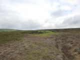
Nearby Images from Flickr
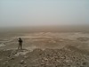
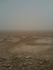
The above images may not be of the site on this page, but were taken nearby. They are loaded from Flickr so please click on them for image credits.
Click here to see more info for this site
Nearby sites
Click here to view sites on an interactive map of the areaKey: Red: member's photo, Blue: 3rd party photo, Yellow: other image, Green: no photo - please go there and take one, Grey: site destroyed
Download sites to:
KML (Google Earth)
GPX (GPS waypoints)
CSV (Garmin/Navman)
CSV (Excel)
To unlock full downloads you need to sign up as a Contributory Member. Otherwise downloads are limited to 50 sites.
Turn off the page maps and other distractions
Nearby sites listing. In the following links * = Image available
19.7km NE 35° Ur of the Chaldees* Ancient Village or Settlement
28.9km NE 45° Tell Khaiber* Ancient Village or Settlement
33.2km E 87° Kisiga Ancient Village or Settlement
48.1km NNW 344° Larsa Ancient Village or Settlement
65.0km NNW 329° Uruk.* Ancient Village or Settlement
84.8km NNE 12° Girsu* Ancient Village or Settlement
86.1km NE 37° Lagash* Ancient Village or Settlement
91.5km N 353° Umma Ancient Village or Settlement
102.5km N 354° Zabalam Ancient Village or Settlement
124.6km NNW 335° Kisurra Ancient Village or Settlement
126.0km N 359° Adab* Ancient Village or Settlement
136.7km NW 320° Shuruppak* Ancient Village or Settlement
140.9km NNW 332° Isin Ancient Village or Settlement
168.3km NNW 333° Nippur* Ancient Village or Settlement
179.8km NW 321° Marad Ancient Village or Settlement
204.5km NW 317° Dilbat Ancient Village or Settlement
230.5km NNW 327° Kish Ancient Village or Settlement
234.4km NW 319° Borsippa* Ancient Village or Settlement
245.6km NW 322° Babylon.* Ancient Village or Settlement
246.9km NNW 330° Kutha Ancient Village or Settlement
263.0km ENE 57° Haft Tepe* Ancient Temple
263.5km NE 54° Susa (Iran)* Ancient Palace
274.8km ENE 60° Chogha Zanbil* Ancient Temple
289.6km ENE 57° Chogha Mish* Ancient Village or Settlement
298.2km NNW 327° Sippar* Ancient Village or Settlement
View more nearby sites and additional images


 We would like to know more about this location. Please feel free to add a brief description and any relevant information in your own language.
 Wir möchten mehr über diese Stätte erfahren. Bitte zögern Sie nicht, eine kurze Beschreibung und relevante Informationen in Deutsch hinzuzufügen.
 Nous aimerions en savoir encore un peu sur les lieux. S'il vous plaît n'hesitez pas à ajouter une courte description et tous les renseignements pertinents dans votre propre langue.
 Quisieramos informarnos un poco más de las lugares. No dude en añadir una breve descripción y otros datos relevantes en su propio idioma.