 with our Megalithic Portal iPhone app")


<< Text Pages >> Tell Sawwan - Ancient Village or Settlement in Iraq
Submitted by AlexHunger on Sunday, 05 November 2006 Page Views: 5997
Multi-periodSite Name: Tell Sawwan Alternative Name: Ancient Samarra, SoumaCountry: Iraq
NOTE: This site is 21.09 km away from the location you searched for.
Type: Ancient Village or Settlement
Nearest Town: Samarra Nearest Village: Tell Sawwan
Latitude: 34.198460N Longitude: 43.874240E
Condition:
| 5 | Perfect |
| 4 | Almost Perfect |
| 3 | Reasonable but with some damage |
| 2 | Ruined but still recognisable as an ancient site |
| 1 | Pretty much destroyed, possibly visible as crop marks |
| 0 | No data. |
| -1 | Completely destroyed |
| 5 | Superb |
| 4 | Good |
| 3 | Ordinary |
| 2 | Not Good |
| 1 | Awful |
| 0 | No data. |
| 5 | Can be driven to, probably with disabled access |
| 4 | Short walk on a footpath |
| 3 | Requiring a bit more of a walk |
| 2 | A long walk |
| 1 | In the middle of nowhere, a nightmare to find |
| 0 | No data. |
| 5 | co-ordinates taken by GPS or official recorded co-ordinates |
| 4 | co-ordinates scaled from a detailed map |
| 3 | co-ordinates scaled from a bad map |
| 2 | co-ordinates of the nearest village |
| 1 | co-ordinates of the nearest town |
| 0 | no data |
Be the first person to rate this site - see the 'Contribute!' box in the right hand menu.
Internal Links:
External Links:
Ancient Village or Settlement in Iraq
During the Chalcolithic Samarran Culture between ca. 5500 and 4800 BCE, the area was relatively densely inhabited thanks to evidence of irrigation and a highly organized social structure. This marked the transition between nomadic and settled living. Much finely-made and decorated was found. It is believed the Samarran Culture was the precursor to the Ubaid period Mesopotamian culture, which preceded the classical Uruk Sumerian civilisation. The area of the present archaeological site covered by vast amounts of mudbrick but this dates from later periods.
You may be viewing yesterday's version of this page. To see the most up to date information please register for a free account.
Do not use the above information on other web sites or publications without permission of the contributor.
Nearby Images from Flickr
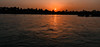
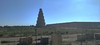

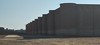

The above images may not be of the site on this page, but were taken nearby. They are loaded from Flickr so please click on them for image credits.
Click here to see more info for this site
Nearby sites
Click here to view sites on an interactive map of the areaKey: Red: member's photo, Blue: 3rd party photo, Yellow: other image, Green: no photo - please go there and take one, Grey: site destroyed
Download sites to:
KML (Google Earth)
GPX (GPS waypoints)
CSV (Garmin/Navman)
CSV (Excel)
To unlock full downloads you need to sign up as a Contributory Member. Otherwise downloads are limited to 50 sites.
Turn off the page maps and other distractions
Nearby sites listing. In the following links * = Image available
0m E 90° Seleucia on the Tigris Ancient Village or Settlement
5.2km WSW 242° Sur-Marrati Ancient Village or Settlement
108.6km SSE 152° Iraqi National Museum in Baghdad Museum
112.6km ESE 108° Eshnunna Ancient Village or Settlement
125.3km S 169° Akkad Ancient Village or Settlement
127.2km NNE 16° Nuzi Ancient Village or Settlement
131.5km SSE 164° Sippar* Ancient Village or Settlement
131.8km N 4° Tell al-Fakhar Ancient Palace
151.0km NNW 338° Assur (Iraq)* Ancient Village or Settlement
178.7km SSE 155° Kutha Ancient Village or Settlement
187.1km NW 326° Hatra (Khvarvaran)* Ancient Temple
189.1km SSE 165° Babylon.* Ancient Village or Settlement
197.0km SSE 158° Kish Ancient Village or Settlement
201.0km NNE 22° Satu Qala (Idu)* Ancient Village or Settlement
205.5km SSE 168° Borsippa* Ancient Village or Settlement
217.0km NNW 347° Nimrud* Ancient Village or Settlement
219.2km N 3° Arbil, Iraq* Ancient Village or Settlement
235.1km SSE 165° Dilbat Ancient Village or Settlement
249.8km NNW 345° Nineveh* Ancient Village or Settlement
251.7km SSE 160° Marad Ancient Village or Settlement
256.7km SSE 151° Nippur* Ancient Village or Settlement
262.9km NNW 331° Taya Ancient Village or Settlement
263.6km NNW 347° Dur-Sharrukin* Ancient Village or Settlement
266.3km NNW 348° Tepe Gawra Ancient Village or Settlement
274.2km W 277° Baghuz Tombs Chambered Tomb
View more nearby sites and additional images


 We would like to know more about this location. Please feel free to add a brief description and any relevant information in your own language.
 Wir möchten mehr über diese Stätte erfahren. Bitte zögern Sie nicht, eine kurze Beschreibung und relevante Informationen in Deutsch hinzuzufügen.
 Nous aimerions en savoir encore un peu sur les lieux. S'il vous plaît n'hesitez pas à ajouter une courte description et tous les renseignements pertinents dans votre propre langue.
 Quisieramos informarnos un poco más de las lugares. No dude en añadir una breve descripción y otros datos relevantes en su propio idioma.