 with our Megalithic Portal iPhone app")


<< Text Pages >> Ayanis - Hillfort in Turkey
Submitted by davidmorgan on Monday, 17 January 2011 Page Views: 3476
Iron Age and Later PrehistorySite Name: AyanisCountry: Turkey
NOTE: This site is 18.197 km away from the location you searched for.
Type: Hillfort
Nearest Town: Van Nearest Village: Agartı
Latitude: 38.708441N Longitude: 43.211306E
Condition:
| 5 | Perfect |
| 4 | Almost Perfect |
| 3 | Reasonable but with some damage |
| 2 | Ruined but still recognisable as an ancient site |
| 1 | Pretty much destroyed, possibly visible as crop marks |
| 0 | No data. |
| -1 | Completely destroyed |
| 5 | Superb |
| 4 | Good |
| 3 | Ordinary |
| 2 | Not Good |
| 1 | Awful |
| 0 | No data. |
| 5 | Can be driven to, probably with disabled access |
| 4 | Short walk on a footpath |
| 3 | Requiring a bit more of a walk |
| 2 | A long walk |
| 1 | In the middle of nowhere, a nightmare to find |
| 0 | No data. |
| 5 | co-ordinates taken by GPS or official recorded co-ordinates |
| 4 | co-ordinates scaled from a detailed map |
| 3 | co-ordinates scaled from a bad map |
| 2 | co-ordinates of the nearest village |
| 1 | co-ordinates of the nearest town |
| 0 | no data |
Internal Links:
External Links:
Hillfort in Van Province, Turkey.
An Urartian fortress built by King Rusa II in about 672 BCE according to dendrochronological studies.
You may be viewing yesterday's version of this page. To see the most up to date information please register for a free account.
Do not use the above information on other web sites or publications without permission of the contributor.
Nearby Images from Flickr
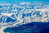
The above images may not be of the site on this page, but were taken nearby. They are loaded from Flickr so please click on them for image credits.
Click here to see more info for this site
Nearby sites
Click here to view sites on an interactive map of the areaKey: Red: member's photo, Blue: 3rd party photo, Yellow: other image, Green: no photo - please go there and take one, Grey: site destroyed
Download sites to:
KML (Google Earth)
GPX (GPS waypoints)
CSV (Garmin/Navman)
CSV (Excel)
To unlock full downloads you need to sign up as a Contributory Member. Otherwise downloads are limited to 50 sites.
Turn off the page maps and other distractions
Nearby sites listing. In the following links * = Image available
20.9km SE 144° Kalecik Stones Standing Stones
25.2km SSE 155° Tushpa* Ancient Village or Settlement
25.4km SSE 153° Urartu Museum Museum
26.6km SE 141° Rusahinili* Hillfort
28.0km SE 126° Anzaf Hillfort
39.6km S 180° Samran Channel* Ancient Mine, Quarry or other Industry
44.9km WNW 288° Kef Kalesi Hillfort
45.0km SSE 152° Sardurihinili* Ancient Palace
51.5km ENE 64° Körzüt Castle* Hillfort
64.5km NNW 334° Giriktepe Ancient Village or Settlement
73.1km SE 136° Yurtbasi Hillfort
134.1km SSE 160° Tirsin Plateau Rock Art
148.5km WNW 286° Kayalidere Ancient Village or Settlement
153.7km WNW 287° Tepekoy* Ancient Village or Settlement
154.6km N 10° Asagi Aktasli Ancient Palace
163.2km SW 228° Güzir Höyük Ancient Village or Settlement
168.5km WSW 239° Ayngerm Yani Ancient Village or Settlement
174.9km NE 41° Artashat Ancient Village or Settlement
175.3km NE 42° Khor Virap* Early Christian Sculptured Stone
177.2km W 280° Ashtishat Site Ancient Temple
178.1km SW 223° Boncuklu Tarla* Ancient Temple
178.2km SW 223° Cemka Hoyugu* Ancient Village or Settlement
178.5km NNE 28° Metsamor Complex* Standing Stones
178.5km SW 223° Zeviya Tivilki Ancient Village or Settlement
179.9km WSW 253° Hallan Cemi Tepe Ancient Village or Settlement
View more nearby sites and additional images


 We would like to know more about this location. Please feel free to add a brief description and any relevant information in your own language.
 Wir möchten mehr über diese Stätte erfahren. Bitte zögern Sie nicht, eine kurze Beschreibung und relevante Informationen in Deutsch hinzuzufügen.
 Nous aimerions en savoir encore un peu sur les lieux. S'il vous plaît n'hesitez pas à ajouter une courte description et tous les renseignements pertinents dans votre propre langue.
 Quisieramos informarnos un poco más de las lugares. No dude en añadir una breve descripción y otros datos relevantes en su propio idioma.