


<< Text Pages >> Tombe Meynier - Cave or Rock Shelter in France in Provence:Bouches-du-Rhône (13)
Submitted by TheCaptain on Wednesday, 08 September 2010 Page Views: 1850
Natural PlacesSite Name: Tombe MeynierCountry: France
NOTE: This site is 8.277 km away from the location you searched for.
Département: Provence:Bouches-du-Rhône (13) Type: Cave or Rock Shelter
Nearest Town: Avignon Nearest Village: Eygalieres
Latitude: 43.762000N Longitude: 4.949000E
Condition:
| 5 | Perfect |
| 4 | Almost Perfect |
| 3 | Reasonable but with some damage |
| 2 | Ruined but still recognisable as an ancient site |
| 1 | Pretty much destroyed, possibly visible as crop marks |
| 0 | No data. |
| -1 | Completely destroyed |
| 5 | Superb |
| 4 | Good |
| 3 | Ordinary |
| 2 | Not Good |
| 1 | Awful |
| 0 | No data. |
| 5 | Can be driven to, probably with disabled access |
| 4 | Short walk on a footpath |
| 3 | Requiring a bit more of a walk |
| 2 | A long walk |
| 1 | In the middle of nowhere, a nightmare to find |
| 0 | No data. |
| 5 | co-ordinates taken by GPS or official recorded co-ordinates |
| 4 | co-ordinates scaled from a detailed map |
| 3 | co-ordinates scaled from a bad map |
| 2 | co-ordinates of the nearest village |
| 1 | co-ordinates of the nearest town |
| 0 | no data |
Be the first person to rate this site - see the 'Contribute!' box in the right hand menu.
Internal Links:
External Links:
Abri Sepulcrale in Provence:Bouches-du-Rhône (13)
Tombe Meynier is a Abri Sepulcrale in the community of Eygalieres, Departement of Bouches-du-Rhône, Region of Provence - Alpes - Cote d'Azur
You may be viewing yesterday's version of this page. To see the most up to date information please register for a free account.
Do not use the above information on other web sites or publications without permission of the contributor.
Nearby Images from Flickr
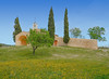
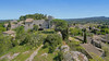
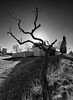
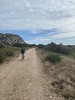
The above images may not be of the site on this page, but were taken nearby. They are loaded from Flickr so please click on them for image credits.
Click here to see more info for this site
Nearby sites
Click here to view sites on an interactive map of the areaKey: Red: member's photo, Blue: 3rd party photo, Yellow: other image, Green: no photo - please go there and take one, Grey: site destroyed
Download sites to:
KML (Google Earth)
GPX (GPS waypoints)
CSV (Garmin/Navman)
CSV (Excel)
To unlock full downloads you need to sign up as a Contributory Member. Otherwise downloads are limited to 50 sites.
Turn off the page maps and other distractions
Nearby sites listing. In the following links * = Image available
6.1km S 182° Roucas de l'Eure Burial Chamber or Dolmen
7.3km SE 132° Grotte du Deffends Cave or Rock Shelter
7.8km ENE 65° Mas des Gavots Burial Chamber or Dolmen
7.9km ENE 65° La Roque Fauconniere Cave or Rock Shelter
7.9km SW 225° Oppidum des Caisses* Ancient Village or Settlement
9.4km W 278° Glanum* Ancient Village or Settlement
10.1km ENE 64° Les Dentales Cave or Rock Shelter
10.1km ENE 64° Grotte Basse de Vidauque Cave or Rock Shelter
10.1km WNW 285° Grotte Romanin 1 Cave or Rock Shelter
10.1km ENE 65° Trou Puceu Cave or Rock Shelter
10.2km WNW 285° Grotte des Chats Cave or Rock Shelter
10.2km ENE 64° Baume des Enfers Cave or Rock Shelter
10.2km WNW 285° Grotte Baldouin Cave or Rock Shelter
10.2km WNW 285° Grotte Romanin 2 Cave or Rock Shelter
12.4km W 261° Les Baux* Ancient Village or Settlement
12.6km W 260° La grotte de Costapera Cave or Rock Shelter
14.0km NE 56° Sainte-Guimelle Cave or Rock Shelter
15.2km NNW 330° Les Tours Cave or Rock Shelter
15.3km NNW 331° Cimitiere Cave or Rock Shelter
16.1km NE 55° Jas de Juvert Cave or Rock Shelter
16.1km NE 56° Fontblanco Cave or Rock Shelter
17.7km SW 219° Baume de Trou Cave or Rock Shelter
17.7km SW 219° Mas deu Moulin Artificial Mound
18.6km WSW 249° Dolmen de la Mérindole Burial Chamber or Dolmen
19.3km W 279° Menhir Mourgue Standing Stone (Menhir)
View more nearby sites and additional images


 We would like to know more about this location. Please feel free to add a brief description and any relevant information in your own language.
 Wir möchten mehr über diese Stätte erfahren. Bitte zögern Sie nicht, eine kurze Beschreibung und relevante Informationen in Deutsch hinzuzufügen.
 Nous aimerions en savoir encore un peu sur les lieux. S'il vous plaît n'hesitez pas à ajouter une courte description et tous les renseignements pertinents dans votre propre langue.
 Quisieramos informarnos un poco más de las lugares. No dude en añadir una breve descripción y otros datos relevantes en su propio idioma.