

<< Our Photo Pages >> Runxputte - Holy Well or Sacred Spring in Netherlands in Noord-Holland
Submitted by Hunengrab77 on Tuesday, 21 July 2020 Page Views: 628
Springs and Holy WellsSite Name: Runxputte Alternative Name: Onze Lieve Vrouwe ter NoodCountry: Netherlands Province: Noord-Holland Type: Holy Well or Sacred Spring
Nearest Town: Heiloo
Latitude: 52.583890N Longitude: 4.687020E
Condition:
| 5 | Perfect |
| 4 | Almost Perfect |
| 3 | Reasonable but with some damage |
| 2 | Ruined but still recognisable as an ancient site |
| 1 | Pretty much destroyed, possibly visible as crop marks |
| 0 | No data. |
| -1 | Completely destroyed |
| 5 | Superb |
| 4 | Good |
| 3 | Ordinary |
| 2 | Not Good |
| 1 | Awful |
| 0 | No data. |
| 5 | Can be driven to, probably with disabled access |
| 4 | Short walk on a footpath |
| 3 | Requiring a bit more of a walk |
| 2 | A long walk |
| 1 | In the middle of nowhere, a nightmare to find |
| 0 | No data. |
| 5 | co-ordinates taken by GPS or official recorded co-ordinates |
| 4 | co-ordinates scaled from a detailed map |
| 3 | co-ordinates scaled from a bad map |
| 2 | co-ordinates of the nearest village |
| 1 | co-ordinates of the nearest town |
| 0 | no data |
Internal Links:
External Links:
")
You may be viewing yesterday's version of this page. To see the most up to date information please register for a free account.
Do not use the above information on other web sites or publications without permission of the contributor.
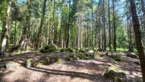
Nearby Images from Flickr

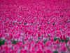
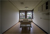
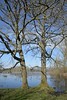

The above images may not be of the site on this page, but were taken nearby. They are loaded from Flickr so please click on them for image credits.
Click here to see more info for this site
Nearby sites
Click here to view sites on an interactive map of the areaKey: Red: member's photo, Blue: 3rd party photo, Yellow: other image, Green: no photo - please go there and take one, Grey: site destroyed
Download sites to:
KML (Google Earth)
GPX (GPS waypoints)
CSV (Garmin/Navman)
CSV (Excel)
To unlock full downloads you need to sign up as a Contributory Member. Otherwise downloads are limited to 50 sites.
Turn off the page maps and other distractions
Nearby sites listing. In the following links * = Image available
2.0km NE 47° Archeologisch museum Baduhenna Heiloo Museum
2.9km NE 37° Sint Willibrordusput en Witte Kerk Heiloo* Holy Well or Sacred Spring
3.2km WNW 296° Adalbertusput* Holy Well or Sacred Spring
3.4km NNE 14° Woodhenge bij Heiloo, Heksenkring* Timber Circle
4.8km SSW 204° Huis van Hilde* Museum
26.1km NNE 17° Maria-op-de-Keins* Holy Well or Sacred Spring
27.7km SSE 150° Allard Pierson Museum* Museum
34.0km ENE 64° Grafheuvel Wervershoof (46173) Round Barrow(s)
34.4km ENE 64° Grafheuvels Wervershoof (46172) Round Barrow(s)
38.3km ENE 72° Grafheuvel Grootebroek (45447) Round Barrow(s)
39.2km NNE 27° De steen van Westerklief Natural Stone / Erratic / Other Natural Feature
40.6km SE 134° Floriskei* Natural Stone / Erratic / Other Natural Feature
43.8km ENE 71° Zuiderzeemuseum Museum
48.8km SE 133° Grafheuvel Huizen (45654) Round Barrow(s)
49.2km SSW 196° Rijksmuseum van Oudheden* Museum
50.0km SE 138° Zwerfkei Aardjesberg* Natural Stone / Erratic / Other Natural Feature
50.2km SE 138° Grafheuvels Hilversum (45550) Round Barrow(s)
50.5km SE 137° Grafheuvels Westerheide 3* Round Barrow(s)
50.8km SE 138° Grafheuvels Westerheide* Round Barrow(s)
50.8km SE 137° Grafheuvel Laren (45635) Round Barrow(s)
50.8km SE 138° Grafheuvels Westerheide 2* Round Barrow(s)
50.8km SE 137° Grafheuvel Laren (45634) Round Barrow(s)
50.9km ESE 120° Almere Hout (511926) Ancient Village or Settlement
51.2km E 98° Museum Batavialand Museum
51.2km ESE 120° Almere Hout (511925) Ancient Village or Settlement
View more nearby sites and additional images


 We would like to know more about this location. Please feel free to add a brief description and any relevant information in your own language.
 Wir möchten mehr über diese Stätte erfahren. Bitte zögern Sie nicht, eine kurze Beschreibung und relevante Informationen in Deutsch hinzuzufügen.
 Nous aimerions en savoir encore un peu sur les lieux. S'il vous plaît n'hesitez pas à ajouter une courte description et tous les renseignements pertinents dans votre propre langue.
 Quisieramos informarnos un poco más de las lugares. No dude en añadir una breve descripción y otros datos relevantes en su propio idioma.