


<< Our Photo Pages >> Pierre Plantée (Lèque) - Standing Stone (Menhir) in France in Languedoc:Gard (30)
Submitted by ocdolmen on Saturday, 16 April 2005 Page Views: 4509
Neolithic and Bronze AgeSite Name: Pierre Plantée (Lèque) Alternative Name: la Lèque, la Peyro PlantadoCountry: France
NOTE: This site is 4.974 km away from the location you searched for.
Département: Languedoc:Gard (30) Type: Standing Stone (Menhir)
Nearest Town: Alès Nearest Village: Lussan
Latitude: 44.193000N Longitude: 4.394000E
Condition:
| 5 | Perfect |
| 4 | Almost Perfect |
| 3 | Reasonable but with some damage |
| 2 | Ruined but still recognisable as an ancient site |
| 1 | Pretty much destroyed, possibly visible as crop marks |
| 0 | No data. |
| -1 | Completely destroyed |
| 5 | Superb |
| 4 | Good |
| 3 | Ordinary |
| 2 | Not Good |
| 1 | Awful |
| 0 | No data. |
| 5 | Can be driven to, probably with disabled access |
| 4 | Short walk on a footpath |
| 3 | Requiring a bit more of a walk |
| 2 | A long walk |
| 1 | In the middle of nowhere, a nightmare to find |
| 0 | No data. |
| 5 | co-ordinates taken by GPS or official recorded co-ordinates |
| 4 | co-ordinates scaled from a detailed map |
| 3 | co-ordinates scaled from a bad map |
| 2 | co-ordinates of the nearest village |
| 1 | co-ordinates of the nearest town |
| 0 | no data |
Internal Links:
External Links:
I have visited· I would like to visit
johnstone visited on 24th Jun 2000 - their rating: Cond: 4 Amb: 4 Access: 4
 (PID:22993)")
This standing-stone is also called "la Lèque" (in occitan "la Leca"). The occitan language has kept old celt words in its vocabulary as "leca" (ie "the stone") which comes from gaulish "lech" (as in "cromlech")
IMPORTANT NOTE: Positional co-ordinates scaled from a detailed map source
Base Mérimée (Historic Monument)
Lieux Sacrés (Holy Places)
You may be viewing yesterday's version of this page. To see the most up to date information please register for a free account.
 (PID:48145)")
Do not use the above information on other web sites or publications without permission of the contributor.
Nearby Images from Flickr


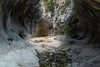
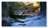

The above images may not be of the site on this page, but were taken nearby. They are loaded from Flickr so please click on them for image credits.
Click here to see more info for this site
Nearby sites
Click here to view sites on an interactive map of the areaKey: Red: member's photo, Blue: 3rd party photo, Yellow: other image, Green: no photo - please go there and take one, Grey: site destroyed
Download sites to:
KML (Google Earth)
GPX (GPS waypoints)
CSV (Garmin/Navman)
CSV (Excel)
To unlock full downloads you need to sign up as a Contributory Member. Otherwise downloads are limited to 50 sites.
Turn off the page maps and other distractions
Nearby sites listing. In the following links * = Image available
1.7km NNW 328° Dolmen dit la Table des Turcs Burial Chamber or Dolmen
3.7km WNW 301° Dolmen dit La Maison des Fées (Méjannes-le-Clap)* Burial Chamber or Dolmen
4.2km NW 309° Menhir de Méjannes* Standing Stone (Menhir)
4.3km WNW 299° Dolmen du Bouissas Burial Chamber or Dolmen
5.8km N 350° La Caporie 1 Burial Chamber or Dolmen
6.5km N 349° Dolmen de Carcuignau 4* Burial Chamber or Dolmen
6.6km N 350° Dolmen de Carcuignau 3* Burial Chamber or Dolmen
6.6km N 350° Dolmen dit le Beaume des Fées* Burial Chamber or Dolmen
6.7km N 350° Dolmen de Carcuignau 2* Burial Chamber or Dolmen
7.3km WNW 295° Dolmen des Charbonniers Burial Chamber or Dolmen
7.3km WNW 294° Dolmen du Tonnerre Burial Chamber or Dolmen
7.7km WNW 294° Dolmen de Piécourt Burial Chamber or Dolmen
8.2km WNW 300° Grotte des Camisards* Cave or Rock Shelter
9.5km SE 139° Pierre Plantée de St-Marcel Standing Stone (Menhir)
10.2km W 260° Oppidum de Saint-Pierre Ancient Village or Settlement
10.2km SSE 147° Dolmen de Coucouveze* Burial Chamber or Dolmen
10.2km SW 236° Oppidum du Mont Bouquet* Ancient Village or Settlement
11.1km NE 38° Issirac 2 Burial Chamber or Dolmen
11.2km WSW 237° Dolmen du Mont Bouquet 2* Burial Chamber or Dolmen
11.2km SE 141° Dolmen de Diole Burial Chamber or Dolmen
11.2km WSW 244° Dolmen de la Serre Bouquet* Burial Chamber or Dolmen
11.2km NE 38° Issirac 1 Burial Chamber or Dolmen
11.2km WSW 237° Dolmen du Mont Bouquet 1* Burial Chamber or Dolmen
11.4km SSW 201° Peyro Fico Standing Stone (Menhir)
13.0km SW 228° Dolmen du Mas Crémat* Burial Chamber or Dolmen
View more nearby sites and additional images


 We would like to know more about this location. Please feel free to add a brief description and any relevant information in your own language.
 Wir möchten mehr über diese Stätte erfahren. Bitte zögern Sie nicht, eine kurze Beschreibung und relevante Informationen in Deutsch hinzuzufügen.
 Nous aimerions en savoir encore un peu sur les lieux. S'il vous plaît n'hesitez pas à ajouter une courte description et tous les renseignements pertinents dans votre propre langue.
 Quisieramos informarnos un poco más de las lugares. No dude en añadir una breve descripción y otros datos relevantes en su propio idioma.