


<< Text Pages >> Menhir de la Femme Blanche - Standing Stone (Menhir) in France in Bourgogne:Yonne (89)
Submitted by holger_rix on Wednesday, 13 April 2016 Page Views: 1000
Neolithic and Bronze AgeSite Name: Menhir de la Femme Blanche Alternative Name: Dame Blanche, Forêt de MorconCountry: France Département: Bourgogne:Yonne (89) Type: Standing Stone (Menhir)
Nearest Town: Avallon Nearest Village: Châtel-Gérard
Latitude: 47.624700N Longitude: 4.078900E
Condition:
| 5 | Perfect |
| 4 | Almost Perfect |
| 3 | Reasonable but with some damage |
| 2 | Ruined but still recognisable as an ancient site |
| 1 | Pretty much destroyed, possibly visible as crop marks |
| 0 | No data. |
| -1 | Completely destroyed |
| 5 | Superb |
| 4 | Good |
| 3 | Ordinary |
| 2 | Not Good |
| 1 | Awful |
| 0 | No data. |
| 5 | Can be driven to, probably with disabled access |
| 4 | Short walk on a footpath |
| 3 | Requiring a bit more of a walk |
| 2 | A long walk |
| 1 | In the middle of nowhere, a nightmare to find |
| 0 | No data. |
| 5 | co-ordinates taken by GPS or official recorded co-ordinates |
| 4 | co-ordinates scaled from a detailed map |
| 3 | co-ordinates scaled from a bad map |
| 2 | co-ordinates of the nearest village |
| 1 | co-ordinates of the nearest town |
| 0 | no data |
Be the first person to rate this site - see the 'Contribute!' box in the right hand menu.
Internal Links:
External Links:
Standing Stone (Menhir) in Bourgogne:Yonne (89)
Châtel-Gérard, Avallon, Yonne, Bourgogne-Franche-Comté
Source: Wikipedia article
Sites mégalithiques de l'Yonne
Picture:
www.t4t35.fr
You may be viewing yesterday's version of this page. To see the most up to date information please register for a free account.
Do not use the above information on other web sites or publications without permission of the contributor.
Nearby Images from Flickr
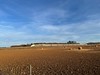

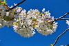
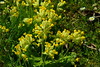
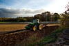
The above images may not be of the site on this page, but were taken nearby. They are loaded from Flickr so please click on them for image credits.
Click here to see more info for this site
Nearby sites
Click here to view sites on an interactive map of the areaKey: Red: member's photo, Blue: 3rd party photo, Yellow: other image, Green: no photo - please go there and take one, Grey: site destroyed
Download sites to:
KML (Google Earth)
GPX (GPS waypoints)
CSV (Garmin/Navman)
CSV (Excel)
To unlock full downloads you need to sign up as a Contributory Member. Otherwise downloads are limited to 50 sites.
Turn off the page maps and other distractions
Nearby sites listing. In the following links * = Image available
3.4km WSW 242° Menhir du Bois des Haies Standing Stone (Menhir)
8.0km WNW 300° Polissoir des Grandes Gueules Polissoir
8.1km W 279° Tumulus de Tormancy Round Barrow(s)
17.4km ESE 122° Menhir-Sainte-Christine* Standing Stone (Menhir)
23.7km W 261° Grottes d'Arcy-sur-Cure* Cave or Rock Shelter
23.8km WSW 254° Camp Antique de Cora-Villaucerre Ancient Village or Settlement
24.4km SW 226° En-Pierrotte Burial Chamber or Dolmen
24.7km WSW 254° Menhir dit la Grosse-Borne Standing Stone (Menhir)
26.7km SSE 147° Cimetière Menhir* Standing Stone (Menhir)
27.4km SSE 161° Roche d'Arthur* Standing Stone (Menhir)
27.4km SSE 161° Pierre Pelot* Standing Stone (Menhir)
29.8km SSE 167° Poron Meurger* Rock Art
30.7km SSW 192° Roche aux Fées (Quarré-les-Tombes)* Rock Outcrop
30.7km W 275° Les Champs-Guyots Burial Chamber or Dolmen
33.4km ENE 71° La Grande Borne (Coulmier-le-Sec)* Standing Stone (Menhir)
37.3km WNW 287° Jussy Site Archeologique Not Known (by us)
38.2km S 183° Dolmen de la Pierre-Plate* Burial Chamber or Dolmen
38.3km ENE 67° La Pierre Percée (Nod-Sur-Seine)* Standing Stone (Menhir)
38.4km NW 308° Dolmen de Bleigny-le-Carreau Burial Chamber or Dolmen
39.0km S 182° Chevresse Dolmen* Burial Chamber or Dolmen
41.0km NE 47° Tumulus de la Motte* Artificial Mound
42.1km SE 129° Camp de Myard* Ancient Village or Settlement
43.6km NE 50° Sainte-Colombe Tumulus* Round Barrow(s)
44.4km NE 44° Bois de Cresilles Tumuli Artificial Mound
45.0km NE 51° Tumulus de la Butte Round Barrow(s)
View more nearby sites and additional images


 We would like to know more about this location. Please feel free to add a brief description and any relevant information in your own language.
 Wir möchten mehr über diese Stätte erfahren. Bitte zögern Sie nicht, eine kurze Beschreibung und relevante Informationen in Deutsch hinzuzufügen.
 Nous aimerions en savoir encore un peu sur les lieux. S'il vous plaît n'hesitez pas à ajouter une courte description et tous les renseignements pertinents dans votre propre langue.
 Quisieramos informarnos un poco más de las lugares. No dude en añadir una breve descripción y otros datos relevantes en su propio idioma.