

<< Text Pages >> Kayalipinar - Ancient Village or Settlement in Turkey
Submitted by davidmorgan on Thursday, 28 November 2013 Page Views: 2054
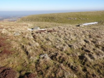
Multi-periodSite Name: Kayalipinar Alternative Name: Kayalıpınar, Samuha, ŠamuhaCountry: Turkey Type: Ancient Village or Settlement
Nearest Town: Sivas Nearest Village: Kayalıpınar
Latitude: 39.619633N Longitude: 36.528063E
Condition:
| 5 | Perfect |
| 4 | Almost Perfect |
| 3 | Reasonable but with some damage |
| 2 | Ruined but still recognisable as an ancient site |
| 1 | Pretty much destroyed, possibly visible as crop marks |
| 0 | No data. |
| -1 | Completely destroyed |
| 5 | Superb |
| 4 | Good |
| 3 | Ordinary |
| 2 | Not Good |
| 1 | Awful |
| 0 | No data. |
| 5 | Can be driven to, probably with disabled access |
| 4 | Short walk on a footpath |
| 3 | Requiring a bit more of a walk |
| 2 | A long walk |
| 1 | In the middle of nowhere, a nightmare to find |
| 0 | No data. |
| 5 | co-ordinates taken by GPS or official recorded co-ordinates |
| 4 | co-ordinates scaled from a detailed map |
| 3 | co-ordinates scaled from a bad map |
| 2 | co-ordinates of the nearest village |
| 1 | co-ordinates of the nearest town |
| 0 | no data |
Internal Links:
External Links:
Ancient Hittite Settlement in Sivas Province, Turkey
A Hittite town dating from the 16th century BCE discovered in 2005.
You may be viewing yesterday's version of this page. To see the most up to date information please register for a free account.
Do not use the above information on other web sites or publications without permission of the contributor.
Click here to see more info for this site
Nearby sites
Click here to view sites on an interactive map of the areaKey: Red: member's photo, Blue: 3rd party photo, Yellow: other image, Green: no photo - please go there and take one, Grey: site destroyed
Download sites to:
KML (Google Earth)
GPX (GPS waypoints)
CSV (Garmin/Navman)
CSV (Excel)
To unlock full downloads you need to sign up as a Contributory Member. Otherwise downloads are limited to 50 sites.
Turn off the page maps and other distractions
Nearby sites listing. In the following links * = Image available
47.7km SE 136° Sarissa Ancient Village or Settlement
51.6km N 358° Bolus Ancient Village or Settlement
83.4km SSE 168° Karakuyu Hittite Dam* Ancient Mine, Quarry or other Industry
87.9km NW 312° Masat Hoyuk Ancient Village or Settlement
90.0km SW 217° Sultan Hani Stele* Rock Art
99.7km W 262° Sarikaya Roman Bath* Ancient Village or Settlement
102.5km WNW 282° Karakiz* Carving
108.5km W 270° Alisar Hoyuk* Ancient Village or Settlement
114.5km SW 222° Karum Kanes* Ancient Village or Settlement
115.0km SW 222° Kültepe Kanes* Ancient Village or Settlement
116.4km N 2° Horoztepe Ancient Village or Settlement
118.7km W 274° Cadir Hoyuk* Ancient Village or Settlement
126.5km W 277° Kerkenes Ancient Village or Settlement
128.0km W 280° Usakli Mound* Ancient Village or Settlement
128.3km NW 324° Oluz Mound* Ancient Village or Settlement
129.2km NNW 333° Amasya Museum* Museum
130.9km WNW 303° Shapinuwa Ancient Village or Settlement
134.2km SW 222° Kayseri Archaeological Museum* Museum
144.5km S 187° Comana Chryse* Ancient Village or Settlement
148.8km WNW 292° Örükaya Roman Dam Ancient Mine, Quarry or other Industry
149.1km W 279° Yozgat Ethnographic Museum Museum
151.4km SW 228° Örenşehir* Ancient Village or Settlement
155.6km WNW 301° Pazarli Ancient Village or Settlement
159.2km SSE 151° Aktil Hoyuk* Ancient Village or Settlement
161.2km SSW 199° Imamkullu* Carving
View more nearby sites and additional images


 We would like to know more about this location. Please feel free to add a brief description and any relevant information in your own language.
 Wir möchten mehr über diese Stätte erfahren. Bitte zögern Sie nicht, eine kurze Beschreibung und relevante Informationen in Deutsch hinzuzufügen.
 Nous aimerions en savoir encore un peu sur les lieux. S'il vous plaît n'hesitez pas à ajouter une courte description et tous les renseignements pertinents dans votre propre langue.
 Quisieramos informarnos un poco más de las lugares. No dude en añadir una breve descripción y otros datos relevantes en su propio idioma.