 with our Megalithic Portal iPhone app")

<< Our Photo Pages >> Sha'ar HaGolan - Ancient Village or Settlement in Israel
Submitted by motist on Monday, 10 September 2012 Page Views: 6891
Multi-periodSite Name: Sha'ar HaGolanCountry: Israel
NOTE: This site is 7.819 km away from the location you searched for.
Type: Ancient Village or Settlement
Nearest Town: Taiberias Nearest Village: Kibuts Sha'ar HaGolan
Latitude: 32.682901N Longitude: 35.601823E
Condition:
| 5 | Perfect |
| 4 | Almost Perfect |
| 3 | Reasonable but with some damage |
| 2 | Ruined but still recognisable as an ancient site |
| 1 | Pretty much destroyed, possibly visible as crop marks |
| 0 | No data. |
| -1 | Completely destroyed |
| 5 | Superb |
| 4 | Good |
| 3 | Ordinary |
| 2 | Not Good |
| 1 | Awful |
| 0 | No data. |
| 5 | Can be driven to, probably with disabled access |
| 4 | Short walk on a footpath |
| 3 | Requiring a bit more of a walk |
| 2 | A long walk |
| 1 | In the middle of nowhere, a nightmare to find |
| 0 | No data. |
| 5 | co-ordinates taken by GPS or official recorded co-ordinates |
| 4 | co-ordinates scaled from a detailed map |
| 3 | co-ordinates scaled from a bad map |
| 2 | co-ordinates of the nearest village |
| 1 | co-ordinates of the nearest town |
| 0 | no data |
Internal Links:
External Links:
I have visited· I would like to visit
bat400 would like to visit
")
The first Yarmukian settlement was unearthed at Megiddo during the 1930s, but was not identified as a distinct Neolithic culture at the time. At Sha'ar HaGolan, in 1949, Prof. Moshe Stekelis first identified the Yarmukian Culture, a Pottery Neolithic culture that inhabited parts of Israel and Jordan. The site, dated to ca. 6400–6000 BCE (calibrated), is located in the central Jordan Valley, on the northern bank of the Yarmouk River.
Its size is circa 20 hectares, making it one of the largest settlements in the world at that time. Although other Yarmukian sites have been identified since, Sha'ar HaGolan is the largest, probably indicating its role as the Yarmukian center.
The site was excavated by two teams from the Hebrew University of Jerusalem: One led by Stekelis (1949–1952) and the other by Yosef Garfinkel (1989–90, 2006–2004). While during the earlier excavations no architecture was found, the second expedition uncovered large courtyard houses, ranging between 250 and 700 m² in area. The courtyard house makes its first appearance at Sha'ar HaGolan, giving the site a special significance in architectural history. This is an architectural concept still found among traditional Mediterranean societies. Monumental construction on this scale is unknown elsewhere during this period. The houses consist of a central courtyard surrounded by several small rooms.
The houses were separated by streets, which constitute evidence of advanced community planning. The dig uncovered a central street about 3 m wide, paved with pebbles set in mud, and a narrow winding alley 1 m wide. These are the earliest streets discovered in Israel and among the earliest streets built by man. A 4.15 m well dug to the local water table indicates a knowledge of hydraulics. Exotic objects discovered during the excavations include sea shells from the Mediterranean, polished stone vessels made of alabaster (or marble), and blades made from obsidian (volcanic glass) from Turkey. The presence of obsidian points to trade connections extending over 700 km.
More information at the Hebrew University of Jerusalem excavation website.
Note: Theory that clay Phallic Symbols are actually earliest 'matches' or 'firestarters'.
You may be viewing yesterday's version of this page. To see the most up to date information please register for a free account.
Do not use the above information on other web sites or publications without permission of the contributor.
Nearby Images from Flickr
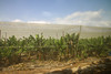
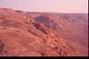
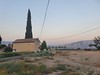

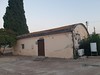

The above images may not be of the site on this page, but were taken nearby. They are loaded from Flickr so please click on them for image credits.
Click here to see more info for this site
Nearby sites
Click here to view sites on an interactive map of the areaKey: Red: member's photo, Blue: 3rd party photo, Yellow: other image, Green: no photo - please go there and take one, Grey: site destroyed
Download sites to:
KML (Google Earth)
GPX (GPS waypoints)
CSV (Garmin/Navman)
CSV (Excel)
To unlock full downloads you need to sign up as a Contributory Member. Otherwise downloads are limited to 50 sites.
Turn off the page maps and other distractions
Nearby sites listing. In the following links * = Image available
4.0km NW 324° Tel Bet Yerah Artificial Mound
4.6km NNW 334° Sea of Galilee Cairn* Cairn
4.6km NW 322° Ohalo II* Ancient Village or Settlement
10.4km NNW 333° Hammat Tiberias* Ancient Village or Settlement
12.0km NNE 27° Sussita* Ancient Village or Settlement
12.7km NNE 27° Wadi Ein Gev Ancient Village or Settlement
12.7km NNE 27° NEG II Prehistoric Village* Ancient Village or Settlement
16.6km NNE 16° Kursi National Park* Ancient Village or Settlement
19.5km NNW 334° Dalmanutha* Ancient Village or Settlement
21.9km SSW 205° Tel Beth Shean* Ancient Village or Settlement
22.8km SE 125° Rasun (Jordan)* Burial Chamber or Dolmen
23.8km S 179° Wadi Hammeh 27 Ancient Village or Settlement
24.5km SW 222° Beit Alpha Ancient Synagogue Mosaic Floor* Ancient Temple
25.2km NNW 333° Hukok* Ancient Temple
25.4km N 6° Bethsaida* Ancient Village or Settlement
25.9km S 177° Pella (Jordan) Ancient Village or Settlement
26.8km ESE 121° Irbid* Ancient Village or Settlement
27.6km W 273° Mary's Well (Nazareth)* Holy Well or Sacred Spring
28.2km NNE 29° The ancient city of Gamla* Ancient Village or Settlement
28.4km NNE 29° Gamla Dolmen field* Burial Chamber or Dolmen
29.1km WSW 241° Jezreel* Ancient Village or Settlement
29.4km NE 40° Dolmen field near Natur on the Golan Heights* Barrow Cemetery
30.8km W 274° Kfar HaHoresh Ancient Temple
31.0km WNW 284° Tzippori* Ancient Village or Settlement
31.1km S 189° Tel Tsaf* Ancient Village or Settlement
View more nearby sites and additional images


 We would like to know more about this location. Please feel free to add a brief description and any relevant information in your own language.
 Wir möchten mehr über diese Stätte erfahren. Bitte zögern Sie nicht, eine kurze Beschreibung und relevante Informationen in Deutsch hinzuzufügen.
 Nous aimerions en savoir encore un peu sur les lieux. S'il vous plaît n'hesitez pas à ajouter une courte description et tous les renseignements pertinents dans votre propre langue.
 Quisieramos informarnos un poco más de las lugares. No dude en añadir una breve descripción y otros datos relevantes en su propio idioma.