 with our Megalithic Portal iPhone app")

<< Our Photo Pages >> Ein Gedi ancient Synagogue - Ancient Temple in Israel
Submitted by motist on Saturday, 13 June 2015 Page Views: 2370
Neolithic and Bronze AgeSite Name: Ein Gedi ancient SynagogueCountry: Israel
NOTE: This site is 11.057 km away from the location you searched for.
Type: Ancient Temple
Nearest Town: Jerusalem Nearest Village: Kibutz Ein Gedi
Latitude: 31.461573N Longitude: 35.392461E
Condition:
| 5 | Perfect |
| 4 | Almost Perfect |
| 3 | Reasonable but with some damage |
| 2 | Ruined but still recognisable as an ancient site |
| 1 | Pretty much destroyed, possibly visible as crop marks |
| 0 | No data. |
| -1 | Completely destroyed |
| 5 | Superb |
| 4 | Good |
| 3 | Ordinary |
| 2 | Not Good |
| 1 | Awful |
| 0 | No data. |
| 5 | Can be driven to, probably with disabled access |
| 4 | Short walk on a footpath |
| 3 | Requiring a bit more of a walk |
| 2 | A long walk |
| 1 | In the middle of nowhere, a nightmare to find |
| 0 | No data. |
| 5 | co-ordinates taken by GPS or official recorded co-ordinates |
| 4 | co-ordinates scaled from a detailed map |
| 3 | co-ordinates scaled from a bad map |
| 2 | co-ordinates of the nearest village |
| 1 | co-ordinates of the nearest town |
| 0 | no data |
Internal Links:
External Links:
")
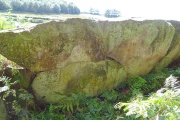
The synagogue at Ein Gedi dates from the Roman-Byzantine period, but it underwent several changes in the course of its use.
When first built at the beginning of the 3rd century, it was a modest, trapezoidal structure. In its northern wall, facing Jerusalem, were two openings. The floor was of simple white mosaic with a swastika pattern in black tesserae in the center. This pattern has been interpreted as a decorative motif or as a good luck symbol.
The synagogue underwent far-reaching renovations during the fourth century: The opening in the center of the northern wall was blocked and made into a square niche which probably contained a wooden Torah ark; along the opposite southern side a three-stepped bench was built; the building was divided by two rows of square pillars into a central hall with two aisles; the entrance was through three openings in the western wall.
In the mid 5th century, the synagogue underwent a further change, but its trapezoidal shape was preserved. Its dimensions were now 16 m. on the western side, 13.5 m. on the eastern side, with a width of 12.5 m. and it was two stories high. A platform (bema) containing a semi-circular niche surrounded by a chancel screen was added to the northern side of the building facing Jerusalem. The whole interior of the synagogue and the pillars were covered with white plaster and painted decorations and a new, colored mosaic floor was laid. The central hall contained a mosaic carpet decorated with a pattern of four-petalled flowers; in the center is a circle with four birds and on the corners of the outer, square frame are pairs of peacocks. The decoration opposite the bema included three seven-branched menorot (candelabra).
The floor of the western aisle, through which one entered the prayer hall, included five inscriptions. These include an Aramaic inscription mentioning the local community as well as private donors who contributed toward the construction and maintenance of the synagogue. One inscription also includes a warning and a curse:
Warnings to those who commit sins causing dissension in the community, passing malicious information to the gentiles, or revealing the secrets of the town.
The one whose eyes roam over the entire earth and sees what is concealed will uproot this person and his seed from under the sun and all the people will say, Amen. Selah.
Two inscriptions in Hebrew relate to Jewish tradition. One notes the names of the thirteen fathers of the world according to 1 Chronicles l:l-4: Adam, Seth, Enosh, Kenan, Mehalalel, Jared, Enoch, Methuselah, Lamech, Noah, Shem, Ham and Japheth.
Another lists the names of the twelve signs of the zodiac and the twelve months of the Hebrew calender; the three patriarchs: Abraham, Isaac and Jacob; and the names of the three companions of Daniel: Hananiah, Mishael and Azariah; and a blessing: Peace upon Israel.
The synagogue was destroyed by fire, probably during the reign of the Emperor Justinian (second half of the 6th century), a period of Jewish persecution. Among the items in the destruction debris was a unique find: a 30 cm. high seven-branched candelabrum made of bronze.
The synagogue building has recently been restored and a huge, protective tent covers it, enabling visitors to enjoy this beautiful synagogue of the Jewish community which once lived at Ein Gedi.
You may be viewing yesterday's version of this page. To see the most up to date information please register for a free account.
")
")
")
")
")
")
")
")
")
")
")
")
")
")
")
")
")
")
")
")
")
")
")
Do not use the above information on other web sites or publications without permission of the contributor.
Click here to see more info for this site
Nearby sites
Click here to view sites on an interactive map of the areaKey: Red: member's photo, Blue: 3rd party photo, Yellow: other image, Green: no photo - please go there and take one, Grey: site destroyed
Download sites to:
KML (Google Earth)
GPX (GPS waypoints)
CSV (Garmin/Navman)
CSV (Excel)
To unlock full downloads you need to sign up as a Contributory Member. Otherwise downloads are limited to 50 sites.
Turn off the page maps and other distractions
Nearby sites listing. In the following links * = Image available
363m WSW 245° Tel Goren* Ancient Village or Settlement
737m NW 326° Ein Gedi Chalcolithic Temple* Ancient Temple
9.6km SW 216° Cave of the Treasure in wadi Mishmar* Cave or Rock Shelter
16.9km SSW 192° Masada* Hillfort
24.9km ENE 62° Mukawir* Hillfort
26.7km SSE 150° Bab edh-Dhra Ancient Village or Settlement
26.8km NNW 328° Herodion* Ancient Palace
27.6km WNW 285° Cave of the Patriarchs Rock Cut Tomb
28.3km WSW 258° Khirbat Susya* Ancient Village or Settlement
28.3km SE 144° Zahrat adh-Dhra’ 2 Ancient Village or Settlement
31.8km NNE 12° Qumran* Ancient Village or Settlement
32.5km SW 232° tel 'Arad* Ancient Village or Settlement
33.1km ESE 105° Redjom el A'abed* Ancient Village or Settlement
33.4km WSW 249° Khirbat Anim* Ancient Temple
33.9km NNW 328° Rachel's Tomb Ancient Temple
34.8km S 187° Mesad Zohar* Hillfort
36.0km NE 54° South of Khajar Mansub Menhirs & Dolmens* Chambered Tomb
36.0km NE 54° el-Mareighat* Burial Chamber or Dolmen
36.1km NNW 333° Talpiot Tomb Rock Cut Tomb
36.3km NE 54° Khajar Mansub* Standing Stone (Menhir)
37.2km E 84° Khirbet Ataruz Ancient Village or Settlement
37.6km NNW 337° Hezekiah's Tunnel* Ancient Mine, Quarry or other Industry
37.8km NNW 337° City of David* Ancient Village or Settlement
38.2km NNW 337° Temple Mount* Ancient Temple
38.6km ESE 116° Wadi Walla Roman mile stone* Marker Stone
View more nearby sites and additional images


 We would like to know more about this location. Please feel free to add a brief description and any relevant information in your own language.
 Wir möchten mehr über diese Stätte erfahren. Bitte zögern Sie nicht, eine kurze Beschreibung und relevante Informationen in Deutsch hinzuzufügen.
 Nous aimerions en savoir encore un peu sur les lieux. S'il vous plaît n'hesitez pas à ajouter une courte description et tous les renseignements pertinents dans votre propre langue.
 Quisieramos informarnos un poco más de las lugares. No dude en añadir una breve descripción y otros datos relevantes en su propio idioma.