
, Aubrey Burl")
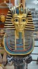
<< Our Photo Pages >> Tomb of Tutankhamun - Rock Cut Tomb in Egypt in Upper Egypt (South)
Submitted by AlexHunger on Saturday, 18 February 2006 Page Views: 9257
Multi-periodSite Name: Tomb of Tutankhamun Alternative Name: KV 62Country: Egypt Region: Upper Egypt (South) Type: Rock Cut Tomb
Nearest Town: Luxor Nearest Village: Valley of the Kings
Latitude: 25.740530N Longitude: 32.601540E
Condition:
| 5 | Perfect |
| 4 | Almost Perfect |
| 3 | Reasonable but with some damage |
| 2 | Ruined but still recognisable as an ancient site |
| 1 | Pretty much destroyed, possibly visible as crop marks |
| 0 | No data. |
| -1 | Completely destroyed |
| 5 | Superb |
| 4 | Good |
| 3 | Ordinary |
| 2 | Not Good |
| 1 | Awful |
| 0 | No data. |
| 5 | Can be driven to, probably with disabled access |
| 4 | Short walk on a footpath |
| 3 | Requiring a bit more of a walk |
| 2 | A long walk |
| 1 | In the middle of nowhere, a nightmare to find |
| 0 | No data. |
| 5 | co-ordinates taken by GPS or official recorded co-ordinates |
| 4 | co-ordinates scaled from a detailed map |
| 3 | co-ordinates scaled from a bad map |
| 2 | co-ordinates of the nearest village |
| 1 | co-ordinates of the nearest town |
| 0 | no data |
Internal Links:
External Links:
I have visited· I would like to visit
Jansold visited on 3rd Mar 2003 - their rating: Cond: 5 Amb: 5 Access: 5
")
Only Intact tomb found in the Valey of the Kings by Howard carter. 18th Dynasty. 138 Meter Altitude.
You may be viewing yesterday's version of this page. To see the most up to date information please register for a free account.
")
")
Do not use the above information on other web sites or publications without permission of the contributor.
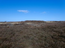
Nearby Images from Flickr

The above images may not be of the site on this page, but were taken nearby. They are loaded from Flickr so please click on them for image credits.
Click here to see more info for this site
Nearby sites
Click here to view sites on an interactive map of the areaKey: Red: member's photo, Blue: 3rd party photo, Yellow: other image, Green: no photo - please go there and take one, Grey: site destroyed
Download sites to:
KML (Google Earth)
GPX (GPS waypoints)
CSV (Garmin/Navman)
CSV (Excel)
To unlock full downloads you need to sign up as a Contributory Member. Otherwise downloads are limited to 50 sites.
Turn off the page maps and other distractions
Nearby sites listing. In the following links * = Image available
24m NE 42° Tomb of Ramses II* Rock Cut Tomb
26m SSW 212° Tomb of Ramses VI* Rock Cut Tomb
34m ENE 63° Tomb of Ramses IX* Rock Cut Tomb
43m ENE 64° Tomb of the Sons of Ramses II* Rock Cut Tomb
46m E 94° Valley of the Kings* Rock Cut Tomb
55m SSW 213° Tomb of Ramses III* Rock Cut Tomb
121m ENE 59° Tomb of Thutmose IV* Rock Cut Tomb
126m NE 37° Tomb of Ramses IV* Rock Cut Tomb
275m SSW 199° Tomb of Thutmose III KV34* Rock Cut Tomb
521m NW 307° Tomb of Amenhotep III* Rock Cut Tomb
589m SE 128° Temple of Mentuhotep II* Ancient Temple
656m ESE 116° Temple of Hatshepsut* Ancient Temple
948m W 277° Tomb of Aye* Rock Cut Tomb
1.1km SSE 152° Tomb of Sennofer* Rock Cut Tomb
1.2km SSE 149° Tomb of Rekhmire* Rock Cut Tomb
1.4km S 182° Deir El Medina Tombs* Rock Cut Tomb
1.4km S 177° Deir El Medina Temple of Hathor* Ancient Temple
1.4km S 184° Tomb of Irunefer* Rock Cut Tomb
1.4km S 182° Tomb of Pashedu* Rock Cut Tomb
1.4km S 184° Tomb of Sennutem* Rock Cut Tomb
1.4km S 184° Tomb of Anherkha* Rock Cut Tomb
1.5km S 184° Tomb of Inherkha Rock Cut Tomb
1.5km S 182° Deir El Medina Village* Ancient Village or Settlement
1.7km SSE 150° Palace of Ramses II* Ancient Palace
1.7km SSE 153° Temple of Thutmose IV* Ancient Temple
View more nearby sites and additional images


 We would like to know more about this location. Please feel free to add a brief description and any relevant information in your own language.
 Wir möchten mehr über diese Stätte erfahren. Bitte zögern Sie nicht, eine kurze Beschreibung und relevante Informationen in Deutsch hinzuzufügen.
 Nous aimerions en savoir encore un peu sur les lieux. S'il vous plaît n'hesitez pas à ajouter une courte description et tous les renseignements pertinents dans votre propre langue.
 Quisieramos informarnos un poco más de las lugares. No dude en añadir una breve descripción y otros datos relevantes en su propio idioma.