


<< Text Pages >> Gevale Castle - Hillfort in Turkey
Submitted by davidmorgan on Tuesday, 20 October 2015 Page Views: 2195
Iron Age and Later PrehistorySite Name: Gevale Castle Alternative Name: Gevale KalesiCountry: Turkey
NOTE: This site is 6.196 km away from the location you searched for.
Type: Hillfort
Nearest Town: Konya
Latitude: 37.901707N Longitude: 32.386923E
Condition:
| 5 | Perfect |
| 4 | Almost Perfect |
| 3 | Reasonable but with some damage |
| 2 | Ruined but still recognisable as an ancient site |
| 1 | Pretty much destroyed, possibly visible as crop marks |
| 0 | No data. |
| -1 | Completely destroyed |
| 5 | Superb |
| 4 | Good |
| 3 | Ordinary |
| 2 | Not Good |
| 1 | Awful |
| 0 | No data. |
| 5 | Can be driven to, probably with disabled access |
| 4 | Short walk on a footpath |
| 3 | Requiring a bit more of a walk |
| 2 | A long walk |
| 1 | In the middle of nowhere, a nightmare to find |
| 0 | No data. |
| 5 | co-ordinates taken by GPS or official recorded co-ordinates |
| 4 | co-ordinates scaled from a detailed map |
| 3 | co-ordinates scaled from a bad map |
| 2 | co-ordinates of the nearest village |
| 1 | co-ordinates of the nearest town |
| 0 | no data |
Internal Links:
External Links:
Hillfort in Konya Province, Turkey
The summit of Mount Takkeli (Takkeli Dağ) was used as a fortified site from the time of the Hittites, right through the Hellenistic, Roman, Byzantine, Seljuk, Karamanid and Ottoman eras.
You may be viewing yesterday's version of this page. To see the most up to date information please register for a free account.
Do not use the above information on other web sites or publications without permission of the contributor.
Nearby Images from Flickr
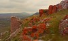
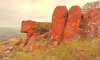
The above images may not be of the site on this page, but were taken nearby. They are loaded from Flickr so please click on them for image credits.
Click here to see more info for this site
Nearby sites
Click here to view sites on an interactive map of the areaKey: Red: member's photo, Blue: 3rd party photo, Yellow: other image, Green: no photo - please go there and take one, Grey: site destroyed
Download sites to:
KML (Google Earth)
GPX (GPS waypoints)
CSV (Garmin/Navman)
CSV (Excel)
To unlock full downloads you need to sign up as a Contributory Member. Otherwise downloads are limited to 50 sites.
Turn off the page maps and other distractions
Nearby sites listing. In the following links * = Image available
9.7km ESE 109° Konya* Ancient Village or Settlement
10.1km ESE 112° Konya Museum Museum
36.6km ESE 120° Abditol Höyük* Ancient Village or Settlement
45.2km ESE 111° Boncuklu Höyük* Ancient Village or Settlement
46.8km SE 124° Çatalhöyük* Ancient Village or Settlement
50.9km WSW 238° Fasillar* Carving
51.6km E 83° Bozdag Roman Dam* Ancient Mine, Quarry or other Industry
55.8km S 179° Karahoyuk (Akoren) Ancient Village or Settlement
63.1km W 262° Eflatun Pinar* Holy Well or Sacred Spring
63.9km E 83° Savatra* Ancient Village or Settlement
64.4km ESE 119° Turkmen Karahoyuk* Ancient Village or Settlement
71.1km NNW 330° Yalburt* Carving
87.4km WNW 282° Arakli Mound Ancient Village or Settlement
109.4km SE 130° Can Hasan* Ancient Village or Settlement
110.7km WNW 293° Temple of Men Askaenos* Ancient Temple
114.1km WNW 294° Pisidian Antioch* Ancient Village or Settlement
114.7km W 265° Sanctuary of Eurymedon* Cave or Rock Shelter
128.7km WSW 254° Adada (Pisidia)* Ancient Village or Settlement
130.1km SW 220° Etenna Ancient Village or Settlement
133.9km WSW 236° Selge* Ancient Village or Settlement
138.8km ENE 65° Acemhöyük* Ancient Village or Settlement
139.8km SW 215° Seleukeia Lyrbe* Ancient Village or Settlement
148.7km WSW 240° Pednelissos* Ancient Village or Settlement
149.5km ENE 70° Aksaray Museum* Museum
151.6km SW 225° Aspendos* Ancient Village or Settlement
View more nearby sites and additional images


 We would like to know more about this location. Please feel free to add a brief description and any relevant information in your own language.
 Wir möchten mehr über diese Stätte erfahren. Bitte zögern Sie nicht, eine kurze Beschreibung und relevante Informationen in Deutsch hinzuzufügen.
 Nous aimerions en savoir encore un peu sur les lieux. S'il vous plaît n'hesitez pas à ajouter une courte description et tous les renseignements pertinents dans votre propre langue.
 Quisieramos informarnos un poco más de las lugares. No dude en añadir una breve descripción y otros datos relevantes en su propio idioma.