


<< Image Pages >> Bubastis - Ancient Village or Settlement in Egypt in Lower Egypt (North)
Submitted by AlexHunger on Sunday, 09 September 2007 Page Views: 8166
Multi-periodSite Name: Bubastis Alternative Name: Tell Basta, Per BastetCountry: Egypt
NOTE: This site is 24.997 km away from the location you searched for.
Region: Lower Egypt (North) Type: Ancient Village or Settlement
Nearest Town: Zagazig Nearest Village: Zagazig
Latitude: 30.572073N Longitude: 31.512643E
Condition:
| 5 | Perfect |
| 4 | Almost Perfect |
| 3 | Reasonable but with some damage |
| 2 | Ruined but still recognisable as an ancient site |
| 1 | Pretty much destroyed, possibly visible as crop marks |
| 0 | No data. |
| -1 | Completely destroyed |
| 5 | Superb |
| 4 | Good |
| 3 | Ordinary |
| 2 | Not Good |
| 1 | Awful |
| 0 | No data. |
| 5 | Can be driven to, probably with disabled access |
| 4 | Short walk on a footpath |
| 3 | Requiring a bit more of a walk |
| 2 | A long walk |
| 1 | In the middle of nowhere, a nightmare to find |
| 0 | No data. |
| 5 | co-ordinates taken by GPS or official recorded co-ordinates |
| 4 | co-ordinates scaled from a detailed map |
| 3 | co-ordinates scaled from a bad map |
| 2 | co-ordinates of the nearest village |
| 1 | co-ordinates of the nearest town |
| 0 | no data |
Be the first person to rate this site - see the 'Contribute!' box in the right hand menu.
Internal Links:
External Links:
")
Bubastis, a city in the eastern Nile Delta, has origins dating back to the 4th Dynasty and was populated into the Roman Period. Goddess of the sacred city was the goddess Bastet, who can be seen as a cat headed woman in museums. There was a temple to Bastet in the town.
Bubastis grew in importance during the 19th Dynasty when the capital was temporarily moved from Thebes (Luxor) to the Delta. Bubastis reached the height of its prosperity in the 22nd Dynasty when Pharaoh Sheshonq I rose to power as he was from there.
You may be viewing yesterday's version of this page. To see the most up to date information please register for a free account.
Do not use the above information on other web sites or publications without permission of the contributor.
Nearby Images from Flickr

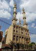
The above images may not be of the site on this page, but were taken nearby. They are loaded from Flickr so please click on them for image credits.
Click here to see more info for this site
Nearby sites
Click here to view sites on an interactive map of the areaKey: Red: member's photo, Blue: 3rd party photo, Yellow: other image, Green: no photo - please go there and take one, Grey: site destroyed
Download sites to:
KML (Google Earth)
GPX (GPS waypoints)
CSV (Garmin/Navman)
CSV (Excel)
To unlock full downloads you need to sign up as a Contributory Member. Otherwise downloads are limited to 50 sites.
Turn off the page maps and other distractions
Nearby sites listing. In the following links * = Image available
34.7km SSW 205° Leontopolis Ancient Village or Settlement
38.0km NE 51° Avaris* Ancient Village or Settlement
39.7km NE 51° Ezbet Rushdi Temple Ancient Temple
40.5km NE 50° Pi-Ramesse Ancient Village or Settlement
50.9km SSW 192° Cairo Airport Obelisk* Standing Stone (Menhir)
53.0km SSW 202° Heliopolis* Ancient Village or Settlement
57.1km NE 38° Tanis* Ancient Village or Settlement
64.3km SSW 205° Museum of Egyptian Antiquities* Museum
64.5km SSW 205° El Zadalek Island Obelisk* Standing Stone (Menhir)
73.3km SW 215° Djedefre's Pyramid Pyramid / Mastaba
75.2km SSW 209° Khufu's Pyramid* Pyramid / Mastaba
75.2km SSW 209° Senegemid Mastabas* Chambered Cairn
75.3km SSW 209° Seschemnofer III. Mastaba* Pyramid / Mastaba
75.4km SSW 209° Giza Plateau* Pyramid / Mastaba
75.4km SSW 209° Giza Mastaba Cemetery* Pyramid / Mastaba
75.5km SSW 209° Great Sphinx* Ancient Temple
75.5km SSW 209° Giza Valley Temple* Ancient Temple
75.8km SSW 209° Khafre's Pyramid* Pyramid / Mastaba
75.8km SSW 208° Heit el-Ghurab* Ancient Village or Settlement
76.2km SSW 209° Menkaure's Pyramid* Pyramid / Mastaba
78.7km SSW 205° Khaba's Pyramid Pyramid / Mastaba
80.3km SSW 203° Niuserra's Pyramid* Pyramid / Mastaba
80.6km SSW 202° Niuserra Sun Temple* Ancient Temple
80.7km SSW 202° Sahure's Pyramid* Pyramid / Mastaba
80.7km SSW 202° Ptah Shepses Mastaba* Chambered Cairn
View more nearby sites and additional images


 We would like to know more about this location. Please feel free to add a brief description and any relevant information in your own language.
 Wir möchten mehr über diese Stätte erfahren. Bitte zögern Sie nicht, eine kurze Beschreibung und relevante Informationen in Deutsch hinzuzufügen.
 Nous aimerions en savoir encore un peu sur les lieux. S'il vous plaît n'hesitez pas à ajouter une courte description et tous les renseignements pertinents dans votre propre langue.
 Quisieramos informarnos un poco más de las lugares. No dude en añadir una breve descripción y otros datos relevantes en su propio idioma.