

<< Text Pages >> Lion Cavern Ngwenya - Ancient Mine, Quarry or other Industry in South Africa
Submitted by davidmorgan on Sunday, 05 July 2020 Page Views: 793
Multi-periodSite Name: Lion Cavern NgwenyaCountry: South Africa
NOTE: This site is 251.179 km away from the location you searched for.
Type: Ancient Mine, Quarry or other Industry
Nearest Town: Mbabane Nearest Village: Ngwenya
Latitude: 26.19256S Longitude: 31.030530E
Condition:
| 5 | Perfect |
| 4 | Almost Perfect |
| 3 | Reasonable but with some damage |
| 2 | Ruined but still recognisable as an ancient site |
| 1 | Pretty much destroyed, possibly visible as crop marks |
| 0 | No data. |
| -1 | Completely destroyed |
| 5 | Superb |
| 4 | Good |
| 3 | Ordinary |
| 2 | Not Good |
| 1 | Awful |
| 0 | No data. |
| 5 | Can be driven to, probably with disabled access |
| 4 | Short walk on a footpath |
| 3 | Requiring a bit more of a walk |
| 2 | A long walk |
| 1 | In the middle of nowhere, a nightmare to find |
| 0 | No data. |
| 5 | co-ordinates taken by GPS or official recorded co-ordinates |
| 4 | co-ordinates scaled from a detailed map |
| 3 | co-ordinates scaled from a bad map |
| 2 | co-ordinates of the nearest village |
| 1 | co-ordinates of the nearest town |
| 0 | no data |
Be the first person to rate this site - see the 'Contribute!' box in the right hand menu.
Internal Links:
External Links:
Ancient Mine in Eswatini (Swaziland)
Possibly the oldest mine in the world, an iron ore mine dated at 43,000 years old.
You may be viewing yesterday's version of this page. To see the most up to date information please register for a free account.
Do not use the above information on other web sites or publications without permission of the contributor.
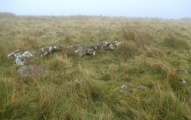
Nearby Images from Flickr
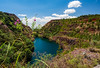
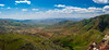
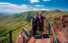
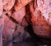
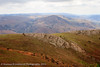
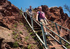
The above images may not be of the site on this page, but were taken nearby. They are loaded from Flickr so please click on them for image credits.
Click here to see more info for this site
Nearby sites
Click here to view sites on an interactive map of the areaKey: Red: member's photo, Blue: 3rd party photo, Yellow: other image, Green: no photo - please go there and take one, Grey: site destroyed
Download sites to:
KML (Google Earth)
GPX (GPS waypoints)
CSV (Garmin/Navman)
CSV (Excel)
To unlock full downloads you need to sign up as a Contributory Member. Otherwise downloads are limited to 50 sites.
Turn off the page maps and other distractions
Nearby sites listing. In the following links * = Image available
68.0km NNW 336° Bantu stone circles* Standing Stones
132.4km SE 134° Border Cave* Cave or Rock Shelter
288.6km W 279° African Window* Museum
320.7km W 276° Malapa* Cave or Rock Shelter
329.7km W 273° Sterkfontein* Cave or Rock Shelter
370.3km S 179° Sibudu Cave* Cave or Rock Shelter
380.0km SSW 200° Kamberg rock art Rock Art
385.5km NW 313° Palala River Bluffs San Rock Paintings* Rock Art
411.4km SSW 202° Ikanti Shelter I Rock Art
472.5km NNW 338° Machete I Rock Art
486.8km SSW 214° Lesob 5 Rock Art
487.0km SSW 214° Lesob 4 Rock Art
487.6km SSW 214° Lesob 2 Rock Art
487.7km SSW 214° Lesob 3 Rock Art
488.4km SSW 214° Lesob 1 Rock Art
514.5km WSW 256° Wolmaransstad Rock Art Rock Art
537.0km WNW 291° Matsieng Footprints Rock Art
608.6km WSW 250° Stowlands Rock art Rock Art
658.3km N 359° Great Zimbabwe* Ancient Village or Settlement
678.2km NNW 337° Inanke Cave Cave or Rock Shelter
678.9km WSW 244° McGregor Museum Museum
683.7km NNW 337° World's View Matobo National Park* Natural Stone / Erratic / Other Natural Feature
687.0km NNW 337° Bambata Cave* Cave or Rock Shelter
687.0km WSW 245° Wildebeestkuil* Rock Art
688.1km WSW 246° Nooitgedacht Rock art Rock Art
View more nearby sites and additional images


 We would like to know more about this location. Please feel free to add a brief description and any relevant information in your own language.
 Wir möchten mehr über diese Stätte erfahren. Bitte zögern Sie nicht, eine kurze Beschreibung und relevante Informationen in Deutsch hinzuzufügen.
 Nous aimerions en savoir encore un peu sur les lieux. S'il vous plaît n'hesitez pas à ajouter une courte description et tous les renseignements pertinents dans votre propre langue.
 Quisieramos informarnos un poco más de las lugares. No dude en añadir una breve descripción y otros datos relevantes en su propio idioma.