


<< Text Pages >> Pierre Branlante de Salles - Rock Outcrop in France in Rhone:Loire (42)
Submitted by holger_rix on Tuesday, 05 April 2016 Page Views: 948
Natural PlacesSite Name: Pierre Branlante de SallesCountry: France
NOTE: This site is 9.134 km away from the location you searched for.
Département: Rhone:Loire (42) Type: Rock Outcrop
Nearest Town: Montbrison Nearest Village: Les Salles
Latitude: 45.861645N Longitude: 3.778960E
Condition:
| 5 | Perfect |
| 4 | Almost Perfect |
| 3 | Reasonable but with some damage |
| 2 | Ruined but still recognisable as an ancient site |
| 1 | Pretty much destroyed, possibly visible as crop marks |
| 0 | No data. |
| -1 | Completely destroyed |
| 5 | Superb |
| 4 | Good |
| 3 | Ordinary |
| 2 | Not Good |
| 1 | Awful |
| 0 | No data. |
| 5 | Can be driven to, probably with disabled access |
| 4 | Short walk on a footpath |
| 3 | Requiring a bit more of a walk |
| 2 | A long walk |
| 1 | In the middle of nowhere, a nightmare to find |
| 0 | No data. |
| 5 | co-ordinates taken by GPS or official recorded co-ordinates |
| 4 | co-ordinates scaled from a detailed map |
| 3 | co-ordinates scaled from a bad map |
| 2 | co-ordinates of the nearest village |
| 1 | co-ordinates of the nearest town |
| 0 | no data |
Be the first person to rate this site - see the 'Contribute!' box in the right hand menu.
Internal Links:
External Links:
Rock Outcrop in Rhone:Loire (42)
Les Salles, Montbrison, Loire, Auvergne-Rhône-Alpes
Source: T4T35.fr
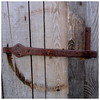
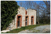
Picture:
www.panoramio.com
You may be viewing yesterday's version of this page. To see the most up to date information please register for a free account.
Do not use the above information on other web sites or publications without permission of the contributor.
Nearby Images from Flickr
The above images may not be of the site on this page, but were taken nearby. They are loaded from Flickr so please click on them for image credits.
Click here to see more info for this site
Nearby sites
Click here to view sites on an interactive map of the areaKey: Red: member's photo, Blue: 3rd party photo, Yellow: other image, Green: no photo - please go there and take one, Grey: site destroyed
Download sites to:
KML (Google Earth)
GPX (GPS waypoints)
CSV (Garmin/Navman)
CSV (Excel)
To unlock full downloads you need to sign up as a Contributory Member. Otherwise downloads are limited to 50 sites.
Turn off the page maps and other distractions
Nearby sites listing. In the following links * = Image available
1.9km NW 314° Pierre de Bachasson Sculptured Stone
3.3km SSW 200° Pierre Branlante des Chassagnes Rock Art
4.7km WNW 301° Pierre Saint-Martin (La Croix Saint-Martin) Rock Art
8.0km NNW 338° Pierre aux Fées (Saint-Priest-la-Prugne) Sculptured Stone
10.5km SW 221° Barque des Morts Rock Art
13.9km W 260° Pierres à Bassin de Montguerlhe Rock Art
14.8km SSW 198° La Renaudie menhir Standing Stone (Menhir)
15.5km N 6° Pierres du Joû Rock Outcrop
15.6km N 3° Pierres du Calvaire Rock Outcrop
15.9km WSW 255° Rocher de l'Aigle Rock Art
15.9km WSW 255° Pierre des Mousquetaires Rock Art
18.4km NW 312° La Pierre du Sang* Rock Art
19.3km N 1° Pierre des Seigneurs Rock Art
19.6km S 179° Menhir du Col du Béal Standing Stone (Menhir)
20.5km NW 306° Cupules de Roussille Rock Art
20.9km ENE 78° Pierrefitte (Dancé) Burial Chamber or Dolmen
25.2km S 183° Dolmen de Pierre Cuberte* Burial Chamber or Dolmen
25.6km NNW 337° Pierres à Cupules de Courtines Rock Art
31.7km E 99° Dolmen de Balbigny* Burial Chamber or Dolmen
35.5km SSE 149° Dolmen de Bard Burial Chamber or Dolmen
35.6km S 190° Pierre Couverte d'Ambert* Burial Chamber or Dolmen
37.4km WSW 246° Pierre-aux-Fées Rock Art
37.9km SSE 157° Dolmen de la Roche-des-Fades Burial Chamber or Dolmen
40.5km SSW 203° Pierres Folles (Fournols)* Natural Stone / Erratic / Other Natural Feature
40.5km SSW 203° Pierre du Lit* Natural Stone / Erratic / Other Natural Feature
View more nearby sites and additional images


 We would like to know more about this location. Please feel free to add a brief description and any relevant information in your own language.
 Wir möchten mehr über diese Stätte erfahren. Bitte zögern Sie nicht, eine kurze Beschreibung und relevante Informationen in Deutsch hinzuzufügen.
 Nous aimerions en savoir encore un peu sur les lieux. S'il vous plaît n'hesitez pas à ajouter une courte description et tous les renseignements pertinents dans votre propre langue.
 Quisieramos informarnos un poco más de las lugares. No dude en añadir una breve descripción y otros datos relevantes en su propio idioma.