

<< Text Pages >> Dolmen de Condamine - Burial Chamber or Dolmen in France in Languedoc:Lozère (48)
Submitted by TheCaptain on Friday, 06 May 2011 Page Views: 1434
Neolithic and Bronze AgeSite Name: Dolmen de CondamineCountry: France
NOTE: This site is 1.908 km away from the location you searched for.
Département: Languedoc:Lozère (48) Type: Burial Chamber or Dolmen
Nearest Town: Mende Nearest Village: Montbrun
Latitude: 44.332451N Longitude: 3.527121E
Condition:
| 5 | Perfect |
| 4 | Almost Perfect |
| 3 | Reasonable but with some damage |
| 2 | Ruined but still recognisable as an ancient site |
| 1 | Pretty much destroyed, possibly visible as crop marks |
| 0 | No data. |
| -1 | Completely destroyed |
| 5 | Superb |
| 4 | Good |
| 3 | Ordinary |
| 2 | Not Good |
| 1 | Awful |
| 0 | No data. |
| 5 | Can be driven to, probably with disabled access |
| 4 | Short walk on a footpath |
| 3 | Requiring a bit more of a walk |
| 2 | A long walk |
| 1 | In the middle of nowhere, a nightmare to find |
| 0 | No data. |
| 5 | co-ordinates taken by GPS or official recorded co-ordinates |
| 4 | co-ordinates scaled from a detailed map |
| 3 | co-ordinates scaled from a bad map |
| 2 | co-ordinates of the nearest village |
| 1 | co-ordinates of the nearest town |
| 0 | no data |
Be the first person to rate this site - see the 'Contribute!' box in the right hand menu.
Internal Links:
External Links:
burial chamber in Languedoc-Rousillon:Lozere
La Condamine is a burial chamber in the community of Montbrun , Departement of Lozere, Region of Languedoc-Rousillon
You may be viewing yesterday's version of this page. To see the most up to date information please register for a free account.
Do not use the above information on other web sites or publications without permission of the contributor.
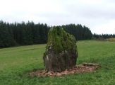
Nearby Images from Flickr
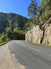
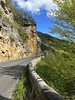
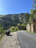
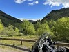
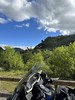
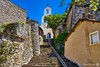
The above images may not be of the site on this page, but were taken nearby. They are loaded from Flickr so please click on them for image credits.
Click here to see more info for this site
Nearby sites
Click here to view sites on an interactive map of the areaKey: Red: member's photo, Blue: 3rd party photo, Yellow: other image, Green: no photo - please go there and take one, Grey: site destroyed
Download sites to:
KML (Google Earth)
GPX (GPS waypoints)
CSV (Garmin/Navman)
CSV (Excel)
To unlock full downloads you need to sign up as a Contributory Member. Otherwise downloads are limited to 50 sites.
Turn off the page maps and other distractions
Nearby sites listing. In the following links * = Image available
1.1km ESE 112° Dolmen de Combe-Lébrouse* Burial Chamber or Dolmen
2.1km ESE 104° Cote 1032 menhirs* Standing Stones
2.1km ESE 106° Cote 1032 dolmen* Burial Chamber or Dolmen
2.5km E 86° Cropilhac deux menhirs* Standing Stones
2.9km E 93° Chemin-du-Tomple dolmen* Burial Chamber or Dolmen
3.3km SE 134° Dolmen de Valbelle* Burial Chamber or Dolmen
3.3km E 95° Dolmen dit la Pierre Plate (Florac)* Burial Chamber or Dolmen
3.6km E 99° Relais Menhir* Standing Stone (Menhir)
5.0km ESE 123° Dolmen de la Bastide Burial Chamber or Dolmen
5.1km NNW 344° Menhir des Coustos Standing Stone (Menhir)
5.2km ESE 122° Tumulus du Mouli del Ben Round Cairn
5.8km NE 48° Menhirs dits de la Can d'Issanges Standing Stone (Menhir)
5.9km SE 132° Menhirs des Jalses de Croupillac* Standing Stones
6.1km NW 317° Tumulus des Lacs 3 Cairn
6.3km NW 314° Tumulus des Lacs 4 Cairn
6.3km NW 315° Tumulus des Lacs 2 Cairn
6.4km NE 47° Menhir de las Ganses Standing Stone (Menhir)
6.5km NW 316° Tumulus des Lacs 1 Cairn
6.8km SSE 150° Cabassude menhir Standing Stone (Menhir)
6.9km WSW 254° Dolmen de Vallongue* Burial Chamber or Dolmen
7.3km NW 308° Tumulus de Jouanas Cairn
7.4km SW 222° Menhir de la plaine de Chanet* Standing Stone (Menhir)
7.7km SW 233° Moures menhir Standing Stone (Menhir)
7.8km ENE 76° Cocurès menhirs Standing Stones
7.9km W 262° Menhir des Espougnes* Standing Stone (Menhir)
View more nearby sites and additional images


 We would like to know more about this location. Please feel free to add a brief description and any relevant information in your own language.
 Wir möchten mehr über diese Stätte erfahren. Bitte zögern Sie nicht, eine kurze Beschreibung und relevante Informationen in Deutsch hinzuzufügen.
 Nous aimerions en savoir encore un peu sur les lieux. S'il vous plaît n'hesitez pas à ajouter une courte description et tous les renseignements pertinents dans votre propre langue.
 Quisieramos informarnos un poco más de las lugares. No dude en añadir una breve descripción y otros datos relevantes en su propio idioma.