

<< Text Pages >> Menhir dit la Pierre Plantée (Pingechabre) - Standing Stone (Menhir) in France in Languedoc:Lozère (48)
Submitted by holger_rix on Thursday, 21 April 2016 Page Views: 894
Neolithic and Bronze AgeSite Name: Menhir dit la Pierre Plantée (Pingechabre) Alternative Name: Menhir de PingechabreCountry: France
NOTE: This site is 14.57 km away from the location you searched for.
Département: Languedoc:Lozère (48) Type: Standing Stone (Menhir)
Nearest Town: Mende Nearest Village: Saint-Pierre-le-Vieux
Latitude: 44.865214N Longitude: 3.303290E
Condition:
| 5 | Perfect |
| 4 | Almost Perfect |
| 3 | Reasonable but with some damage |
| 2 | Ruined but still recognisable as an ancient site |
| 1 | Pretty much destroyed, possibly visible as crop marks |
| 0 | No data. |
| -1 | Completely destroyed |
| 5 | Superb |
| 4 | Good |
| 3 | Ordinary |
| 2 | Not Good |
| 1 | Awful |
| 0 | No data. |
| 5 | Can be driven to, probably with disabled access |
| 4 | Short walk on a footpath |
| 3 | Requiring a bit more of a walk |
| 2 | A long walk |
| 1 | In the middle of nowhere, a nightmare to find |
| 0 | No data. |
| 5 | co-ordinates taken by GPS or official recorded co-ordinates |
| 4 | co-ordinates scaled from a detailed map |
| 3 | co-ordinates scaled from a bad map |
| 2 | co-ordinates of the nearest village |
| 1 | co-ordinates of the nearest town |
| 0 | no data |
Be the first person to rate this site - see the 'Contribute!' box in the right hand menu.
Internal Links:
External Links:
Standing Stone (Menhir) in Languedoc:Lozère (48)
Chaffard, Saint-Pierre-le-Vieux, Mende, Lozère, Languedoc-Roussillon-Midi-Pyrénées
Source: Wikipedia article
Sites mégalithiques de la Lozère
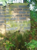
Picture:
dolmen1.free.fr
You may be viewing yesterday's version of this page. To see the most up to date information please register for a free account.
Do not use the above information on other web sites or publications without permission of the contributor.
Nearby Images from Flickr

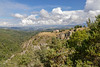
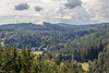
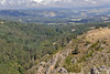
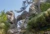
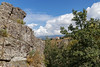
The above images may not be of the site on this page, but were taken nearby. They are loaded from Flickr so please click on them for image credits.
Click here to see more info for this site
Nearby sites
Click here to view sites on an interactive map of the areaKey: Red: member's photo, Blue: 3rd party photo, Yellow: other image, Green: no photo - please go there and take one, Grey: site destroyed
Download sites to:
KML (Google Earth)
GPX (GPS waypoints)
CSV (Garmin/Navman)
CSV (Excel)
To unlock full downloads you need to sign up as a Contributory Member. Otherwise downloads are limited to 50 sites.
Turn off the page maps and other distractions
Nearby sites listing. In the following links * = Image available
8.9km NW 322° Loubaresse* Standing Stone (Menhir)
20.9km SSE 168° Dolmen de l'Hermet Burial Chamber or Dolmen
21.9km NW 321° Tumulus des Rocs Artificial Mound
22.6km NNE 29° Dolmen de la Thuile aux Fées* Burial Chamber or Dolmen
24.4km WNW 300° Menhir de la Croix-Grosse* Standing Stone (Menhir)
24.7km NW 323° Dolmen du Chausse* Burial Chamber or Dolmen
25.0km NW 323° Plateau de Mons Barrow Cemetery
25.5km W 267° Menhir d'Arjalet Standing Stone (Menhir)
25.7km N 10° Cronce menhir Standing Stone (Menhir)
26.2km WNW 302° Bois-Grand Dolmen* Burial Chamber or Dolmen
26.7km WNW 299° Bargueyrac Menhir* Standing Stone (Menhir)
26.8km WNW 301° La Table au Loup* Burial Chamber or Dolmen
27.3km NW 307° Tombe du Capitaine* Burial Chamber or Dolmen
27.7km NW 309° Pierre Levée dolmen 2 (Villedieu)* Burial Chamber or Dolmen
27.7km WNW 289° Menhir du Bois des Sagnes Standing Stone (Menhir)
27.9km NW 309° Pierre Levée dolmen 1 (Villedieu)* Burial Chamber or Dolmen
28.0km NW 309° Pierre Levée (Villedieu)* Standing Stone (Menhir)
28.2km SSE 155° Menhir de Savigner Standing Stone (Menhir)
29.2km NW 313° Dolmen de Crousette* Burial Chamber or Dolmen
29.7km WNW 297° Alleuzet Dolmen* Burial Chamber or Dolmen
32.0km NW 325° Menhir de Saint-Menais Standing Stone (Menhir)
32.3km WNW 301° Dolmen de Lapeyre Burial Chamber or Dolmen
33.1km S 179° Dolmen de la Croix du Siffleur* Burial Chamber or Dolmen
33.5km NW 309° Pierre-du-Loup (Valuejols)* Burial Chamber or Dolmen
33.8km S 180° Dolmens du Plateau de Poujoulet* Burial Chamber or Dolmen
View more nearby sites and additional images


 We would like to know more about this location. Please feel free to add a brief description and any relevant information in your own language.
 Wir möchten mehr über diese Stätte erfahren. Bitte zögern Sie nicht, eine kurze Beschreibung und relevante Informationen in Deutsch hinzuzufügen.
 Nous aimerions en savoir encore un peu sur les lieux. S'il vous plaît n'hesitez pas à ajouter une courte description et tous les renseignements pertinents dans votre propre langue.
 Quisieramos informarnos un poco más de las lugares. No dude en añadir una breve descripción y otros datos relevantes en su propio idioma.