


<< Text Pages >> Pierre-aux-Fées - Rock Art in France in Auvergne:Puy-de-Dôme (63)
Submitted by TheCaptain on Wednesday, 08 September 2010 Page Views: 2277
Rock ArtSite Name: Pierre-aux-FéesCountry: France
NOTE: This site is 1.107 km away from the location you searched for.
Département: Auvergne:Puy-de-Dôme (63) Type: Rock Art
Nearest Town: Clermont-Ferrand Nearest Village: Billom
Latitude: 45.723000N Longitude: 3.339000E
Condition:
| 5 | Perfect |
| 4 | Almost Perfect |
| 3 | Reasonable but with some damage |
| 2 | Ruined but still recognisable as an ancient site |
| 1 | Pretty much destroyed, possibly visible as crop marks |
| 0 | No data. |
| -1 | Completely destroyed |
| 5 | Superb |
| 4 | Good |
| 3 | Ordinary |
| 2 | Not Good |
| 1 | Awful |
| 0 | No data. |
| 5 | Can be driven to, probably with disabled access |
| 4 | Short walk on a footpath |
| 3 | Requiring a bit more of a walk |
| 2 | A long walk |
| 1 | In the middle of nowhere, a nightmare to find |
| 0 | No data. |
| 5 | co-ordinates taken by GPS or official recorded co-ordinates |
| 4 | co-ordinates scaled from a detailed map |
| 3 | co-ordinates scaled from a bad map |
| 2 | co-ordinates of the nearest village |
| 1 | co-ordinates of the nearest town |
| 0 | no data |
Be the first person to rate this site - see the 'Contribute!' box in the right hand menu.
Internal Links:
External Links:
I have visited· I would like to visit
TheCaptain has visited here
Pierre-aux-Fées is a Pierre a Cupules in the community of Billom, Departement of Puy-de-Dome, Region of Auvergne
You may be viewing yesterday's version of this page. To see the most up to date information please register for a free account.
 (PID:23925)")
Do not use the above information on other web sites or publications without permission of the contributor.
Nearby Images from Flickr

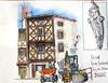
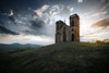
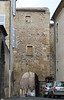
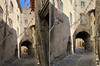
The above images may not be of the site on this page, but were taken nearby. They are loaded from Flickr so please click on them for image credits.
Click here to see more info for this site
Nearby sites
Click here to view sites on an interactive map of the areaKey: Red: member's photo, Blue: 3rd party photo, Yellow: other image, Green: no photo - please go there and take one, Grey: site destroyed
Download sites to:
KML (Google Earth)
GPX (GPS waypoints)
CSV (Garmin/Navman)
CSV (Excel)
To unlock full downloads you need to sign up as a Contributory Member. Otherwise downloads are limited to 50 sites.
Turn off the page maps and other distractions
Nearby sites listing. In the following links * = Image available
8.4km NW 304° Oppidum du Puy du Mur Ancient Village or Settlement
11.1km W 259° Orthostat of Martres de Veyre* Chambered Tomb
14.8km WSW 248° Pierrefade (Charvilhat) Standing Stone (Menhir)
15.3km WSW 239° Veyre-Monton buried standing stones* Standing Stones
16.0km WNW 293° Menhir de la Grande Borne* Standing Stone (Menhir)
16.3km WNW 294° Menhir du Puy de la Poix* Standing Stone (Menhir)
16.7km WNW 283° Pierre Piquée du Pont d'Aubières* Standing Stone (Menhir)
16.8km W 269° Plateau de Gergovie* Ancient Village or Settlement
17.3km WNW 295° Menhir de Brézet Standing Stone (Menhir)
17.3km WNW 288° Orthostat de la Sarre Burial Chamber or Dolmen
18.3km W 278° Pierre Piquée d'Aubière, Rue Pourliat* Marker Stone
21.8km SW 231° Menhir dit Pierre Fichade* Standing Stone (Menhir)
21.9km ENE 59° Pierre des Mousquetaires Rock Art
21.9km ENE 59° Rocher de l'Aigle Rock Art
22.2km W 262° Chaos de Flore* Rock Outcrop
22.3km SSW 210° Grottes de Perrier* Cave or Rock Shelter
22.8km WNW 293° Oppidum des Côtes de Clermont Ancient Village or Settlement
22.9km W 271° Menhir de Berzet* Standing Stone (Menhir)
23.1km W 268° Dolmen de Samson* Burial Chamber or Dolmen
23.9km SSW 195° Dolmen de Loubaresse* Burial Chamber or Dolmen
24.3km ENE 57° Pierres à Bassin de Montguerlhe Rock Art
24.4km WSW 243° Pierre Branlante d'Olloix* Natural Stone / Erratic / Other Natural Feature
24.4km NW 317° Stade de la Varenne Menhir* Standing Stone (Menhir)
24.4km WSW 243° Olloix Dolmen* Burial Chamber or Dolmen
24.6km W 273° Thedes Menhir* Standing Stone (Menhir)
View more nearby sites and additional images


 We would like to know more about this location. Please feel free to add a brief description and any relevant information in your own language.
 Wir möchten mehr über diese Stätte erfahren. Bitte zögern Sie nicht, eine kurze Beschreibung und relevante Informationen in Deutsch hinzuzufügen.
 Nous aimerions en savoir encore un peu sur les lieux. S'il vous plaît n'hesitez pas à ajouter une courte description et tous les renseignements pertinents dans votre propre langue.
 Quisieramos informarnos un poco más de las lugares. No dude en añadir una breve descripción y otros datos relevantes en su propio idioma.