


<< Text Pages >> Berberkayasi - Rock Cut Tomb in Turkey
Submitted by davidmorgan on Saturday, 13 February 2016 Page Views: 1244
Multi-periodSite Name: Berberkayasi Alternative Name: BerberkayasıCountry: Turkey
NOTE: This site is 1.979 km away from the location you searched for.
Type: Rock Cut Tomb
Nearest Town: Iznik
Latitude: 40.426843N Longitude: 29.740486E
Condition:
| 5 | Perfect |
| 4 | Almost Perfect |
| 3 | Reasonable but with some damage |
| 2 | Ruined but still recognisable as an ancient site |
| 1 | Pretty much destroyed, possibly visible as crop marks |
| 0 | No data. |
| -1 | Completely destroyed |
| 5 | Superb |
| 4 | Good |
| 3 | Ordinary |
| 2 | Not Good |
| 1 | Awful |
| 0 | No data. |
| 5 | Can be driven to, probably with disabled access |
| 4 | Short walk on a footpath |
| 3 | Requiring a bit more of a walk |
| 2 | A long walk |
| 1 | In the middle of nowhere, a nightmare to find |
| 0 | No data. |
| 5 | co-ordinates taken by GPS or official recorded co-ordinates |
| 4 | co-ordinates scaled from a detailed map |
| 3 | co-ordinates scaled from a bad map |
| 2 | co-ordinates of the nearest village |
| 1 | co-ordinates of the nearest town |
| 0 | no data |
Internal Links:
External Links:
Rock Cut Tomb in Bursa Province, Turkey
A Bithynian basalt tomb erected for King Prusias in the 2nd century BCE.
You may be viewing yesterday's version of this page. To see the most up to date information please register for a free account.
Do not use the above information on other web sites or publications without permission of the contributor.
Nearby Images from Flickr
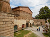
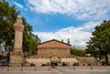
The above images may not be of the site on this page, but were taken nearby. They are loaded from Flickr so please click on them for image credits.
Click here to see more info for this site
Nearby sites
Click here to view sites on an interactive map of the areaKey: Red: member's photo, Blue: 3rd party photo, Yellow: other image, Green: no photo - please go there and take one, Grey: site destroyed
Download sites to:
KML (Google Earth)
GPX (GPS waypoints)
CSV (Garmin/Navman)
CSV (Excel)
To unlock full downloads you need to sign up as a Contributory Member. Otherwise downloads are limited to 50 sites.
Turn off the page maps and other distractions
Nearby sites listing. In the following links * = Image available
6.7km N 349° Dört Tepeler Chambered Tomb
21.3km SSW 213° Barcin Tumulus Ancient Village or Settlement
37.8km SSE 146° Bilecik* Ancient Village or Settlement
78.4km SE 145° Demircihoyuk Ancient Village or Settlement
86.9km WSW 251° Aktopraklik Hoyuk Ancient Village or Settlement
91.1km NW 315° Spiral Column* Carving
91.1km NW 315° Istanbul Amenhotep III Obelisk* Standing Stone (Menhir)
91.2km NW 315° The Basilica Cistern, Istanbul* Ancient Mine, Quarry or other Industry
91.3km NW 316° Istanbul Archaeological Museum* Museum
91.6km NW 315° Column of Constantine* Standing Stone (Menhir)
92.0km NW 314° Yenikapi Ancient Village or Settlement
92.3km NW 315° Istanbul University Archaeological Museum Museum
94.1km WSW 253° Apollonia ad Rhyndacum* Ancient Village or Settlement
94.6km S 174° Seyitömer Höyük* Ancient Village or Settlement
96.5km SSW 199° Deliklitaş Sculptured Stone
108.3km NW 309° Bathonea Ancient Village or Settlement
129.1km SE 138° Kulluoba Hoyuk Ancient Village or Settlement
136.7km S 185° Aizanoi* Ancient Village or Settlement
147.0km WSW 258° Daskyleion* Ancient Village or Settlement
153.6km SSE 151° Kümbet North Tomb* Rock Cut Tomb
154.0km SSE 151° Kümbet Rock Sanctuary* Ancient Temple
154.1km SSE 151° Kümbet Lion Tomb* Rock Cut Tomb
156.6km SSE 148° Gerdek Kaya* Rock Cut Tomb
157.9km SSE 148° Areyastis Monument* Sculptured Stone
158.3km SSE 158° Aslankaya* Carving
View more nearby sites and additional images


 We would like to know more about this location. Please feel free to add a brief description and any relevant information in your own language.
 Wir möchten mehr über diese Stätte erfahren. Bitte zögern Sie nicht, eine kurze Beschreibung und relevante Informationen in Deutsch hinzuzufügen.
 Nous aimerions en savoir encore un peu sur les lieux. S'il vous plaît n'hesitez pas à ajouter une courte description et tous les renseignements pertinents dans votre propre langue.
 Quisieramos informarnos un poco más de las lugares. No dude en añadir una breve descripción y otros datos relevantes en su propio idioma.