


<< Our Photo Pages >> Kastellorizo Lycian Tomb - Rock Cut Tomb in Greece in Greek Islands
Submitted by Kuba on Tuesday, 24 November 2020 Page Views: 466
Roman, Greek and ClassicalSite Name: Kastellorizo Lycian Tomb Alternative Name: Λυκιακός τάφοςCountry: Greece
NOTE: This site is 1.049 km away from the location you searched for.
Region: Greek Islands Type: Rock Cut Tomb
Nearest Town: Megisti
Latitude: 36.151208N Longitude: 29.594920E
Condition:
| 5 | Perfect |
| 4 | Almost Perfect |
| 3 | Reasonable but with some damage |
| 2 | Ruined but still recognisable as an ancient site |
| 1 | Pretty much destroyed, possibly visible as crop marks |
| 0 | No data. |
| -1 | Completely destroyed |
| 5 | Superb |
| 4 | Good |
| 3 | Ordinary |
| 2 | Not Good |
| 1 | Awful |
| 0 | No data. |
| 5 | Can be driven to, probably with disabled access |
| 4 | Short walk on a footpath |
| 3 | Requiring a bit more of a walk |
| 2 | A long walk |
| 1 | In the middle of nowhere, a nightmare to find |
| 0 | No data. |
| 5 | co-ordinates taken by GPS or official recorded co-ordinates |
| 4 | co-ordinates scaled from a detailed map |
| 3 | co-ordinates scaled from a bad map |
| 2 | co-ordinates of the nearest village |
| 1 | co-ordinates of the nearest town |
| 0 | no data |
Internal Links:
External Links:
I have visited· I would like to visit
rrmoser would like to visit
")
Lycian rock-cut tomb from the 4th century BC, supposedly the only one on the Greek soil.
You may be viewing yesterday's version of this page. To see the most up to date information please register for a free account.
Do not use the above information on other web sites or publications without permission of the contributor.
Nearby Images from Flickr
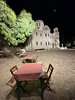
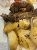
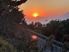
The above images may not be of the site on this page, but were taken nearby. They are loaded from Flickr so please click on them for image credits.
Click here to see more info for this site
Nearby sites
Click here to view sites on an interactive map of the areaKey: Red: member's photo, Blue: 3rd party photo, Yellow: other image, Green: no photo - please go there and take one, Grey: site destroyed
Download sites to:
KML (Google Earth)
GPX (GPS waypoints)
CSV (Garmin/Navman)
CSV (Excel)
To unlock full downloads you need to sign up as a Contributory Member. Otherwise downloads are limited to 50 sites.
Turn off the page maps and other distractions
Nearby sites listing. In the following links * = Image available
6.5km NNE 34° Antiphellos* Ancient Village or Settlement
11.6km NNW 333° Gökçeören* Rock Cut Tomb
11.9km NNE 31° Phellos.* Ancient Village or Settlement
15.6km ENE 75° Apollonia (Turkey)* Ancient Village or Settlement
16.8km E 87° Aperlai Ancient Village or Settlement
19.8km NNE 21° Kandyba* Ancient Village or Settlement
22.4km ENE 62° Cyaneae* Ancient Village or Settlement
23.5km ENE 77° Teimiussa* Ancient Village or Settlement
24.4km E 79° Simena* Ancient Village or Settlement
24.6km ENE 71° Bucak* Rock Cut Tomb
24.8km NE 52° Korba (Turkey) Ancient Village or Settlement
26.7km ENE 71° Hoyran* Ancient Village or Settlement
27.9km WNW 296° Patara* Ancient Village or Settlement
30.3km ENE 64° Trysa Heroon* Chambered Tomb
33.0km ENE 72° Sura (Lycia)* Ancient Village or Settlement
33.5km ENE 75° Andriake* Ancient Village or Settlement
33.7km NW 313° Xanthos* Ancient Village or Settlement
34.0km NW 306° Letoon* Ancient Village or Settlement
37.0km ENE 71° Myra Rock Cut Tombs* Rock Cut Tomb
38.4km WNW 302° Pydnai* Ancient Village or Settlement
46.0km NW 309° Sidyma* Ancient Village or Settlement
47.6km NNW 341° Tlos Settlement* Ancient Village or Settlement
48.3km NW 321° Pinara* Ancient Village or Settlement
52.6km N 356° Kastabara* Ancient Village or Settlement
55.7km ENE 67° Limyra* Ancient Village or Settlement
View more nearby sites and additional images


 We would like to know more about this location. Please feel free to add a brief description and any relevant information in your own language.
 Wir möchten mehr über diese Stätte erfahren. Bitte zögern Sie nicht, eine kurze Beschreibung und relevante Informationen in Deutsch hinzuzufügen.
 Nous aimerions en savoir encore un peu sur les lieux. S'il vous plaît n'hesitez pas à ajouter une courte description et tous les renseignements pertinents dans votre propre langue.
 Quisieramos informarnos un poco más de las lugares. No dude en añadir una breve descripción y otros datos relevantes en su propio idioma.