


<< Text Pages >> Pirttihaudankangas Giant's Church - Stone Fort or Dun in Finland
Submitted by Anne T on Thursday, 19 May 2016 Page Views: 971
Multi-periodSite Name: Pirttihaudankangas Giant's Church Alternative Name: Pirttihaudankangas JätinkirkkoCountry: Finland
NOTE: This site is 32.477 km away from the location you searched for.
Type: Stone Fort or Dun
Nearest Town: Raahe Nearest Village: Orava or Mattylanperä
Latitude: 64.539846N Longitude: 24.576907E
Condition:
| 5 | Perfect |
| 4 | Almost Perfect |
| 3 | Reasonable but with some damage |
| 2 | Ruined but still recognisable as an ancient site |
| 1 | Pretty much destroyed, possibly visible as crop marks |
| 0 | No data. |
| -1 | Completely destroyed |
| 5 | Superb |
| 4 | Good |
| 3 | Ordinary |
| 2 | Not Good |
| 1 | Awful |
| 0 | No data. |
| 5 | Can be driven to, probably with disabled access |
| 4 | Short walk on a footpath |
| 3 | Requiring a bit more of a walk |
| 2 | A long walk |
| 1 | In the middle of nowhere, a nightmare to find |
| 0 | No data. |
| 5 | co-ordinates taken by GPS or official recorded co-ordinates |
| 4 | co-ordinates scaled from a detailed map |
| 3 | co-ordinates scaled from a bad map |
| 2 | co-ordinates of the nearest village |
| 1 | co-ordinates of the nearest town |
| 0 | no data |
Internal Links:
External Links:
Stone Fort or Dun in Finland
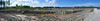
Pirttihaudankangas Giant’s Church in the Raahe region is one of around 50 Neolithic stone structures found only in Ostrobothnia in Western Finland.
Dated as prehistoric, the official records for the Cultural Environment Agency state that Pirttihaudankangas is located near Mattilanperältä (just over 5 km to the south). The structure measures around 35 x 50 metres. About 100 metres south south east there are three röykkiötä (pits, mounds or cairns?) each with a diameter of 2.5 to 3 metres and a height of 30-40 cms. This site is located in a mining area subject to subsidence, which caused some destruction in 2010. To the east and south, the defensive walls of this Giant's Church would have been 2-3 metres high.
Largely dated as Stone Age, all Giant's Church structures are recorded as having been built between 2,500 and 2,000 BC in a time when sea level was much higher, so they will have been islands.
For further information and comment see our news article "an introduction to the Giant's Churches of Finland."
(Thanks to Martti Lahti in Finland for the information, although apologies for any errors in translation).
Note: Have you visited this site? Are you able to provide further details? Do you have a photograph you can contribute?
You may be viewing yesterday's version of this page. To see the most up to date information please register for a free account.
Do not use the above information on other web sites or publications without permission of the contributor.
Nearby Images from Flickr
The above images may not be of the site on this page, but were taken nearby. They are loaded from Flickr so please click on them for image credits.
Click here to see more info for this site
Nearby sites
Click here to view sites on an interactive map of the areaKey: Red: member's photo, Blue: 3rd party photo, Yellow: other image, Green: no photo - please go there and take one, Grey: site destroyed
Download sites to:
KML (Google Earth)
GPX (GPS waypoints)
CSV (Garmin/Navman)
CSV (Excel)
To unlock full downloads you need to sign up as a Contributory Member. Otherwise downloads are limited to 50 sites.
Turn off the page maps and other distractions
Nearby sites listing. In the following links * = Image available
965m NNW 343° Pirttivaara Giant's Church Stone Fort or Dun
5.4km NNE 29° Kettukangas Giant's Church Stone Fort or Dun
6.4km NE 37° Pikku Jakenaro Giant's Church Stone Fort or Dun
11.0km NNE 32° Kiviojankangas Giant's Church Stone Fort or Dun
12.1km NNE 32° Kastelli Linnakangas Giant's Church Stone Fort or Dun
12.1km NNE 33° Kastelli Giant's Church* Stone Fort or Dun
13.3km NE 35° Pikku Liekokangas Giant's Church Stone Fort or Dun
17.4km NW 317° Miehenneva Giant's Church Stone Fort or Dun
36.6km ENE 74° Linnakangas Giant's Church Stone Fort or Dun
37.9km ENE 76° Pesuankangas Giant's Church Stone Fort or Dun
38.3km NE 53° Mustosenkangas Giant's Church Stone Fort or Dun
56.5km ENE 78° Linnamaa Giant's Church Stone Fort or Dun
59.1km SSW 207° Hangaskangas Giant's Church Stone Fort or Dun
66.5km ENE 71° Metelinkangas Giant's Church Stone Fort or Dun
68.1km ENE 75° Hautakangas Giant's Church (Tyrnävä) Stone Fort or Dun
80.5km NE 44° Linnasaari Giant's Church Stone Fort or Dun
85.4km ENE 59° Jättiläissaari Giant's Church Stone Fort or Dun
89.4km SSW 208° Hautakangas Giant's Church (Kokkola) Stone Fort or Dun
90.6km NE 38° Laivakangas NE Giant's Church Stone Fort or Dun
93.4km NE 38° Rajakangas Giant's Church* Stone Fort or Dun
95.3km SSW 208° Pikku Hautakangas Stone Fort or Dun
97.2km NNE 33° Mäntyselkä Giant's Church Stone Fort or Dun
98.9km SSW 213° Kämppäkangas Giant's Church 2 Stone Fort or Dun
99.2km SSW 212° Kämppäkangas Giant's Church 1 Stone Fort or Dun
99.5km SSW 212° Rahkalampinkangas 1 Giant's Church Stone Fort or Dun
View more nearby sites and additional images


 We would like to know more about this location. Please feel free to add a brief description and any relevant information in your own language.
 Wir möchten mehr über diese Stätte erfahren. Bitte zögern Sie nicht, eine kurze Beschreibung und relevante Informationen in Deutsch hinzuzufügen.
 Nous aimerions en savoir encore un peu sur les lieux. S'il vous plaît n'hesitez pas à ajouter une courte description et tous les renseignements pertinents dans votre propre langue.
 Quisieramos informarnos un poco más de las lugares. No dude en añadir una breve descripción y otros datos relevantes en su propio idioma.