


<< Our Photo Pages >> Falasarna - Ancient Village or Settlement in Greece in Crete
Submitted by Klingon on Tuesday, 07 June 2005 Page Views: 7527
Multi-periodSite Name: Falasarna Alternative Name: ΦαλάσαρναCountry: Greece
NOTE: This site is 9.656 km away from the location you searched for.
Region: Crete Type: Ancient Village or Settlement
Nearest Town: Kastelli Kisamos Nearest Village: Azogiras
Latitude: 35.508900N Longitude: 23.569500E
Condition:
| 5 | Perfect |
| 4 | Almost Perfect |
| 3 | Reasonable but with some damage |
| 2 | Ruined but still recognisable as an ancient site |
| 1 | Pretty much destroyed, possibly visible as crop marks |
| 0 | No data. |
| -1 | Completely destroyed |
| 5 | Superb |
| 4 | Good |
| 3 | Ordinary |
| 2 | Not Good |
| 1 | Awful |
| 0 | No data. |
| 5 | Can be driven to, probably with disabled access |
| 4 | Short walk on a footpath |
| 3 | Requiring a bit more of a walk |
| 2 | A long walk |
| 1 | In the middle of nowhere, a nightmare to find |
| 0 | No data. |
| 5 | co-ordinates taken by GPS or official recorded co-ordinates |
| 4 | co-ordinates scaled from a detailed map |
| 3 | co-ordinates scaled from a bad map |
| 2 | co-ordinates of the nearest village |
| 1 | co-ordinates of the nearest town |
| 0 | no data |
Internal Links:
External Links:
I have visited· I would like to visit
Klingon visited - their rating: Cond: 3 Amb: 5 Access: 3
")
Port from 500 BC.
You may be viewing yesterday's version of this page. To see the most up to date information please register for a free account.
")
")
")
Do not use the above information on other web sites or publications without permission of the contributor.
Nearby Images from Flickr
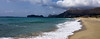
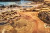
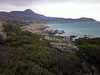
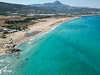
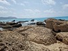
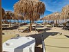
The above images may not be of the site on this page, but were taken nearby. They are loaded from Flickr so please click on them for image credits.
Click here to see more info for this site
Nearby sites
Click here to view sites on an interactive map of the areaKey: Red: member's photo, Blue: 3rd party photo, Yellow: other image, Green: no photo - please go there and take one, Grey: site destroyed
Download sites to:
KML (Google Earth)
GPX (GPS waypoints)
CSV (Garmin/Navman)
CSV (Excel)
To unlock full downloads you need to sign up as a Contributory Member. Otherwise downloads are limited to 50 sites.
Turn off the page maps and other distractions
Nearby sites listing. In the following links * = Image available
24.9km NE 46° Diktynnaion Ancient Temple
32.0km SE 140° Elyros* Ancient Village or Settlement
35.4km SSE 146° Lissos (Crete)* Ancient Village or Settlement
40.6km E 89° Chania Archaeological Museum* Museum
40.8km E 89° Kydonia* Ancient Village or Settlement
50.9km E 97° Stylos Tholos Tomb* Chambered Tomb
51.2km E 97° Stylos Settlement* Ancient Village or Settlement
52.1km E 95° Aptera* Ancient Village or Settlement
52.8km E 80° Arkoudiotissa Cave* Cave or Rock Shelter
54.8km E 90° Minoa (Marathi)* Ancient Village or Settlement
83.5km E 101° Archaeological Museum of Rethymno* Museum
83.7km ESE 104° Nekropolis Minois* Chambered Tomb
86.9km ESE 104° Vrysinas Ancient Temple
95.0km ESE 107° Ancient Sanctuary of Hermes* Ancient Temple
102.2km E 101° Orthi Petra Rock Cut Tomb
102.3km E 101° Elefderna* Ancient Village or Settlement
103.0km E 99° Margarites Tholos Tomb* Chambered Tomb
111.6km ESE 110° Apodoulou (Settlement) Ancient Village or Settlement
112.4km ESE 110° Apodoulou (Tomb) Passage Grave
117.1km E 101° Dimitra Sanctuary* Rock Cut Tomb
117.7km E 101° Ancient Axos* Ancient Village or Settlement
117.8km E 101° Tihio (Axos)* Rock Cut Tomb
117.9km E 101° Panagia (Axos)* Ancient Village or Settlement
119.0km ESE 106° Ideon Andron* Cave or Rock Shelter
121.3km ESE 118° Matala* Rock Cut Tomb
View more nearby sites and additional images

")
 We would like to know more about this location. Please feel free to add a brief description and any relevant information in your own language.
 Wir möchten mehr über diese Stätte erfahren. Bitte zögern Sie nicht, eine kurze Beschreibung und relevante Informationen in Deutsch hinzuzufügen.
 Nous aimerions en savoir encore un peu sur les lieux. S'il vous plaît n'hesitez pas à ajouter une courte description et tous les renseignements pertinents dans votre propre langue.
 Quisieramos informarnos un poco más de las lugares. No dude en añadir una breve descripción y otros datos relevantes en su propio idioma.