

<< Text Pages >> Nagyrev Zsidohalom Tell - Ancient Village or Settlement in Hungary
Submitted by AlexHunger on Thursday, 01 January 2009 Page Views: 2836
Multi-periodSite Name: Nagyrev Zsidohalom TellCountry: Hungary
NOTE: This site is 4.452 km away from the location you searched for.
Type: Ancient Village or Settlement
Nearest Town: Budapest Nearest Village: Nagyrev
Latitude: 46.941254N Longitude: 20.151719E
Condition:
| 5 | Perfect |
| 4 | Almost Perfect |
| 3 | Reasonable but with some damage |
| 2 | Ruined but still recognisable as an ancient site |
| 1 | Pretty much destroyed, possibly visible as crop marks |
| 0 | No data. |
| -1 | Completely destroyed |
| 5 | Superb |
| 4 | Good |
| 3 | Ordinary |
| 2 | Not Good |
| 1 | Awful |
| 0 | No data. |
| 5 | Can be driven to, probably with disabled access |
| 4 | Short walk on a footpath |
| 3 | Requiring a bit more of a walk |
| 2 | A long walk |
| 1 | In the middle of nowhere, a nightmare to find |
| 0 | No data. |
| 5 | co-ordinates taken by GPS or official recorded co-ordinates |
| 4 | co-ordinates scaled from a detailed map |
| 3 | co-ordinates scaled from a bad map |
| 2 | co-ordinates of the nearest village |
| 1 | co-ordinates of the nearest town |
| 0 | no data |
Internal Links:
External Links:
Ancient Village or Settlement in Hungary
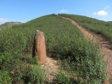
Hungarian Bronze Age tell on the banks of the Tisza River.
You may be viewing yesterday's version of this page. To see the most up to date information please register for a free account.
Do not use the above information on other web sites or publications without permission of the contributor.
Nearby Images from Flickr
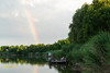
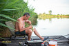

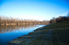
The above images may not be of the site on this page, but were taken nearby. They are loaded from Flickr so please click on them for image credits.
Click here to see more info for this site
Nearby sites
Click here to view sites on an interactive map of the areaKey: Red: member's photo, Blue: 3rd party photo, Yellow: other image, Green: no photo - please go there and take one, Grey: site destroyed
Download sites to:
KML (Google Earth)
GPX (GPS waypoints)
CSV (Garmin/Navman)
CSV (Excel)
To unlock full downloads you need to sign up as a Contributory Member. Otherwise downloads are limited to 50 sites.
Turn off the page maps and other distractions
Nearby sites listing. In the following links * = Image available
13.1km SW 218° Tiszaug-Kemenyteto Tell Ancient Village or Settlement
16.1km N 355° Tószeg-Laposhalom Tell Ancient Village or Settlement
26.4km ESE 122° Gödény-halom* Ancient Village or Settlement
33.0km WNW 292° Nagykőrös-Földvar Tell Ancient Village or Settlement
73.5km N 351° Jaszdozsa-Kapolnahalom Tell Ancient Village or Settlement
76.9km ESE 112° Kevermesi sztélé* Standing Stones
80.7km E 90° Veszto-Magor Tell Ancient Village or Settlement
84.7km ESE 106° Dobozi Kő* Modern Stone Circle etc
89.9km NNE 32° Tiszafüred Asotthalom Tell Ancient Village or Settlement
90.6km W 271° Dunaujvaros-Koziderpadlas Tell Ancient Village or Settlement
90.9km NNE 12° Füzesabony-Öregdomb Tell Ancient Village or Settlement
92.3km WSW 258° Bölcske-Vörösgyuru Tell Ancient Village or Settlement
95.7km SSE 156° Bekai halom Ancient Village or Settlement
98.5km W 269° Baracs-Földvar Tell Ancient Village or Settlement
101.6km WNW 296° Százhalombatta Barrow Barrow Cemetery
101.6km WNW 296° Százhalombatta Tell* Ancient Village or Settlement
101.9km ENE 74° Bakonszeg-Kadarbomb Tell Ancient Village or Settlement
101.9km ENE 74° Konyár* Round Barrow(s)
102.6km SW 231° Érsekhalmi Földvár* Artificial Mound
103.8km ENE 66° Ördögárok* Misc. Earthwork
106.4km NE 34° Ároktõ-Dongóhalom Tell Ancient Village or Settlement
108.3km NW 310° Aquincumi Museum Museum
108.5km SE 144° Ziridava Ancient Village or Settlement
110.8km ENE 74° Berettyoujfalu-Szilhalom Tell Ancient Village or Settlement
112.0km ENE 74° Berettyoujfalu-Herpaly-Földwar Tell Ancient Village or Settlement
View more nearby sites and additional images


 We would like to know more about this location. Please feel free to add a brief description and any relevant information in your own language.
 Wir möchten mehr über diese Stätte erfahren. Bitte zögern Sie nicht, eine kurze Beschreibung und relevante Informationen in Deutsch hinzuzufügen.
 Nous aimerions en savoir encore un peu sur les lieux. S'il vous plaît n'hesitez pas à ajouter une courte description et tous les renseignements pertinents dans votre propre langue.
 Quisieramos informarnos un poco más de las lugares. No dude en añadir una breve descripción y otros datos relevantes en su propio idioma.