 with our Megalithic Portal iPhone app")


<< Text Pages >> Dolmen dels Planers de la Serafina - Burial Chamber or Dolmen in Spain in Cataluña
Submitted by holger_rix on Thursday, 05 November 2015 Page Views: 750
Neolithic and Bronze AgeSite Name: Dolmen dels Planers de la SerafinaCountry: Spain
NOTE: This site is 1.159 km away from the location you searched for.
Region: Cataluña Type: Burial Chamber or Dolmen
Latitude: 42.427092N Longitude: 2.852175E
Condition:
| 5 | Perfect |
| 4 | Almost Perfect |
| 3 | Reasonable but with some damage |
| 2 | Ruined but still recognisable as an ancient site |
| 1 | Pretty much destroyed, possibly visible as crop marks |
| 0 | No data. |
| -1 | Completely destroyed |
| 5 | Superb |
| 4 | Good |
| 3 | Ordinary |
| 2 | Not Good |
| 1 | Awful |
| 0 | No data. |
| 5 | Can be driven to, probably with disabled access |
| 4 | Short walk on a footpath |
| 3 | Requiring a bit more of a walk |
| 2 | A long walk |
| 1 | In the middle of nowhere, a nightmare to find |
| 0 | No data. |
| 5 | co-ordinates taken by GPS or official recorded co-ordinates |
| 4 | co-ordinates scaled from a detailed map |
| 3 | co-ordinates scaled from a bad map |
| 2 | co-ordinates of the nearest village |
| 1 | co-ordinates of the nearest town |
| 0 | no data |
Be the first person to rate this site - see the 'Contribute!' box in the right hand menu.
Internal Links:
External Links:
I have visited· I would like to visit
kalcoatl visited on 14th Jun 2021 - their rating: Cond: 2 Amb: 2 Access: 4 15 seconds walk from the GR11 footpath, approx half an hour out of La Jonquera. Signposted from same but very overgrown with no reasonable access to the dolmen due to wildly overgrown bushes etc.
You may be viewing yesterday's version of this page. To see the most up to date information please register for a free account.
Do not use the above information on other web sites or publications without permission of the contributor.
Nearby Images from Flickr

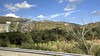
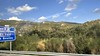
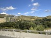
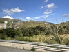
The above images may not be of the site on this page, but were taken nearby. They are loaded from Flickr so please click on them for image credits.
Click here to see more info for this site
Nearby sites
Click here to view sites on an interactive map of the areaKey: Red: member's photo, Blue: 3rd party photo, Yellow: other image, Green: no photo - please go there and take one, Grey: site destroyed
Download sites to:
KML (Google Earth)
GPX (GPS waypoints)
CSV (Garmin/Navman)
CSV (Excel)
To unlock full downloads you need to sign up as a Contributory Member. Otherwise downloads are limited to 50 sites.
Turn off the page maps and other distractions
Nearby sites listing. In the following links * = Image available
23m WSW 249° Menhir dels Planers de la Serafina* Standing Stone (Menhir)
1.8km SSE 154° Dolmen de Rocalba* Burial Chamber or Dolmen
2.8km SSW 198° Menhir de Mas del Puig Standing Stone (Menhir)
2.8km SSW 198° Menhir del Camp de la Matalena Standing Stone (Menhir)
3.1km N 3° Col de Panissars* Ancient Trackway
3.4km SSE 148° Menhir de Palaus* Standing Stone (Menhir)
3.5km NE 51° Dolmen dels Pedreguers Burial Chamber or Dolmen
3.8km ESE 117° Dolmen de Canadal* Burial Chamber or Dolmen
4.5km SSW 194° Menhir del Roc del Frare* Standing Stone (Menhir)
5.1km S 186° Menhir el Roc del Capellà Standing Stone (Menhir)
5.2km SE 144° Dolmen La Jaça d´en Torrent* Burial Chamber or Dolmen
5.2km SE 126° Dolmen dels Estanys 3* Burial Chamber or Dolmen
5.3km SE 126° Dolmen Vila Burial Chamber or Dolmen
5.5km SE 128° Dolmen dels Estanys 1* Burial Chamber or Dolmen
5.6km SE 143° Dolmen La Barraca del Lladre* Burial Chamber or Dolmen
5.6km SW 224° Dolmen del Pardal* Burial Chamber or Dolmen
5.6km SE 129° Dolmen dels Estanys 2* Burial Chamber or Dolmen
5.7km ESE 118° Puig de la Llosa menhir* Standing Stone (Menhir)
5.7km SE 130° Menhir dels Estanys 2* Standing Stone (Menhir)
5.8km SE 129° Menhir dels Estanys 1* Standing Stone (Menhir)
5.9km ESE 121° Dolmen Mas Baleta II* Burial Chamber or Dolmen
5.9km ESE 119° Dolmen Mas Baleta I* Burial Chamber or Dolmen
5.9km ESE 120° Mas Baleta 3* Barrow Cemetery
6.1km SE 127° Menhir Quer Afumat* Standing Stone (Menhir)
6.2km N 351° Fortification Romaine dite Castell Dels Moros* Ancient Village or Settlement
View more nearby sites and additional images


 We would like to know more about this location. Please feel free to add a brief description and any relevant information in your own language.
 Wir möchten mehr über diese Stätte erfahren. Bitte zögern Sie nicht, eine kurze Beschreibung und relevante Informationen in Deutsch hinzuzufügen.
 Nous aimerions en savoir encore un peu sur les lieux. S'il vous plaît n'hesitez pas à ajouter une courte description et tous les renseignements pertinents dans votre propre langue.
 Quisieramos informarnos un poco más de las lugares. No dude en añadir una breve descripción y otros datos relevantes en su propio idioma.