
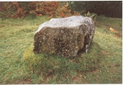

<< Text Pages >> Dolmen de Sant Roc - Burial Chamber or Dolmen in Spain in Cataluña
Submitted by holger_rix on Thursday, 05 November 2015 Page Views: 948
Neolithic and Bronze AgeSite Name: Dolmen de Sant Roc Alternative Name: Cementiri dels Moros de Sant RocCountry: Spain
NOTE: This site is 11.691 km away from the location you searched for.
Region: Cataluña Type: Burial Chamber or Dolmen
Latitude: 42.018650N Longitude: 2.659538E
Condition:
| 5 | Perfect |
| 4 | Almost Perfect |
| 3 | Reasonable but with some damage |
| 2 | Ruined but still recognisable as an ancient site |
| 1 | Pretty much destroyed, possibly visible as crop marks |
| 0 | No data. |
| -1 | Completely destroyed |
| 5 | Superb |
| 4 | Good |
| 3 | Ordinary |
| 2 | Not Good |
| 1 | Awful |
| 0 | No data. |
| 5 | Can be driven to, probably with disabled access |
| 4 | Short walk on a footpath |
| 3 | Requiring a bit more of a walk |
| 2 | A long walk |
| 1 | In the middle of nowhere, a nightmare to find |
| 0 | No data. |
| 5 | co-ordinates taken by GPS or official recorded co-ordinates |
| 4 | co-ordinates scaled from a detailed map |
| 3 | co-ordinates scaled from a bad map |
| 2 | co-ordinates of the nearest village |
| 1 | co-ordinates of the nearest town |
| 0 | no data |
Be the first person to rate this site - see the 'Contribute!' box in the right hand menu.
Internal Links:
External Links:
Burial Chamber (Dolmen) in Cataluña
You may be viewing yesterday's version of this page. To see the most up to date information please register for a free account.
Do not use the above information on other web sites or publications without permission of the contributor.
Nearby Images from Flickr
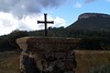
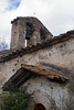
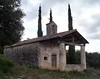
The above images may not be of the site on this page, but were taken nearby. They are loaded from Flickr so please click on them for image credits.
Click here to see more info for this site
Nearby sites
Click here to view sites on an interactive map of the areaKey: Red: member's photo, Blue: 3rd party photo, Yellow: other image, Green: no photo - please go there and take one, Grey: site destroyed
Download sites to:
KML (Google Earth)
GPX (GPS waypoints)
CSV (Garmin/Navman)
CSV (Excel)
To unlock full downloads you need to sign up as a Contributory Member. Otherwise downloads are limited to 50 sites.
Turn off the page maps and other distractions
Nearby sites listing. In the following links * = Image available
1.2km WSW 251° Jaciment Arqueològic La Balma de la Xemeneia Ancient Village or Settlement
6.0km SW 227° Cova del Pasteral Cave or Rock Shelter
6.4km SW 225° Dolmen de Coll de Gria Burial Chamber or Dolmen
9.9km NW 325° Jaciment Prehistòric del Roc de la Melca Rock Outcrop
10.1km ENE 65° Dolmen de la Mota Burial Chamber or Dolmen
10.4km NNW 328° Cista del Camí del Raspat Cist
10.7km NE 34° Dolmen de les Closes (Pla de l`Estany)* Burial Chamber or Dolmen
11.2km NW 314° Dolmen del Puig dels Moros Burial Chamber or Dolmen
11.3km NE 37° Villa Romana de Vilauba Ancient Village or Settlement
11.4km WNW 303° Cova Sepulcral del Neolític Antic de l'Avellaner Cave or Rock Shelter
14.6km NE 34° La Draga* Ancient Village or Settlement
15.7km NNW 341° Menhir de la Pedra del Diable Standing Stone (Menhir)
16.8km NW 324° Menhir Volcan Santa Margarida Standing Stone (Menhir)
18.8km W 273° Dolmen de la Font de la Vena Burial Chamber or Dolmen
19.1km ENE 76° Dolmen de la Castellana Burial Chamber or Dolmen
19.5km W 269° Dolmen de Sant Corneli* Burial Chamber or Dolmen
20.2km SW 216° Menhir a Sant Hilari Sacalm* Standing Stone (Menhir)
23.2km W 274° Dolmen de Puigsespedres Burial Chamber or Dolmen
23.7km W 266° Dolmen de Can Tafura Burial Chamber or Dolmen
25.8km ESE 105° Cista del Puig d'Arques* Cist
27.2km WSW 256° Anthropomorphic Tombs de Sant Feliuet* Barrow Cemetery
27.2km WSW 256° Jaciment Neolític de Savassona* Sculptured Stone
27.6km ESE 105° Menhir de Sant Sadurní* Standing Stone (Menhir)
28.6km SE 138° Can Cabanyes de Montagut* Standing Stone (Menhir)
31.0km WSW 255° Dolmen de Puigseslloses* Burial Chamber or Dolmen
View more nearby sites and additional images


 We would like to know more about this location. Please feel free to add a brief description and any relevant information in your own language.
 Wir möchten mehr über diese Stätte erfahren. Bitte zögern Sie nicht, eine kurze Beschreibung und relevante Informationen in Deutsch hinzuzufügen.
 Nous aimerions en savoir encore un peu sur les lieux. S'il vous plaît n'hesitez pas à ajouter une courte description et tous les renseignements pertinents dans votre propre langue.
 Quisieramos informarnos un poco más de las lugares. No dude en añadir una breve descripción y otros datos relevantes en su propio idioma.