 with our Megalithic Portal iPhone app")

<< Text Pages >> Dolmen du Malroch - Burial Chamber or Dolmen in France in Auvergne:Allier (03)
Submitted by holger_rix on Saturday, 05 March 2016 Page Views: 962
Neolithic and Bronze AgeSite Name: Dolmen du MalrochCountry: France
NOTE: This site is 2.303 km away from the location you searched for.
Département: Auvergne:Allier (03) Type: Burial Chamber or Dolmen
Nearest Town: Montluçon Nearest Village: Hérisson
Latitude: 46.500730N Longitude: 2.738760E
Condition:
| 5 | Perfect |
| 4 | Almost Perfect |
| 3 | Reasonable but with some damage |
| 2 | Ruined but still recognisable as an ancient site |
| 1 | Pretty much destroyed, possibly visible as crop marks |
| 0 | No data. |
| -1 | Completely destroyed |
| 5 | Superb |
| 4 | Good |
| 3 | Ordinary |
| 2 | Not Good |
| 1 | Awful |
| 0 | No data. |
| 5 | Can be driven to, probably with disabled access |
| 4 | Short walk on a footpath |
| 3 | Requiring a bit more of a walk |
| 2 | A long walk |
| 1 | In the middle of nowhere, a nightmare to find |
| 0 | No data. |
| 5 | co-ordinates taken by GPS or official recorded co-ordinates |
| 4 | co-ordinates scaled from a detailed map |
| 3 | co-ordinates scaled from a bad map |
| 2 | co-ordinates of the nearest village |
| 1 | co-ordinates of the nearest town |
| 0 | no data |
Be the first person to rate this site - see the 'Contribute!' box in the right hand menu.
Internal Links:
External Links:
Burial Chamber (Dolmen) in Auvergne:Allier (03)
La Côte du Lac, Hérisson, Montluçon, Allier, Auvergne-Rhône-Alpes
Source: T4T35.fr
You may be viewing yesterday's version of this page. To see the most up to date information please register for a free account.
Do not use the above information on other web sites or publications without permission of the contributor.
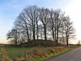
Nearby Images from Flickr
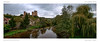
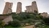
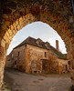
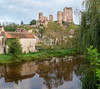
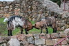
The above images may not be of the site on this page, but were taken nearby. They are loaded from Flickr so please click on them for image credits.
Click here to see more info for this site
Nearby sites
Click here to view sites on an interactive map of the areaKey: Red: member's photo, Blue: 3rd party photo, Yellow: other image, Green: no photo - please go there and take one, Grey: site destroyed
Download sites to:
KML (Google Earth)
GPX (GPS waypoints)
CSV (Garmin/Navman)
CSV (Excel)
To unlock full downloads you need to sign up as a Contributory Member. Otherwise downloads are limited to 50 sites.
Turn off the page maps and other distractions
Nearby sites listing. In the following links * = Image available
2.9km SE 144° Menhir de Venas Standing Stone (Menhir)
6.1km SSW 195° Menhir de Pirolet Standing Stone (Menhir)
6.8km SSW 194° Menhir du Mont* Standing Stone (Menhir)
7.7km SSW 201° Cupules du Petit Mazeau Rock Art
8.0km NNE 33° Menhir du Vilhain* Standing Stone (Menhir)
8.4km WSW 237° Menhir de Givarlais* Standing Stone (Menhir)
8.8km N 3° Menhir des Autais* Standing Stone (Menhir)
9.0km S 187° Dolmen de la Table du Loup Burial Chamber or Dolmen
10.8km SW 224° Menhir de la Croix Brouzeau Standing Stone (Menhir)
19.7km S 176° Dolmen dit la Cabane du Loup (Doyet)* Burial Chamber or Dolmen
24.3km SSE 163° Les Pierres Fougères Rock Outcrop
31.6km W 272° Camp de César (Sidiailles) Ancient Village or Settlement
33.9km SSW 206° Siège de Saint-Martin Rock Art
41.6km W 280° Châteaumeillant Oppidum Ancient Village or Settlement
43.3km SSE 168° Brosses menhir* Standing Stone (Menhir)
43.7km ESE 118° Menhir de Bransat Standing Stone (Menhir)
44.5km WSW 242° Pierres Jaumâtres* Rock Outcrop
45.9km E 81° Musée d'Art et d'Archéologie* Museum
46.8km S 171° Menhirs of Barbouly* Stone Row / Alignment
47.2km NE 48° Oppidum d'Azy-le-Vif Ancient Village or Settlement
48.0km NW 325° Menhir de Chavannes* Standing Stone (Menhir)
49.2km SSE 153° Table de Péraclos* Rock Outcrop
49.6km E 98° Tumulus de Bessay-sur-Allier Round Barrow(s)
52.1km SE 142° Menhir de Bègues Standing Stone (Menhir)
52.7km SSW 200° Dolmen de Chaume Ronde Burial Chamber or Dolmen
View more nearby sites and additional images


 We would like to know more about this location. Please feel free to add a brief description and any relevant information in your own language.
 Wir möchten mehr über diese Stätte erfahren. Bitte zögern Sie nicht, eine kurze Beschreibung und relevante Informationen in Deutsch hinzuzufügen.
 Nous aimerions en savoir encore un peu sur les lieux. S'il vous plaît n'hesitez pas à ajouter une courte description et tous les renseignements pertinents dans votre propre langue.
 Quisieramos informarnos un poco más de las lugares. No dude en añadir una breve descripción y otros datos relevantes en su propio idioma.