

<< Our Photo Pages >> Pierre de l'Armoire - Burial Chamber or Dolmen in France in Ile-de-France:Seine-et-Marne 77
Submitted by thecaptain on Friday, 23 February 2007 Page Views: 3801
Neolithic and Bronze AgeSite Name: Pierre de l'Armoire Alternative Name: Rumont dolmen, Dolmen dit la Pierre l'ArmoireCountry: France
NOTE: This site is 6.038 km away from the location you searched for.
Département: Ile-de-France:Seine-et-Marne 77 Type: Burial Chamber or Dolmen
Nearest Town: Malesherbes Nearest Village: Rumont
Latitude: 48.279464N Longitude: 2.506980E
Condition:
| 5 | Perfect |
| 4 | Almost Perfect |
| 3 | Reasonable but with some damage |
| 2 | Ruined but still recognisable as an ancient site |
| 1 | Pretty much destroyed, possibly visible as crop marks |
| 0 | No data. |
| -1 | Completely destroyed |
| 5 | Superb |
| 4 | Good |
| 3 | Ordinary |
| 2 | Not Good |
| 1 | Awful |
| 0 | No data. |
| 5 | Can be driven to, probably with disabled access |
| 4 | Short walk on a footpath |
| 3 | Requiring a bit more of a walk |
| 2 | A long walk |
| 1 | In the middle of nowhere, a nightmare to find |
| 0 | No data. |
| 5 | co-ordinates taken by GPS or official recorded co-ordinates |
| 4 | co-ordinates scaled from a detailed map |
| 3 | co-ordinates scaled from a bad map |
| 2 | co-ordinates of the nearest village |
| 1 | co-ordinates of the nearest town |
| 0 | no data |
Internal Links:
External Links:
I have visited· I would like to visit
TheCaptain visited on 6th Aug 2005 - their rating: Cond: 4 Amb: 4 Access: 4 This dolmen can be found a couple of kilometres north of the village of Rumont, along the D.16a road. There is then a signpost to it, and it's about a kilometres walk from the road along a farm track.
The dolmen is within a cropped field, but has a reasonable area left around it, and is in the remains of a mound. it looks to be an Angevin type dolmen, with a rectangular chamber 4 metres long by 2.5 metres in width, and it is covered by a large capstone of irregular shape, up to 6 m by 4m, and it has a large hole in the west end. The entrance opens to the east at 115°, but there is not much of a porchway left, except some fallen stones. This was a nice find after all the recent poor dolmens, and nice to have it signposted.
")
It looks to be an Angevin type dolmen, with a rectangular chamber 4 metres long by 2.5 metres in width, and it is covered by a large capstone of irregular shape, up to 6 m by 4m, and it has a large hole in the west end. The entrance opens to the east at 115°, but there is not much of a porchway left, except some fallen stones.
This was a nice find after all the recent poor dolmens I had visited, and good to have it signposted.
IMPORTANT NOTE : Positional coordinates taken from a gps receiver.
You may be viewing yesterday's version of this page. To see the most up to date information please register for a free account.
")
Do not use the above information on other web sites or publications without permission of the contributor.
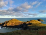
Nearby Images from Flickr
The above images may not be of the site on this page, but were taken nearby. They are loaded from Flickr so please click on them for image credits.
Click here to see more info for this site
Nearby sites
Click here to view sites on an interactive map of the areaKey: Red: member's photo, Blue: 3rd party photo, Yellow: other image, Green: no photo - please go there and take one, Grey: site destroyed
Download sites to:
KML (Google Earth)
GPX (GPS waypoints)
CSV (Garmin/Navman)
CSV (Excel)
To unlock full downloads you need to sign up as a Contributory Member. Otherwise downloads are limited to 50 sites.
Turn off the page maps and other distractions
Nearby sites listing. In the following links * = Image available
3.6km W 265° Roche-aux-Loups Dolmen Burial Chamber or Dolmen
4.7km N 356° L'abri Leuillet Rock Art
5.3km WNW 289° Vallée aux Noirs engravings* Rock Art
5.8km ENE 75° Abri du Mont Blanc Cave or Rock Shelter
6.0km W 276° Hypogée Le Guichet Passage Grave
6.4km ENE 78° Fontaine Saint Mathurin Holy Well or Sacred Spring
6.4km WNW 290° Grotte de Malesherbes Rock Art
6.6km ENE 76° Massif de Fontainebleau Rock Art
6.7km E 79° Grotte à la Peinture Larchant Rock Art
7.0km WNW 296° Grotte de Villetard Rock Art
7.2km WSW 258° Dolmen de Mailleton Burial Chamber or Dolmen
7.6km ENE 70° Grotte De La Dame Jouanne Rock Art
7.6km WNW 291° Hypogée de Rouville Passage Grave
7.6km WNW 302° Nanteau-sur-Essonne Passage Grave
7.8km NNW 332° Menhir de la Croix Saint Jacques* Standing Stone (Menhir)
8.3km WNW 299° Engraved Face of Closeau* Rock Art
8.5km W 271° Pierre de la Chaise Standing Stone (Menhir)
9.6km N 8° Grotte de Noisy-sur-Ecole II Rock Art
9.7km NNW 336° Menhir dit la Pierre aux Prêtres* Standing Stone (Menhir)
9.7km N 0° Noisy-sur-Ecole Sepulture Passage Grave
10.2km E 98° Grottes de Puiseles Rock Art
10.8km NNE 14° Abri sous Roche de la Grande Montagne Rock Art
10.9km NW 319° Les Sept Coups d'Epée* Polissoir
11.0km N 360° Abri de Ségognole Cave or Rock Shelter
11.2km N 2° Grottes de Noisy-sur-Ecole I Rock Art
View more nearby sites and additional images


 We would like to know more about this location. Please feel free to add a brief description and any relevant information in your own language.
 Wir möchten mehr über diese Stätte erfahren. Bitte zögern Sie nicht, eine kurze Beschreibung und relevante Informationen in Deutsch hinzuzufügen.
 Nous aimerions en savoir encore un peu sur les lieux. S'il vous plaît n'hesitez pas à ajouter une courte description et tous les renseignements pertinents dans votre propre langue.
 Quisieramos informarnos un poco más de las lugares. No dude en añadir una breve descripción y otros datos relevantes en su propio idioma.