

<< Text Pages >> Pierre du Marais - Standing Stone (Menhir) in France in Centre:Loiret (45)
Submitted by AlexHunger on Thursday, 10 February 2005 Page Views: 2756
Neolithic and Bronze AgeSite Name: Pierre du Marais Alternative Name: Menhir des Bonnes FemmesCountry: France
NOTE: This site is 7.114 km away from the location you searched for.
Département: Centre:Loiret (45) Type: Standing Stone (Menhir)
Nearest Town: Montargis Nearest Village: Sceaux-du-Gâtinais
Latitude: 48.109100N Longitude: 2.570000E
Condition:
| 5 | Perfect |
| 4 | Almost Perfect |
| 3 | Reasonable but with some damage |
| 2 | Ruined but still recognisable as an ancient site |
| 1 | Pretty much destroyed, possibly visible as crop marks |
| 0 | No data. |
| -1 | Completely destroyed |
| 5 | Superb |
| 4 | Good |
| 3 | Ordinary |
| 2 | Not Good |
| 1 | Awful |
| 0 | No data. |
| 5 | Can be driven to, probably with disabled access |
| 4 | Short walk on a footpath |
| 3 | Requiring a bit more of a walk |
| 2 | A long walk |
| 1 | In the middle of nowhere, a nightmare to find |
| 0 | No data. |
| 5 | co-ordinates taken by GPS or official recorded co-ordinates |
| 4 | co-ordinates scaled from a detailed map |
| 3 | co-ordinates scaled from a bad map |
| 2 | co-ordinates of the nearest village |
| 1 | co-ordinates of the nearest town |
| 0 | no data |
Be the first person to rate this site - see the 'Contribute!' box in the right hand menu.
Internal Links:
External Links:
Menhir in Loiret
2 Km west of twon in a swampy area.
Note: Positional co-ordinates scaled from a detailed map source.
You may be viewing yesterday's version of this page. To see the most up to date information please register for a free account.
Do not use the above information on other web sites or publications without permission of the contributor.
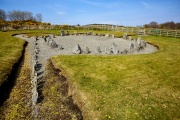
Nearby Images from Flickr


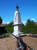
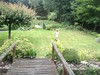
The above images may not be of the site on this page, but were taken nearby. They are loaded from Flickr so please click on them for image credits.
Click here to see more info for this site
Nearby sites
Click here to view sites on an interactive map of the areaKey: Red: member's photo, Blue: 3rd party photo, Yellow: other image, Green: no photo - please go there and take one, Grey: site destroyed
Download sites to:
KML (Google Earth)
GPX (GPS waypoints)
CSV (Garmin/Navman)
CSV (Excel)
To unlock full downloads you need to sign up as a Contributory Member. Otherwise downloads are limited to 50 sites.
Turn off the page maps and other distractions
Nearby sites listing. In the following links * = Image available
2.1km ESE 106° Menhir dit la Pierre Corse Standing Stone (Menhir)
9.8km WNW 283° Menhir du Bois de Champ-Colon Standing Stone (Menhir)
13.6km E 90° Montabon Dolmen Burial Chamber or Dolmen
14.8km E 95° Menhir dit la Grosse Pierre (Fontenay-sur-Loing) Standing Stone (Menhir)
15.1km ESE 118° Pierre aux Fées (Cepoy) Standing Stone (Menhir)
18.4km NNE 17° Grottes de Puiseles Rock Art
19.0km NNE 26° Rocher de la Grande Ecole Passage Grave
19.1km NNE 26° Rocher de la Joie Passage Grave
19.5km NNW 346° Pierre de l'Armoire* Burial Chamber or Dolmen
20.0km NNE 27° Musee de la Prehistoire d'Ile de France* Museum
20.1km ESE 113° Menhir dit la Pierre du Gros Vilain Standing Stone (Menhir)
20.3km N 5° Grotte à la Peinture Larchant Rock Art
20.3km NNW 336° Roche-aux-Loups Dolmen Burial Chamber or Dolmen
20.4km N 4° Fontaine Saint Mathurin Holy Well or Sacred Spring
20.5km N 3° Abri du Mont Blanc Cave or Rock Shelter
20.6km N 5° Massif de Fontainebleau Rock Art
21.0km WSW 256° Chambon-La-Foret Tumuli Artificial Mound
21.1km NW 326° Dolmen de Mailleton Burial Chamber or Dolmen
21.3km NNE 31° Menhir dit la Pierre aux Moines* Standing Stone (Menhir)
21.7km N 6° Grotte De La Dame Jouanne Rock Art
21.7km E 82° Menhir dit la Pierre aux Sorciers* Standing Stone (Menhir)
22.2km NNW 332° Hypogée Le Guichet Passage Grave
22.6km E 87° Cercle de Blanche-Forêt Stone Circle
22.8km NNW 335° Vallée aux Noirs engravings* Rock Art
22.9km ESE 108° Pierre de Minuit Menhir* Standing Stone (Menhir)
View more nearby sites and additional images


 We would like to know more about this location. Please feel free to add a brief description and any relevant information in your own language.
 Wir möchten mehr über diese Stätte erfahren. Bitte zögern Sie nicht, eine kurze Beschreibung und relevante Informationen in Deutsch hinzuzufügen.
 Nous aimerions en savoir encore un peu sur les lieux. S'il vous plaît n'hesitez pas à ajouter une courte description et tous les renseignements pertinents dans votre propre langue.
 Quisieramos informarnos un poco más de las lugares. No dude en añadir una breve descripción y otros datos relevantes en su propio idioma.