


<< Text Pages >> Dolmen la Calcine - Burial Chamber or Dolmen in France in Languedoc:Pyrénées-Orientales 66
Submitted by holger_rix on Monday, 01 February 2016 Page Views: 1134
Neolithic and Bronze AgeSite Name: Dolmen la CalcineCountry: France Département: Languedoc:Pyrénées-Orientales 66 Type: Burial Chamber or Dolmen
Nearest Town: Perpignan Nearest Village: Ansignan
Latitude: 42.761900N Longitude: 2.516390E
Condition:
| 5 | Perfect |
| 4 | Almost Perfect |
| 3 | Reasonable but with some damage |
| 2 | Ruined but still recognisable as an ancient site |
| 1 | Pretty much destroyed, possibly visible as crop marks |
| 0 | No data. |
| -1 | Completely destroyed |
| 5 | Superb |
| 4 | Good |
| 3 | Ordinary |
| 2 | Not Good |
| 1 | Awful |
| 0 | No data. |
| 5 | Can be driven to, probably with disabled access |
| 4 | Short walk on a footpath |
| 3 | Requiring a bit more of a walk |
| 2 | A long walk |
| 1 | In the middle of nowhere, a nightmare to find |
| 0 | No data. |
| 5 | co-ordinates taken by GPS or official recorded co-ordinates |
| 4 | co-ordinates scaled from a detailed map |
| 3 | co-ordinates scaled from a bad map |
| 2 | co-ordinates of the nearest village |
| 1 | co-ordinates of the nearest town |
| 0 | no data |
Be the first person to rate this site - see the 'Contribute!' box in the right hand menu.
Internal Links:
External Links:
Burial Chamber (Dolmen) in Languedoc:Pyrénées-Orientales 66
Chemin de Grande Communication, Ansignan, Perpignan, Pyrénées-Orientales, Languedoc-Roussillon-Midi-Pyrénées
Source: T4T35.fr
You may be viewing yesterday's version of this page. To see the most up to date information please register for a free account.
Do not use the above information on other web sites or publications without permission of the contributor.
Nearby Images from Flickr
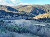
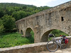
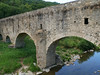
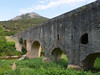
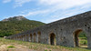
The above images may not be of the site on this page, but were taken nearby. They are loaded from Flickr so please click on them for image credits.
Click here to see more info for this site
Nearby sites
Click here to view sites on an interactive map of the areaKey: Red: member's photo, Blue: 3rd party photo, Yellow: other image, Green: no photo - please go there and take one, Grey: site destroyed
Download sites to:
KML (Google Earth)
GPX (GPS waypoints)
CSV (Garmin/Navman)
CSV (Excel)
To unlock full downloads you need to sign up as a Contributory Member. Otherwise downloads are limited to 50 sites.
Turn off the page maps and other distractions
Nearby sites listing. In the following links * = Image available
355m NNW 331° Aqueduc d’Ansignan* Ancient Mine, Quarry or other Industry
750m W 270° Dolmen de la Rouyre* Burial Chamber or Dolmen
915m W 275° Roches à Cupules d’Ansignan Rock Art
1.5km W 267° Dolmen de la Roc de l'Arca Burial Chamber or Dolmen
1.5km SSE 167° Dolmen de Las Apostados Burial Chamber or Dolmen
1.5km SE 125° Dolmen de la Caouno del Moro Burial Chamber or Dolmen
1.6km W 273° Dolmen de la Cauna del Moro Burial Chamber or Dolmen
1.6km ESE 123° Cauna de Felluns Cave or Rock Shelter
1.9km W 276° Cupules de la Caquno del Moro Rock Art
1.9km SE 140° Dolmen de Las Colombinos* Burial Chamber or Dolmen
2.3km WNW 285° Cupules de Roc de les Corts Rock Art
3.5km ESE 119° Necropole du Camp del Ginebre Barrow Cemetery
5.4km N 349° Dolmen des Tres Palets Burial Chamber or Dolmen
5.5km N 350° Cauna de l'Or Cave or Rock Shelter
5.6km N 350° Dolmen des Espandiols Burial Chamber or Dolmen
7.5km SW 220° Dolmen du Coll del Tribe Burial Chamber or Dolmen
7.5km SW 220° Dolmen de la Cova del Misser Burial Chamber or Dolmen
8.0km SSW 200° Dolmen de la Mort de l'Eguassier Burial Chamber or Dolmen
8.3km ESE 118° Moli del Vent* Burial Chamber or Dolmen
8.6km SW 222° Dolmen de Campoussy* Burial Chamber or Dolmen
8.9km ESE 124° Château-Musée de Bélesta Museum
8.9km ESE 123° Bélesta Museum of prehistory* Museum
8.9km ESE 123° Caladroy dolmen 2 Burial Chamber or Dolmen
8.9km ESE 123° Cauna de Belesta Cave or Rock Shelter
9.0km E 93° Dolmen Saint Martin Burial Chamber or Dolmen
View more nearby sites and additional images


 We would like to know more about this location. Please feel free to add a brief description and any relevant information in your own language.
 Wir möchten mehr über diese Stätte erfahren. Bitte zögern Sie nicht, eine kurze Beschreibung und relevante Informationen in Deutsch hinzuzufügen.
 Nous aimerions en savoir encore un peu sur les lieux. S'il vous plaît n'hesitez pas à ajouter une courte description et tous les renseignements pertinents dans votre propre langue.
 Quisieramos informarnos un poco más de las lugares. No dude en añadir una breve descripción y otros datos relevantes en su propio idioma.