


<< Text Pages >> Hypogée Le Guichet - Passage Grave in France in Ile-de-France:Seine-et-Marne 77
Submitted by TheCaptain on Wednesday, 08 September 2010 Page Views: 1734
Neolithic and Bronze AgeSite Name: Hypogée Le GuichetCountry: France
NOTE: This site is 0.504 km away from the location you searched for.
Département: Ile-de-France:Seine-et-Marne 77 Type: Passage Grave
Nearest Town: Nemours Nearest Village: Buthiers
Latitude: 48.285000N Longitude: 2.427000E
Condition:
| 5 | Perfect |
| 4 | Almost Perfect |
| 3 | Reasonable but with some damage |
| 2 | Ruined but still recognisable as an ancient site |
| 1 | Pretty much destroyed, possibly visible as crop marks |
| 0 | No data. |
| -1 | Completely destroyed |
| 5 | Superb |
| 4 | Good |
| 3 | Ordinary |
| 2 | Not Good |
| 1 | Awful |
| 0 | No data. |
| 5 | Can be driven to, probably with disabled access |
| 4 | Short walk on a footpath |
| 3 | Requiring a bit more of a walk |
| 2 | A long walk |
| 1 | In the middle of nowhere, a nightmare to find |
| 0 | No data. |
| 5 | co-ordinates taken by GPS or official recorded co-ordinates |
| 4 | co-ordinates scaled from a detailed map |
| 3 | co-ordinates scaled from a bad map |
| 2 | co-ordinates of the nearest village |
| 1 | co-ordinates of the nearest town |
| 0 | no data |
Be the first person to rate this site - see the 'Contribute!' box in the right hand menu.
Internal Links:
External Links:
Le Guichet is a Hypogee in the community of Buthiers, Departement of Seine-et-Marne, Region of Ile-de-France
You may be viewing yesterday's version of this page. To see the most up to date information please register for a free account.
Do not use the above information on other web sites or publications without permission of the contributor.
Nearby Images from Flickr
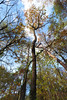
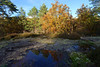
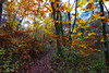
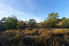
The above images may not be of the site on this page, but were taken nearby. They are loaded from Flickr so please click on them for image credits.
Click here to see more info for this site
Nearby sites
Click here to view sites on an interactive map of the areaKey: Red: member's photo, Blue: 3rd party photo, Yellow: other image, Green: no photo - please go there and take one, Grey: site destroyed
Download sites to:
KML (Google Earth)
GPX (GPS waypoints)
CSV (Garmin/Navman)
CSV (Excel)
To unlock full downloads you need to sign up as a Contributory Member. Otherwise downloads are limited to 50 sites.
Turn off the page maps and other distractions
Nearby sites listing. In the following links * = Image available
1.4km NE 39° Vallée aux Noirs engravings* Rock Art
1.5km N 356° Grotte de Malesherbes Rock Art
2.4km SSW 209° Dolmen de Mailleton Burial Chamber or Dolmen
2.4km NNW 333° Hypogée de Rouville Passage Grave
2.5km N 351° Grotte de Villetard Rock Art
2.6km ESE 112° Roche-aux-Loups Dolmen Burial Chamber or Dolmen
2.6km WSW 258° Pierre de la Chaise Standing Stone (Menhir)
3.5km N 351° Nanteau-sur-Essonne Passage Grave
3.6km NNW 338° Engraved Face of Closeau* Rock Art
5.9km NW 315° Grotte de Prinvaux* Cave or Rock Shelter
6.0km E 96° Pierre de l'Armoire* Burial Chamber or Dolmen
6.7km NNE 20° Menhir de la Croix Saint Jacques* Standing Stone (Menhir)
6.9km NE 54° L'abri Leuillet Rock Art
7.7km N 351° Les Sept Coups d'Epée* Polissoir
8.5km NNE 14° Menhir dit la Pierre aux Prêtres* Standing Stone (Menhir)
8.5km NNW 342° Hypogée du Champtier des Bureaux Passage Grave
8.8km NNW 341° Buno-Bonnevaux polissoir Polissoir
8.8km NNW 346° Hypogée de la Fontaine Saint-Léger Passage Grave
9.3km NNW 334° Menhir de la Pierre Droite (Prunay)* Standing Stone (Menhir)
10.6km N 354° Menhir dit la Pierre Droite (Paly)* Standing Stone (Menhir)
10.9km NNE 33° Noisy-sur-Ecole Sepulture Passage Grave
11.5km NE 39° Grotte de Noisy-sur-Ecole II Rock Art
11.5km E 86° Abri du Mont Blanc Cave or Rock Shelter
11.9km NNE 29° Abri de Ségognole Cave or Rock Shelter
12.1km NNW 342° Grotte de Tramerolles Cave or Rock Shelter
View more nearby sites and additional images


 We would like to know more about this location. Please feel free to add a brief description and any relevant information in your own language.
 Wir möchten mehr über diese Stätte erfahren. Bitte zögern Sie nicht, eine kurze Beschreibung und relevante Informationen in Deutsch hinzuzufügen.
 Nous aimerions en savoir encore un peu sur les lieux. S'il vous plaît n'hesitez pas à ajouter une courte description et tous les renseignements pertinents dans votre propre langue.
 Quisieramos informarnos un poco más de las lugares. No dude en añadir una breve descripción y otros datos relevantes en su propio idioma.