


<< Other Photo Pages >> Grassi Menhir - Standing Stone (Menhir) in Italy in Puglia
Submitted by davidmorgan on Tuesday, 05 August 2014 Page Views: 1049
Neolithic and Bronze AgeSite Name: Grassi MenhirCountry: Italy
NOTE: This site is 0.229 km away from the location you searched for.
Region: Puglia Type: Standing Stone (Menhir)
Nearest Town: Carpignano Salentino
Latitude: 40.202000N Longitude: 18.332702E
Condition:
| 5 | Perfect |
| 4 | Almost Perfect |
| 3 | Reasonable but with some damage |
| 2 | Ruined but still recognisable as an ancient site |
| 1 | Pretty much destroyed, possibly visible as crop marks |
| 0 | No data. |
| -1 | Completely destroyed |
| 5 | Superb |
| 4 | Good |
| 3 | Ordinary |
| 2 | Not Good |
| 1 | Awful |
| 0 | No data. |
| 5 | Can be driven to, probably with disabled access |
| 4 | Short walk on a footpath |
| 3 | Requiring a bit more of a walk |
| 2 | A long walk |
| 1 | In the middle of nowhere, a nightmare to find |
| 0 | No data. |
| 5 | co-ordinates taken by GPS or official recorded co-ordinates |
| 4 | co-ordinates scaled from a detailed map |
| 3 | co-ordinates scaled from a bad map |
| 2 | co-ordinates of the nearest village |
| 1 | co-ordinates of the nearest town |
| 0 | no data |
Internal Links:
External Links:
Standing Stone (Menhir) in Puglia
A 3.3 metre tall menhir re-erected in 1953.
You may be viewing yesterday's version of this page. To see the most up to date information please register for a free account.
Do not use the above information on other web sites or publications without permission of the contributor.
davidmorgan has found this location on Google Street View:
Nearby Images from Flickr


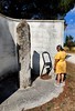
The above images may not be of the site on this page, but were taken nearby. They are loaded from Flickr so please click on them for image credits.
Click here to see more info for this site
Nearby sites
Click here to view sites on an interactive map of the areaKey: Red: member's photo, Blue: 3rd party photo, Yellow: other image, Green: no photo - please go there and take one, Grey: site destroyed
Download sites to:
KML (Google Earth)
GPX (GPS waypoints)
CSV (Garmin/Navman)
CSV (Excel)
To unlock full downloads you need to sign up as a Contributory Member. Otherwise downloads are limited to 50 sites.
Turn off the page maps and other distractions
Nearby sites listing. In the following links * = Image available
1.2km ENE 65° Chianca di Santo Stefano Trilithon* Burial Chamber or Dolmen
1.4km E 81° Staurotomea Standing stone* Standing Stone (Menhir)
2.4km W 261° Teofilo Menhir* Standing Stone (Menhir)
5.6km SW 217° Minonna Standing stone* Standing Stone (Menhir)
5.7km S 182° Croce di Bagnolo Standing Stone* Standing Stone (Menhir)
5.8km SSW 213° Candelora Menhir* Standing Stone (Menhir)
5.8km S 169° Bagnolo Standing Stone* Standing Stone (Menhir)
5.9km SW 223° Scineo Menhir Standing Stone (Menhir)
6.1km NNW 327° Pietra di San Vito Standing Stone (Menhir)
6.1km SSW 208° Giovane Menhir* Standing Stone (Menhir)
6.2km SW 217° Lama Standing Stone* Standing Stone (Menhir)
6.4km SSW 204° Croce alle Tajate Menhir* Standing Stone (Menhir)
6.6km NNW 343° Placa Dolmen* Burial Chamber or Dolmen
6.7km SSW 205° Meriggina Dolmen Burial Chamber or Dolmen
6.8km SW 221° Massenia Piccinna Menhir Standing Stone (Menhir)
6.9km W 270° Sant'Anna Menhir* Standing Stone (Menhir)
6.9km SSW 195° Santa Maria Menhir Standing Stone (Menhir)
7.1km SSW 212° Chipuru Menhir Standing Stone (Menhir)
7.2km S 176° Spruno Standing stone Standing Stone (Menhir)
7.2km SSW 203° Calamauri Dolmen I Burial Chamber or Dolmen
7.3km SSW 212° Santa Loja Menhir Standing Stone (Menhir)
7.3km SE 139° Santu Lasi Standing stone Standing Stone (Menhir)
7.3km SSW 204° Calamauri Dolmen II Burial Chamber or Dolmen
7.4km N 353° Gurgulante Dolmen* Burial Chamber or Dolmen
7.9km SSW 207° Calamauri Menhir* Standing Stone (Menhir)
View more nearby sites and additional images


 We would like to know more about this location. Please feel free to add a brief description and any relevant information in your own language.
 Wir möchten mehr über diese Stätte erfahren. Bitte zögern Sie nicht, eine kurze Beschreibung und relevante Informationen in Deutsch hinzuzufügen.
 Nous aimerions en savoir encore un peu sur les lieux. S'il vous plaît n'hesitez pas à ajouter une courte description et tous les renseignements pertinents dans votre propre langue.
 Quisieramos informarnos un poco más de las lugares. No dude en añadir una breve descripción y otros datos relevantes en su propio idioma.