


<< Text Pages >> Taucheira - Ancient Village or Settlement in Libya
Submitted by AlexHunger on Thursday, 17 April 2008 Page Views: 3616
Multi-periodSite Name: Taucheira Alternative Name: Teucheira, Tauchira, Teuchira, ArsinoeCountry: Libya
NOTE: This site is 323.911 km away from the location you searched for.
Type: Ancient Village or Settlement
Nearest Town: Benghazi Nearest Village: Tocra
Latitude: 32.533333N Longitude: 20.566667E
Condition:
| 5 | Perfect |
| 4 | Almost Perfect |
| 3 | Reasonable but with some damage |
| 2 | Ruined but still recognisable as an ancient site |
| 1 | Pretty much destroyed, possibly visible as crop marks |
| 0 | No data. |
| -1 | Completely destroyed |
| 5 | Superb |
| 4 | Good |
| 3 | Ordinary |
| 2 | Not Good |
| 1 | Awful |
| 0 | No data. |
| 5 | Can be driven to, probably with disabled access |
| 4 | Short walk on a footpath |
| 3 | Requiring a bit more of a walk |
| 2 | A long walk |
| 1 | In the middle of nowhere, a nightmare to find |
| 0 | No data. |
| 5 | co-ordinates taken by GPS or official recorded co-ordinates |
| 4 | co-ordinates scaled from a detailed map |
| 3 | co-ordinates scaled from a bad map |
| 2 | co-ordinates of the nearest village |
| 1 | co-ordinates of the nearest town |
| 0 | no data |
Internal Links:
External Links:
Ancient Village or Settlement in Libya
Founded around 510 BCE, Tocra was one of the first ports settled from Cyrene. Under the Ptolemies it was renamed Arsinoe after Queen Arsinoe II of Egypt. Later it became a Roman colony and was fortified by Justinian I. Taucheira was particularly noted for the worship of Cybele. Due o the soft sandstone, the buildings have not survived the local earthquakes well.
Exact location not known.
You may be viewing yesterday's version of this page. To see the most up to date information please register for a free account.
Do not use the above information on other web sites or publications without permission of the contributor.
Nearby Images from Flickr
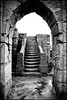
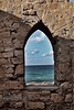
The above images may not be of the site on this page, but were taken nearby. They are loaded from Flickr so please click on them for image credits.
Click here to see more info for this site
Nearby sites
Click here to view sites on an interactive map of the areaKey: Red: member's photo, Blue: 3rd party photo, Yellow: other image, Green: no photo - please go there and take one, Grey: site destroyed
Download sites to:
KML (Google Earth)
GPX (GPS waypoints)
CSV (Garmin/Navman)
CSV (Excel)
To unlock full downloads you need to sign up as a Contributory Member. Otherwise downloads are limited to 50 sites.
Turn off the page maps and other distractions
Nearby sites listing. In the following links * = Image available
40.6km ENE 61° Ptolemais Museum Ancient Village or Settlement
40.9km ENE 61° Ptolemais Ancient Village or Settlement
65.5km SW 226° Euesperides* Ancient Village or Settlement
114.6km ENE 76° Al Bayda' Asklepieion Ancient Temple
114.7km E 84° Slonta Grotto Cave or Rock Shelter
124.6km ENE 75° Cyrene Rock Cut Tombs* Rock Cut Tomb
124.6km ENE 75° Cyrene Sacred Spring* Holy Well or Sacred Spring
124.6km ENE 75° Cyrene Temple of Apollo* Ancient Temple
124.6km ENE 75° Cyrene Temple of Artemis* Ancient Temple
124.6km ENE 75° Cyrene Sanctuary of Apollo* Ancient Temple
124.7km ENE 75° Cyrene Temple of Demeter* Ancient Temple
124.9km ENE 75° Cyrene Necropolis* Rock Cut Tomb
125.0km ENE 75° Cyrene* Ancient Village or Settlement
125.5km ENE 75° Cyrene Temple of Zeus* Ancient Temple
137.7km ENE 72° Apollonia (Libya)* Ancient Village or Settlement
153.8km ENE 77° Snibat al-Awila Tombs Portal Tomb
423.2km NE 44° Lissos (Crete)* Ancient Village or Settlement
427.2km NE 43° Elyros* Ancient Village or Settlement
431.3km NE 39° Falasarna* Ancient Village or Settlement
456.1km NE 39° Diktynnaion Ancient Temple
459.4km NE 43° Chania Archaeological Museum* Museum
459.7km NE 43° Kydonia* Ancient Village or Settlement
461.4km NE 44° Stylos Tholos Tomb* Chambered Tomb
461.5km NE 44° Stylos Settlement* Ancient Village or Settlement
463.4km NE 44° Aptera* Ancient Village or Settlement
View more nearby sites and additional images


 We would like to know more about this location. Please feel free to add a brief description and any relevant information in your own language.
 Wir möchten mehr über diese Stätte erfahren. Bitte zögern Sie nicht, eine kurze Beschreibung und relevante Informationen in Deutsch hinzuzufügen.
 Nous aimerions en savoir encore un peu sur les lieux. S'il vous plaît n'hesitez pas à ajouter une courte description et tous les renseignements pertinents dans votre propre langue.
 Quisieramos informarnos un poco más de las lugares. No dude en añadir una breve descripción y otros datos relevantes en su propio idioma.