

<< Other Photo Pages >> Stillfried Zentrum der Urzeit - Museum in Austria
Submitted by holubjoh on Saturday, 21 October 2017 Page Views: 1057
MuseumsSite Name: Stillfried Zentrum der UrzeitCountry: Austria
NOTE: This site is 3.371 km away from the location you searched for.
Type: Museum
Nearest Village: Stillfried
Latitude: 48.413002N Longitude: 16.842679E
Condition:
| 5 | Perfect |
| 4 | Almost Perfect |
| 3 | Reasonable but with some damage |
| 2 | Ruined but still recognisable as an ancient site |
| 1 | Pretty much destroyed, possibly visible as crop marks |
| 0 | No data. |
| -1 | Completely destroyed |
| 5 | Superb |
| 4 | Good |
| 3 | Ordinary |
| 2 | Not Good |
| 1 | Awful |
| 0 | No data. |
| 5 | Can be driven to, probably with disabled access |
| 4 | Short walk on a footpath |
| 3 | Requiring a bit more of a walk |
| 2 | A long walk |
| 1 | In the middle of nowhere, a nightmare to find |
| 0 | No data. |
| 5 | co-ordinates taken by GPS or official recorded co-ordinates |
| 4 | co-ordinates scaled from a detailed map |
| 3 | co-ordinates scaled from a bad map |
| 2 | co-ordinates of the nearest village |
| 1 | co-ordinates of the nearest town |
| 0 | no data |
Internal Links:
External Links:
")
Stillfried Zentrum der Urzeit
You may be viewing yesterday's version of this page. To see the most up to date information please register for a free account.
Do not use the above information on other web sites or publications without permission of the contributor.
Nearby Images from Flickr
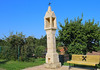
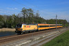
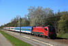
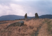
The above images may not be of the site on this page, but were taken nearby. They are loaded from Flickr so please click on them for image credits.
Click here to see more info for this site
Nearby sites
Click here to view sites on an interactive map of the areaKey: Red: member's photo, Blue: 3rd party photo, Yellow: other image, Green: no photo - please go there and take one, Grey: site destroyed
Download sites to:
KML (Google Earth)
GPX (GPS waypoints)
CSV (Garmin/Navman)
CSV (Excel)
To unlock full downloads you need to sign up as a Contributory Member. Otherwise downloads are limited to 50 sites.
Turn off the page maps and other distractions
Nearby sites listing. In the following links * = Image available
23.3km SE 131° Stupavsky hrad* Hillfort
24.1km WSW 255° Pillichsdorf Kalvarienberg Tumulus Round Barrow(s)
25.8km W 267° Keltenstein Ulrichskirchen* Holed Stone
27.0km NW 312° MAMUZ Museum Mistelbach* Museum
27.4km SSE 152° Villa Rustica Bratislava Dubravka Ancient Village or Settlement
27.8km N 6° Rabensburg Tumuli (1) Round Barrow(s)
30.0km N 7° Rabensburg Tumulus (2) Round Barrow(s)
32.5km NW 307° MAMUZ Schloss Asparn-Zaya* Museum
37.6km WSW 242° Summstein Wasserpark* Modern Stone Circle etc
40.2km W 279° Niederfellabrunn Leeberg Round Barrow(s)
40.9km W 277° Niederhollabrunn Leeberg Round Barrow(s)
42.6km WSW 237° Naturhistorisches Museum Wien* Museum
45.8km SSE 150° Gerulata Ancient Village or Settlement
46.5km W 281° Leeberg* Artificial Mound
46.9km NNE 25° Church of Saint Margaret of Antioch, Kopčany* Misc. Earthwork
47.1km NNE 22° Slavic fortified settlement in Mikulčice* Ancient Village or Settlement
47.4km W 279° Geitzendorf* Barrow Cemetery
49.9km NNE 28° Menhiry Holic* Standing Stones
49.9km NNW 344° Klentnice Stone Circle* Modern Stone Circle etc
50.1km W 266° Hügelgrab Löwenberg* Round Barrow(s)
53.1km NNW 347° Archeopark Pavlov* Museum
54.8km NNW 345° Dolní Věstonice* Ancient Village or Settlement
59.4km SSW 195° Donnerskirchen Tumulus* Round Barrow(s)
71.2km NE 45° Javorníky Menhir Standing Stone (Menhir)
73.6km SW 236° Hafnerberg Steinkreise Stone Circle
View more nearby sites and additional images


 We would like to know more about this location. Please feel free to add a brief description and any relevant information in your own language.
 Wir möchten mehr über diese Stätte erfahren. Bitte zögern Sie nicht, eine kurze Beschreibung und relevante Informationen in Deutsch hinzuzufügen.
 Nous aimerions en savoir encore un peu sur les lieux. S'il vous plaît n'hesitez pas à ajouter une courte description et tous les renseignements pertinents dans votre propre langue.
 Quisieramos informarnos un poco más de las lugares. No dude en añadir una breve descripción y otros datos relevantes en su propio idioma.