


<< Text Pages >> Krimissa Temple of Apollo - Ancient Temple in Italy in Calabria
Submitted by AlexHunger on Sunday, 09 September 2007 Page Views: 5684
Roman, Greek and ClassicalSite Name: Krimissa Temple of Apollo Alternative Name: Krimisa Temple of ApolloCountry: Italy
NOTE: This site is 7.312 km away from the location you searched for.
Region: Calabria Type: Ancient Temple
Nearest Town: Crotone Nearest Village: Cirò Marina
Latitude: 39.396550N Longitude: 17.146700E
Condition:
| 5 | Perfect |
| 4 | Almost Perfect |
| 3 | Reasonable but with some damage |
| 2 | Ruined but still recognisable as an ancient site |
| 1 | Pretty much destroyed, possibly visible as crop marks |
| 0 | No data. |
| -1 | Completely destroyed |
| 5 | Superb |
| 4 | Good |
| 3 | Ordinary |
| 2 | Not Good |
| 1 | Awful |
| 0 | No data. |
| 5 | Can be driven to, probably with disabled access |
| 4 | Short walk on a footpath |
| 3 | Requiring a bit more of a walk |
| 2 | A long walk |
| 1 | In the middle of nowhere, a nightmare to find |
| 0 | No data. |
| 5 | co-ordinates taken by GPS or official recorded co-ordinates |
| 4 | co-ordinates scaled from a detailed map |
| 3 | co-ordinates scaled from a bad map |
| 2 | co-ordinates of the nearest village |
| 1 | co-ordinates of the nearest town |
| 0 | no data |
Internal Links:
External Links:
Ancient Temple in Calabria
Remains of ancient Greek temple to Apollo Alaios dating to about 550 BCE measuring 46m by 19m with a colonnade of 8 by 19 Doric columns.
You may be viewing yesterday's version of this page. To see the most up to date information please register for a free account.
Do not use the above information on other web sites or publications without permission of the contributor.
Nearby Images from Flickr

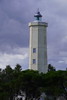
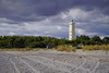
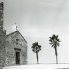

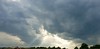
The above images may not be of the site on this page, but were taken nearby. They are loaded from Flickr so please click on them for image credits.
Click here to see more info for this site
Nearby sites
Click here to view sites on an interactive map of the areaKey: Red: member's photo, Blue: 3rd party photo, Yellow: other image, Green: no photo - please go there and take one, Grey: site destroyed
Download sites to:
KML (Google Earth)
GPX (GPS waypoints)
CSV (Garmin/Navman)
CSV (Excel)
To unlock full downloads you need to sign up as a Contributory Member. Otherwise downloads are limited to 50 sites.
Turn off the page maps and other distractions
Nearby sites listing. In the following links * = Image available
41.5km S 173° Lakinion Temple of Hera* Ancient Temple
66.3km WNW 303° Sybaris* Ancient Village or Settlement
80.9km SW 216° Scolacium* Ancient Temple
94.0km NNW 332° Cugno dei Vagni* Ancient Village or Settlement
99.9km NE 55° Terenzano Menhir* Standing Stone (Menhir)
100.0km NNW 336° Siritide* Ancient Village or Settlement
100.2km NE 54° Ninfeo Menhir Standing Stone (Menhir)
100.8km NE 51° Torre Ospina Dolmen Burial Chamber or Dolmen
105.8km ENE 57° Largo Croce Menhir Standing Stone (Menhir)
106.1km ENE 57° Visitazione Menhir Standing Stone (Menhir)
106.3km ENE 62° Argentina-Graziadei Dolmen* Burial Chamber or Dolmen
111.9km ENE 63° Madonna di Costantinopoli Menhir Standing Stone (Menhir)
111.9km NE 53° Manfio Menhir Standing Stone (Menhir)
113.2km NNW 346° Metapontion* Ancient Village or Settlement
113.7km ENE 63° Mensi Menhir* Standing Stone (Menhir)
115.0km ENE 64° Spirito Santo Menhir* Standing Stone (Menhir)
115.5km ENE 64° Menhir Della Croce* Standing Stone (Menhir)
116.1km NE 53° Coelimanna Menhir* Standing Stone (Menhir)
116.1km SSW 205° Museo Archeologico di Monasterace Museum
116.5km NE 53° Supersano Standing stone* Standing Stone (Menhir)
116.6km SSW 205° Kaulonia Ancient Village or Settlement
116.6km SSW 205° Caulonia* Ancient Village or Settlement
116.7km NE 51° Sombrino Menhir Standing Stone (Menhir)
116.8km NNW 346° Tavole Palatine Temple of Hera* Ancient Temple
118.9km WNW 299° Grotta del Romito Cave or Rock Shelter
View more nearby sites and additional images


 We would like to know more about this location. Please feel free to add a brief description and any relevant information in your own language.
 Wir möchten mehr über diese Stätte erfahren. Bitte zögern Sie nicht, eine kurze Beschreibung und relevante Informationen in Deutsch hinzuzufügen.
 Nous aimerions en savoir encore un peu sur les lieux. S'il vous plaît n'hesitez pas à ajouter une courte description et tous les renseignements pertinents dans votre propre langue.
 Quisieramos informarnos un poco más de las lugares. No dude en añadir una breve descripción y otros datos relevantes en su propio idioma.