


<< Our Photo Pages >> U oveček - Rock Outcrop in Czech Republic in Moravia
Submitted by ladrin on Tuesday, 06 March 2018 Page Views: 929
Natural PlacesSite Name: U oveček Alternative Name: At the sheepsCountry: Czech Republic
NOTE: This site is 23.486 km away from the location you searched for.
Region: Moravia Type: Rock Outcrop
Nearest Town: Znojmo
Latitude: 48.862161N Longitude: 16.030239E
Condition:
| 5 | Perfect |
| 4 | Almost Perfect |
| 3 | Reasonable but with some damage |
| 2 | Ruined but still recognisable as an ancient site |
| 1 | Pretty much destroyed, possibly visible as crop marks |
| 0 | No data. |
| -1 | Completely destroyed |
| 5 | Superb |
| 4 | Good |
| 3 | Ordinary |
| 2 | Not Good |
| 1 | Awful |
| 0 | No data. |
| 5 | Can be driven to, probably with disabled access |
| 4 | Short walk on a footpath |
| 3 | Requiring a bit more of a walk |
| 2 | A long walk |
| 1 | In the middle of nowhere, a nightmare to find |
| 0 | No data. |
| 5 | co-ordinates taken by GPS or official recorded co-ordinates |
| 4 | co-ordinates scaled from a detailed map |
| 3 | co-ordinates scaled from a bad map |
| 2 | co-ordinates of the nearest village |
| 1 | co-ordinates of the nearest town |
| 0 | no data |
Internal Links:
External Links:
")
Just a few steps from the place of ancient hillfort "Hradiště" can be found an interesting cluster of white stones called "U oveček" (can be translated as a "At the sheeps"). Strong outcrop of the quartzite core on the small hill has to attract people ever since.
In past the stones were set to form a cross by the monks from the nearby monastery. Later, however, the cross was destroyed and folk creativity named the place "At the sheeps".
You may be viewing yesterday's version of this page. To see the most up to date information please register for a free account.
")
")
")
")
Do not use the above information on other web sites or publications without permission of the contributor.
Nearby Images from Flickr
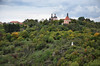
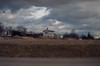
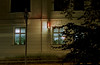
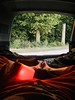
The above images may not be of the site on this page, but were taken nearby. They are loaded from Flickr so please click on them for image credits.
Click here to see more info for this site
Nearby sites
Click here to view sites on an interactive map of the areaKey: Red: member's photo, Blue: 3rd party photo, Yellow: other image, Green: no photo - please go there and take one, Grey: site destroyed
Download sites to:
KML (Google Earth)
GPX (GPS waypoints)
CSV (Garmin/Navman)
CSV (Excel)
To unlock full downloads you need to sign up as a Contributory Member. Otherwise downloads are limited to 50 sites.
Turn off the page maps and other distractions
Nearby sites listing. In the following links * = Image available
407m SE 144° Great Moravia hillfort - Hradiště* Hillfort
716m SE 128° Stone stele Hradiste* Standing Stone (Menhir)
794m WNW 297° Samaritánka Well* Holy Well or Sacred Spring
4.2km W 263° Masovice Prehistoric Settlements Ancient Village or Settlement
9.0km SSW 209° Heiliger Stein (Mitterretzbach)* Rock Art
20.1km SW 218° Kalenderstein von Leodagger* Rock Art
28.0km WSW 256° Summstein Geras* Modern Stone Circle etc
36.0km SW 225° Mold and Rosenburg Ancient Settlements Ancient Village or Settlement
43.9km SSE 161° Leeberg* Artificial Mound
44.7km SSE 163° Geitzendorf* Barrow Cemetery
45.0km E 86° Dolní Věstonice* Ancient Village or Settlement
45.5km SE 132° MAMUZ Schloss Asparn-Zaya* Museum
45.9km E 92° Klentnice Stone Circle* Modern Stone Circle etc
47.3km E 88° Archeopark Pavlov* Museum
48.2km SSE 155° Niederfellabrunn Leeberg Round Barrow(s)
49.1km SSE 157° Niederhollabrunn Leeberg Round Barrow(s)
50.9km SE 129° MAMUZ Museum Mistelbach* Museum
53.6km NE 46° Anthropos Pavilion* Museum
54.2km W 265° Grosse Basilica* Modern Stone Circle etc
54.3km S 169° Hügelgrab Löwenberg* Round Barrow(s)
55.9km NE 49° Moravské zemské muzeum* Museum
61.0km W 277° Platz des Scorpions* Natural Stone / Erratic / Other Natural Feature
61.2km SSW 202° Gräberfeld Traisental* Barrow Cemetery
61.6km SE 146° Keltenstein Ulrichskirchen* Holed Stone
61.8km SSW 204° Urzeitmuseum* Museum
View more nearby sites and additional images


 We would like to know more about this location. Please feel free to add a brief description and any relevant information in your own language.
 Wir möchten mehr über diese Stätte erfahren. Bitte zögern Sie nicht, eine kurze Beschreibung und relevante Informationen in Deutsch hinzuzufügen.
 Nous aimerions en savoir encore un peu sur les lieux. S'il vous plaît n'hesitez pas à ajouter une courte description et tous les renseignements pertinents dans votre propre langue.
 Quisieramos informarnos un poco más de las lugares. No dude en añadir una breve descripción y otros datos relevantes en su propio idioma.