 with our Megalithic Portal iPhone app")

<< Text Pages >> Valle dei Dolmen Monte Sant´Angelo - Rock Cut Tomb in Italy in Puglia
Submitted by KaiHofmann on Thursday, 28 January 2016 Page Views: 895
Multi-periodSite Name: Valle dei Dolmen Monte Sant´AngeloCountry: Italy
NOTE: This site is 6.743 km away from the location you searched for.
Region: Puglia Type: Rock Cut Tomb
Nearest Town: Monte San Angelo
Latitude: 41.701004N Longitude: 15.937880E
Condition:
| 5 | Perfect |
| 4 | Almost Perfect |
| 3 | Reasonable but with some damage |
| 2 | Ruined but still recognisable as an ancient site |
| 1 | Pretty much destroyed, possibly visible as crop marks |
| 0 | No data. |
| -1 | Completely destroyed |
| 5 | Superb |
| 4 | Good |
| 3 | Ordinary |
| 2 | Not Good |
| 1 | Awful |
| 0 | No data. |
| 5 | Can be driven to, probably with disabled access |
| 4 | Short walk on a footpath |
| 3 | Requiring a bit more of a walk |
| 2 | A long walk |
| 1 | In the middle of nowhere, a nightmare to find |
| 0 | No data. |
| 5 | co-ordinates taken by GPS or official recorded co-ordinates |
| 4 | co-ordinates scaled from a detailed map |
| 3 | co-ordinates scaled from a bad map |
| 2 | co-ordinates of the nearest village |
| 1 | co-ordinates of the nearest town |
| 0 | no data |
Internal Links:
External Links:
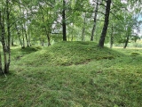
Rock Cut Tomb in Puglia
Several small caves in a valley south west of Monte San Angelo, possibly used as rock cut tombs.
You may be viewing yesterday's version of this page. To see the most up to date information please register for a free account.
Do not use the above information on other web sites or publications without permission of the contributor.
Nearby Images from Flickr
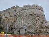
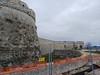
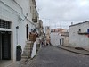
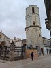
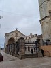
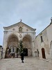
The above images may not be of the site on this page, but were taken nearby. They are loaded from Flickr so please click on them for image credits.
Click here to see more info for this site
Nearby sites
Click here to view sites on an interactive map of the areaKey: Red: member's photo, Blue: 3rd party photo, Yellow: other image, Green: no photo - please go there and take one, Grey: site destroyed
Download sites to:
KML (Google Earth)
GPX (GPS waypoints)
CSV (Garmin/Navman)
CSV (Excel)
To unlock full downloads you need to sign up as a Contributory Member. Otherwise downloads are limited to 50 sites.
Turn off the page maps and other distractions
Nearby sites listing. In the following links * = Image available
1.6km ENE 61° Monte Sant´Angelo* Early Christian Sculptured Stone
2.6km SSE 159° Monte San Angelo Necropolis Rock Cut Tomb
7.3km SSW 201° Scaloria Cavern Cave or Rock Shelter
9.9km E 95° Monte Saraceno Necropolis* Rock Cut Tomb
10.8km NE 54° Monte Sacro* Natural Stone / Erratic / Other Natural Feature
11.5km SSW 203° Ipogei Capparelli Ancient Village or Settlement
14.8km WNW 283° Monte Calvo Ancient Village or Settlement
26.2km NNE 14° Miniera di selce di Valle Sbernia Ancient Mine, Quarry or other Industry
27.3km W 259° Grotta Paglicci Cave or Rock Shelter
27.7km W 259° Dolmen di Madonna di Cristo Burial Chamber or Dolmen
28.2km NE 40° Defensola Flintstone Mine Ancient Mine, Quarry or other Industry
28.4km NNE 30° Parco Archaologico della Salata Rock Cut Tomb
28.7km NNE 18° Grotta Di Manaccora Cave or Rock Shelter
28.8km NNE 26° Sfinalicchio Cavern Rock Art
29.4km W 265° Museo Grotta Paglicci e il Paliolitico del Gargano Museum
31.7km WSW 239° Passo di Corvo* Henge
36.4km SW 236° Daunian Arpi Ancient Village or Settlement
48.4km SSE 158° Mount of Cannae* Ancient Village or Settlement
49.0km SSE 159° Canne Standing Stone* Standing Stone (Menhir)
72.6km SE 141° Chianca Dolmen* Chambered Tomb
73.2km SE 141° Dolmen di Albarosa Passage Grave
73.5km SE 143° Paladini Dolmen* Burial Chamber or Dolmen
75.0km SE 140° Frisari Dolmen Burial Chamber or Dolmen
84.3km SE 136° San Silvestro Dolmen Burial Chamber or Dolmen
85.4km SE 141° Pietrefitte 1* Standing Stone (Menhir)
View more nearby sites and additional images


 We would like to know more about this location. Please feel free to add a brief description and any relevant information in your own language.
 Wir möchten mehr über diese Stätte erfahren. Bitte zögern Sie nicht, eine kurze Beschreibung und relevante Informationen in Deutsch hinzuzufügen.
 Nous aimerions en savoir encore un peu sur les lieux. S'il vous plaît n'hesitez pas à ajouter une courte description et tous les renseignements pertinents dans votre propre langue.
 Quisieramos informarnos un poco más de las lugares. No dude en añadir una breve descripción y otros datos relevantes en su propio idioma.