


<< Our Photo Pages >> Kiusu - Henge in Japan in Hokkaidō
Submitted by Aska on Sunday, 03 October 2010 Page Views: 5109
Neolithic and Bronze AgeSite Name: Kiusu Alternative Name: キウス周堤墓Country: Japan
NOTE: This site is 11.621 km away from the location you searched for.
Region: Hokkaidō Type: Henge
Nearest Town: Chitose (Hokkaidō pref.) Nearest Village: Chūō 中央
Latitude: 42.885780N Longitude: 141.716030E
Condition:
| 5 | Perfect |
| 4 | Almost Perfect |
| 3 | Reasonable but with some damage |
| 2 | Ruined but still recognisable as an ancient site |
| 1 | Pretty much destroyed, possibly visible as crop marks |
| 0 | No data. |
| -1 | Completely destroyed |
| 5 | Superb |
| 4 | Good |
| 3 | Ordinary |
| 2 | Not Good |
| 1 | Awful |
| 0 | No data. |
| 5 | Can be driven to, probably with disabled access |
| 4 | Short walk on a footpath |
| 3 | Requiring a bit more of a walk |
| 2 | A long walk |
| 1 | In the middle of nowhere, a nightmare to find |
| 0 | No data. |
| 5 | co-ordinates taken by GPS or official recorded co-ordinates |
| 4 | co-ordinates scaled from a detailed map |
| 3 | co-ordinates scaled from a bad map |
| 2 | co-ordinates of the nearest village |
| 1 | co-ordinates of the nearest town |
| 0 | no data |
Internal Links:
External Links:
")
From the centre of the henges, some burial artifacts were excavated, so some archaeologists believe that these earthen circle have similar meaning to other stone circles in Hokkaidō.
You may be viewing yesterday's version of this page. To see the most up to date information please register for a free account.
Do not use the above information on other web sites or publications without permission of the contributor.
Nearby Images from Flickr


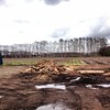

The above images may not be of the site on this page, but were taken nearby. They are loaded from Flickr so please click on them for image credits.
Click here to see more info for this site
Nearby sites
Click here to view sites on an interactive map of the areaKey: Red: member's photo, Blue: 3rd party photo, Yellow: other image, Green: no photo - please go there and take one, Grey: site destroyed
Download sites to:
KML (Google Earth)
GPX (GPS waypoints)
CSV (Garmin/Navman)
CSV (Excel)
To unlock full downloads you need to sign up as a Contributory Member. Otherwise downloads are limited to 50 sites.
Turn off the page maps and other distractions
Nearby sites listing. In the following links * = Image available
29.0km W 278° Makomanai Takino-Reien cemetery* Modern Stone Circle etc
30.4km NNW 328° Ebetsu Kofungun* Round Barrow(s)
30.5km NNW 328° Ebetsu Chashi* Hillfort
68.4km WNW 302° Temiya cave* Carving
69.2km NW 304° ex-Aoyama Bettei residence* Modern Stone Circle etc
72.6km NNE 14° Hokkaidō Children's Land* Modern Stone Circle etc
76.8km WNW 297° Oshoro* Stone Circle
76.9km WNW 297° ChijinYama* Stone Circle
78.2km NE 35° Nokanan henge* Henge
78.5km WNW 296° NishizakiYama* Stone Circle
79.0km WNW 296° Fugoppe cave* Carving
80.5km SE 136° Mena Chashi* Hillfort
81.9km SE 139° Hoinasir Chashi* Hillfort
81.9km SE 139° Sibecar Chashi* Hillfort
85.6km W 266° Hokuei* Stone Circle
91.3km NNE 16° Otoe* Stone Circle
101.4km NNE 23° Kamui-Kotan stone circle* Stone Circle
129.8km SW 229° Washi-no-ki* Stone Circle
173.5km E 91° Otafunbe Chashi* Hillfort
176.0km ENE 68° Yuk'epira Chashi* Hillfort
209.0km SW 220° Hōgen-ji temple (in Hokkaidō)* Modern Stone Circle etc
209.1km SW 220° Hōdō-ji temple* Modern Stone Circle etc
209.2km SW 220° Kōzen-ji temple (in Hokkaidō)* Modern Stone Circle etc
218.4km E 86° Mosirya Chashi* Hillfort
219.4km E 86° Charanke Chashi* Hillfort
View more nearby sites and additional images


 We would like to know more about this location. Please feel free to add a brief description and any relevant information in your own language.
 Wir möchten mehr über diese Stätte erfahren. Bitte zögern Sie nicht, eine kurze Beschreibung und relevante Informationen in Deutsch hinzuzufügen.
 Nous aimerions en savoir encore un peu sur les lieux. S'il vous plaît n'hesitez pas à ajouter une courte description et tous les renseignements pertinents dans votre propre langue.
 Quisieramos informarnos un poco más de las lugares. No dude en añadir una breve descripción y otros datos relevantes en su propio idioma.