

<< Our Photo Pages >> IshiButai open air theater - Modern Stone Circle etc in Japan in Honshū
Submitted by Aska on Sunday, 18 August 2019 Page Views: 721
Modern SitesSite Name: IshiButai open air theater Alternative Name: 石舞台野外劇場 Ishi Butai yagai gekijōCountry: Japan
NOTE: This site is 7.187 km away from the location you searched for.
Region: Honshū Type: Modern Stone Circle etc
Nearest Town: Marumori-machi (Miyagi pref.) Nearest Village: Ōhari-ōkura 大張&#
Latitude: 37.951780N Longitude: 140.677510E
Condition:
| 5 | Perfect |
| 4 | Almost Perfect |
| 3 | Reasonable but with some damage |
| 2 | Ruined but still recognisable as an ancient site |
| 1 | Pretty much destroyed, possibly visible as crop marks |
| 0 | No data. |
| -1 | Completely destroyed |
| 5 | Superb |
| 4 | Good |
| 3 | Ordinary |
| 2 | Not Good |
| 1 | Awful |
| 0 | No data. |
| 5 | Can be driven to, probably with disabled access |
| 4 | Short walk on a footpath |
| 3 | Requiring a bit more of a walk |
| 2 | A long walk |
| 1 | In the middle of nowhere, a nightmare to find |
| 0 | No data. |
| 5 | co-ordinates taken by GPS or official recorded co-ordinates |
| 4 | co-ordinates scaled from a detailed map |
| 3 | co-ordinates scaled from a bad map |
| 2 | co-ordinates of the nearest village |
| 1 | co-ordinates of the nearest town |
| 0 | no data |
Internal Links:
External Links:
")
A quarry industry Ōkurayama Sutajio (studio) made this monument, a round stone stage surrounded by a stone circle accompanied with a S-shaped pillar, close to its office in 1992.
Official site with English translation
You may be viewing yesterday's version of this page. To see the most up to date information please register for a free account.
")
Do not use the above information on other web sites or publications without permission of the contributor.
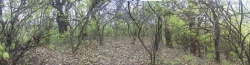
Nearby Images from Flickr
The above images may not be of the site on this page, but were taken nearby. They are loaded from Flickr so please click on them for image credits.
Click here to see more info for this site
Nearby sites
Click here to view sites on an interactive map of the areaKey: Red: member's photo, Blue: 3rd party photo, Yellow: other image, Green: no photo - please go there and take one, Grey: site destroyed
Download sites to:
KML (Google Earth)
GPX (GPS waypoints)
CSV (Garmin/Navman)
CSV (Excel)
To unlock full downloads you need to sign up as a Contributory Member. Otherwise downloads are limited to 50 sites.
Turn off the page maps and other distractions
Nearby sites listing. In the following links * = Image available
18.5km NE 54° Takenohana Yokoana* Rock Cut Tomb
36.9km NNE 28° Atagoyama Yokoana* Rock Cut Tomb
43.4km WNW 284° Matsuzawa kofungun* Chambered Cairn
43.8km NW 317° Kōzen-ji temple (in Yamagata)* Modern Stone Circle etc
45.3km NW 318° Ex-Saisei-kan hospital main building* Modern Stone Circle etc
47.9km NE 35° Tagajō* Ancient Village or Settlement
58.7km NW 323° Sagae* Stone Circle
59.6km NE 44° Jōgan tsunami warning tablet* Modern Stone Circle etc
62.7km SSE 152° History and Folklore Museum Futaba-Machi* Museum
65.3km NNE 30° Takaiwa Yokoana* Rock Cut Tomb
66.9km NNE 19° Yamahata Yokoana* Rock Cut Tomb
67.4km NE 41° Yamoto Yokoana* Rock Cut Tomb
70.3km NNE 29° Kamei Gakoi Yokoana rock cut tombs* Rock Cut Tomb
78.3km NNE 32° Oido Yokoana* Rock Cut Tomb
79.9km NNE 13° Kawakita Yokoana* Rock Cut Tomb
86.0km NE 41° Izumizawa Kofun* Chambered Cairn
86.2km WSW 244° Nagai MaenoYama Kofun* Long Barrow
86.9km NE 50° Onagawa Stone Memorial of Life tsunami warning tablets* Modern Stone Circle etc
91.8km NE 53° Izushima stone settings* Stone Circle
94.4km SSW 200° Izumizaki Yokoana* Rock Cut Tomb
97.0km SSW 201° Nojikubo Kofun* Passage Grave
97.4km WNW 289° Achiyadaira* Stone Circle
105.0km NE 40° Minamisanriku replica Moai statues* Modern Stone Circle etc
108.2km SSE 166° Nakata Yokoana* Rock Cut Tomb
118.8km WSW 251° Kosegasawa Cave Cave or Rock Shelter
View more nearby sites and additional images


 We would like to know more about this location. Please feel free to add a brief description and any relevant information in your own language.
 Wir möchten mehr über diese Stätte erfahren. Bitte zögern Sie nicht, eine kurze Beschreibung und relevante Informationen in Deutsch hinzuzufügen.
 Nous aimerions en savoir encore un peu sur les lieux. S'il vous plaît n'hesitez pas à ajouter une courte description et tous les renseignements pertinents dans votre propre langue.
 Quisieramos informarnos un poco más de las lugares. No dude en añadir una breve descripción y otros datos relevantes en su propio idioma.