 with our Megalithic Portal iPhone app")


<< Our Photo Pages >> Il-Gebla ta' Sasuna - Burial Chamber or Dolmen in Malta in Gozo
Submitted by enkidu41 on Wednesday, 20 October 2004 Page Views: 8716
Neolithic and Bronze AgeSite Name: Il-Gebla ta' SasunaCountry: Malta
NOTE: This site is 0.924 km away from the location you searched for.
Island: Gozo Type: Burial Chamber or Dolmen
Nearest Town: Victoria Nearest Village: Xaghra
Latitude: 36.054169N Longitude: 14.258889E
Condition:
| 5 | Perfect |
| 4 | Almost Perfect |
| 3 | Reasonable but with some damage |
| 2 | Ruined but still recognisable as an ancient site |
| 1 | Pretty much destroyed, possibly visible as crop marks |
| 0 | No data. |
| -1 | Completely destroyed |
| 5 | Superb |
| 4 | Good |
| 3 | Ordinary |
| 2 | Not Good |
| 1 | Awful |
| 0 | No data. |
| 5 | Can be driven to, probably with disabled access |
| 4 | Short walk on a footpath |
| 3 | Requiring a bit more of a walk |
| 2 | A long walk |
| 1 | In the middle of nowhere, a nightmare to find |
| 0 | No data. |
| 5 | co-ordinates taken by GPS or official recorded co-ordinates |
| 4 | co-ordinates scaled from a detailed map |
| 3 | co-ordinates scaled from a bad map |
| 2 | co-ordinates of the nearest village |
| 1 | co-ordinates of the nearest town |
| 0 | no data |
Internal Links:
External Links:
")
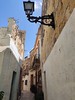
The monument is in a garden and is visible through a locked iron gate - or, for the more intrepid, over a 10' wall with the assistance of strategically placed bench seats against the wall in the street alongside!
You may be viewing yesterday's version of this page. To see the most up to date information please register for a free account.
")
")
Do not use the above information on other web sites or publications without permission of the contributor.
Nearby Images from Flickr
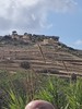

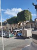
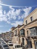
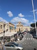
The above images may not be of the site on this page, but were taken nearby. They are loaded from Flickr so please click on them for image credits.
Click here to see more info for this site
Nearby sites
Click here to view sites on an interactive map of the areaKey: Red: member's photo, Blue: 3rd party photo, Yellow: other image, Green: no photo - please go there and take one, Grey: site destroyed
Download sites to:
KML (Google Earth)
GPX (GPS waypoints)
CSV (Garmin/Navman)
CSV (Excel)
To unlock full downloads you need to sign up as a Contributory Member. Otherwise downloads are limited to 50 sites.
Turn off the page maps and other distractions
Nearby sites listing. In the following links * = Image available
803m S 173° Santa Verna* Ancient Temple
969m SE 140° L'Ghar ta' Gejzu* Cave or Rock Shelter
1.0km SSE 148° Xaghra Circle* Stone Circle
1.1km SE 137° Ggantija Standing Stones* Standing Stones
1.2km SE 130° Ggantija* Ancient Temple
1.2km ESE 121° L’Ghar Tramuntana* Cave or Rock Shelter
1.7km NW 321° Ta' Kuljat* Ancient Village or Settlement
1.8km WNW 285° Is-Srug* Cave or Rock Shelter
1.9km N 2° Ghajn Damma Stones* Standing Stones
1.9km SE 136° In-Nuffara Settlement* Ancient Village or Settlement
2.0km WSW 242° Gozo Museum of Archaeology* Museum
2.2km NNE 20° Ghajn Damma Stone Row* Stone Row / Alignment
2.5km SSW 213° Tac-Cawla Settlement* Ancient Village or Settlement
2.8km WSW 241° Kercem Rock Cut Tombs* Rock Cut Tomb
2.9km S 186° Ta' Blankas Stone Row* Stone Row / Alignment
2.9km SW 217° Ta' Marziena* Ancient Temple
2.9km S 184° Ta' Blankas Cart Ruts* Ancient Trackway
2.9km WSW 242° Il-Hagra tad-Dawwara* Standing Stone (Menhir)
2.9km S 185° Ta' Blankas Dolmen B* Burial Chamber or Dolmen
3.0km S 186° Ta' Blankas Dolmen A* Burial Chamber or Dolmen
3.2km SSE 162° Ta' Lambert Stones* Stone Row / Alignment
3.3km SSE 160° Ta' Lambert Cart Ruts* Ancient Trackway
3.5km SE 138° Borg il-Gharib* Ancient Temple
3.6km SE 140° L-Imrejzbiet* Stone Circle
3.6km S 184° Ta' Cenc Gallery Grave* Chambered Tomb
View more nearby sites and additional images


 We would like to know more about this location. Please feel free to add a brief description and any relevant information in your own language.
 Wir möchten mehr über diese Stätte erfahren. Bitte zögern Sie nicht, eine kurze Beschreibung und relevante Informationen in Deutsch hinzuzufügen.
 Nous aimerions en savoir encore un peu sur les lieux. S'il vous plaît n'hesitez pas à ajouter une courte description et tous les renseignements pertinents dans votre propre langue.
 Quisieramos informarnos un poco más de las lugares. No dude en añadir una breve descripción y otros datos relevantes en su propio idioma.