


<< Our Photo Pages >> Sōun-ji temple - Modern Stone Circle etc in Japan in Honshū
Submitted by Aska on Sunday, 05 January 2020 Page Views: 837
Modern SitesSite Name: Sōun-ji temple Alternative Name: 早雲寺 Soun-jiCountry: Japan
NOTE: This site is 9.753 km away from the location you searched for.
Region: Honshū Type: Modern Stone Circle etc
Nearest Town: Hakone-machi (Kanagawa prefecture) Nearest Village: Yumoto 湯本
Latitude: 35.230110N Longitude: 139.103650E
Condition:
| 5 | Perfect |
| 4 | Almost Perfect |
| 3 | Reasonable but with some damage |
| 2 | Ruined but still recognisable as an ancient site |
| 1 | Pretty much destroyed, possibly visible as crop marks |
| 0 | No data. |
| -1 | Completely destroyed |
| 5 | Superb |
| 4 | Good |
| 3 | Ordinary |
| 2 | Not Good |
| 1 | Awful |
| 0 | No data. |
| 5 | Can be driven to, probably with disabled access |
| 4 | Short walk on a footpath |
| 3 | Requiring a bit more of a walk |
| 2 | A long walk |
| 1 | In the middle of nowhere, a nightmare to find |
| 0 | No data. |
| 5 | co-ordinates taken by GPS or official recorded co-ordinates |
| 4 | co-ordinates scaled from a detailed map |
| 3 | co-ordinates scaled from a bad map |
| 2 | co-ordinates of the nearest village |
| 1 | co-ordinates of the nearest town |
| 0 | no data |
Internal Links:
External Links:
")
A temple dedicated to a samurai warrior Sōun HŌJŌ (1456-1519) has a hidden dry landscape garden. The temple stands by the Tōkaidō old highway between Tōkyō and Kyōto (500km approx.) at the starting point of climbing slope towards Mt.Hakone, the highest point (846m alt.) of the road.
You may be viewing yesterday's version of this page. To see the most up to date information please register for a free account.
Do not use the above information on other web sites or publications without permission of the contributor.
Nearby Images from Flickr
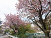
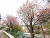
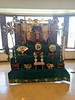


The above images may not be of the site on this page, but were taken nearby. They are loaded from Flickr so please click on them for image credits.
Click here to see more info for this site
Nearby sites
Click here to view sites on an interactive map of the areaKey: Red: member's photo, Blue: 3rd party photo, Yellow: other image, Green: no photo - please go there and take one, Grey: site destroyed
Download sites to:
KML (Google Earth)
GPX (GPS waypoints)
CSV (Garmin/Navman)
CSV (Excel)
To unlock full downloads you need to sign up as a Contributory Member. Otherwise downloads are limited to 50 sites.
Turn off the page maps and other distractions
Nearby sites listing. In the following links * = Image available
13.1km NNE 21° Kanekodai* Stone Circle
13.2km ENE 58° Haneo Yokoana* Rock Cut Tomb
16.5km NE 53° Dainichigakubo Yokoana* Rock Cut Tomb
17.9km ENE 58° Tarekoyato-nishi Yokoana* Rock Cut Tomb
19.3km ENE 61° Shōgakubo Yokoana* Rock Cut Tomb
19.8km SW 220° Yōtoku-ji temple* Standing Stones
20.4km ENE 59° Manda Miyanoiri Yokoana* Rock Cut Tomb
20.9km SW 219° Kashiya-no Hyakketsu* Rock Cut Tomb
23.6km WSW 249° Shimizu Yanagikita Kofun* Passage Grave
25.1km NE 41° Sannomiya-Shimoyato* Stone Circle
25.8km SW 236° Tama-Toishi* Polissoir
26.8km SW 233° JA Nansun* Modern Stone Circle etc
31.3km ENE 59° Koshinoyama Yokoana* Rock Cut Tomb
31.6km SSW 200° KamiShiroiwa* Stone Circle
33.8km WSW 252° Kōshinzuka Kofun* Passage Grave
40.2km ENE 69° Senbagayatsu Yokoana* Rock Cut Tomb
41.8km ENE 79° Kōmyō-ji temple (in Kamakura)* Modern Stone Circle etc
42.3km ENE 74° Meigetsu-in temple* Modern Stone Circle etc
42.5km ENE 74° Kenchō-ji temple* Modern Stone Circle etc
43.0km ENE 69° Shichikokuyama Yokoana* Rock Cut Tomb
43.7km ENE 76° Jōmyō-ji temple* Modern Stone Circle etc
44.1km ENE 76° Zuisen-ji temple* Modern Stone Circle etc
44.8km N 360° Uenoyama Kofun (in Yamanashi)* Chambered Cairn
45.1km NNW 343° Oni-no Tsue* Standing Stone (Menhir)
47.3km NNW 331° Oni-no Tateishi* Standing Stone (Menhir)
View more nearby sites and additional images


 We would like to know more about this location. Please feel free to add a brief description and any relevant information in your own language.
 Wir möchten mehr über diese Stätte erfahren. Bitte zögern Sie nicht, eine kurze Beschreibung und relevante Informationen in Deutsch hinzuzufügen.
 Nous aimerions en savoir encore un peu sur les lieux. S'il vous plaît n'hesitez pas à ajouter une courte description et tous les renseignements pertinents dans votre propre langue.
 Quisieramos informarnos un poco más de las lugares. No dude en añadir una breve descripción y otros datos relevantes en su propio idioma.