


<< Our Photo Pages >> Toro Iseki - Ancient Village or Settlement in Japan in Honshū
Submitted by Aska on Saturday, 12 September 2020 Page Views: 617
Multi-periodSite Name: Toro Iseki Alternative Name: 登呂遺跡Country: Japan
NOTE: This site is 0.492 km away from the location you searched for.
Region: Honshū Type: Ancient Village or Settlement
Nearest Town: Shizuoka (Shizuoka prefecture) Nearest Village: Toro 登呂
Latitude: 34.956450N Longitude: 138.408070E
Condition:
| 5 | Perfect |
| 4 | Almost Perfect |
| 3 | Reasonable but with some damage |
| 2 | Ruined but still recognisable as an ancient site |
| 1 | Pretty much destroyed, possibly visible as crop marks |
| 0 | No data. |
| -1 | Completely destroyed |
| 5 | Superb |
| 4 | Good |
| 3 | Ordinary |
| 2 | Not Good |
| 1 | Awful |
| 0 | No data. |
| 5 | Can be driven to, probably with disabled access |
| 4 | Short walk on a footpath |
| 3 | Requiring a bit more of a walk |
| 2 | A long walk |
| 1 | In the middle of nowhere, a nightmare to find |
| 0 | No data. |
| 5 | co-ordinates taken by GPS or official recorded co-ordinates |
| 4 | co-ordinates scaled from a detailed map |
| 3 | co-ordinates scaled from a bad map |
| 2 | co-ordinates of the nearest village |
| 1 | co-ordinates of the nearest town |
| 0 | no data |
Internal Links:
External Links:
")
A ruin of ancient village in Yayoi-era. Discovered during the construction of a military factory in 1943 and practical excavation was carried out after the war. Pit houses, stilted warehouses and paddy (rice) fields were excavated. The excavation is regarded as the first achievement of Japanese modern archaeology in democratic Japan after the war, independent from Japanese imperial mythology which had prevailed over the historical study and education until then.
Toro has been most popular ancient site in Japan which is often mentioned in school textbook of Japanese history as the proof of that Yayoi-era was a historical stage based on rice cultivation (=agriculture) in contrast to the previous Jōmon-era, hunters-and-collectors stage.
Official site of Toro Museum in English
You may be viewing yesterday's version of this page. To see the most up to date information please register for a free account.
")
Do not use the above information on other web sites or publications without permission of the contributor.
Nearby Images from Flickr
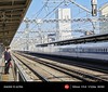


The above images may not be of the site on this page, but were taken nearby. They are loaded from Flickr so please click on them for image credits.
Click here to see more info for this site
Nearby sites
Click here to view sites on an interactive map of the areaKey: Red: member's photo, Blue: 3rd party photo, Yellow: other image, Green: no photo - please go there and take one, Grey: site destroyed
Download sites to:
KML (Google Earth)
GPX (GPS waypoints)
CSV (Garmin/Navman)
CSV (Excel)
To unlock full downloads you need to sign up as a Contributory Member. Otherwise downloads are limited to 50 sites.
Turn off the page maps and other distractions
Nearby sites listing. In the following links * = Image available
5.1km NW 324° Rinsai-ji temple* Modern Stone Circle etc
6.9km W 270° Saioku-ji temple* Modern Stone Circle etc
14.0km NE 43° Seiken-ji temple* Modern Stone Circle etc
34.1km SW 223° Koumare-ishi* Natural Stone / Erratic / Other Natural Feature
36.9km ENE 57° Kōshinzuka Kofun* Passage Grave
40.0km NNE 21° Sengo* Stone Circle
44.3km ENE 71° JA Nansun* Modern Stone Circle etc
44.8km ENE 69° Tama-Toishi* Polissoir
46.3km SE 131° Iwakura Kofungun* Chambered Cairn
46.7km ENE 62° Shimizu Yanagikita Kofun* Passage Grave
52.2km ENE 74° Kashiya-no Hyakketsu* Rock Cut Tomb
52.5km E 89° KamiShiroiwa* Stone Circle
52.8km ENE 73° Yōtoku-ji temple* Standing Stones
54.3km W 263° Terayama Kofungun* Chambered Cairn
54.8km WSW 241° Iō-ji temple* Modern Stone Circle etc
57.7km WSW 258° Nekata cave* Cave or Rock Shelter
59.4km WSW 241° Hōshu-ji temple* Modern Stone Circle etc
62.5km WSW 253° Nihongaya Kofungun* Chambered Cairn
68.2km WSW 258° Jissō-ji temple* Modern Stone Circle etc
69.0km WSW 258° Ryōtan-ji temple (in Hamamatsu)* Modern Stone Circle etc
70.2km ENE 64° Sōun-ji temple* Modern Stone Circle etc
70.6km N 11° Ōzuka Kofun (in Yamanashi)* Long Barrow
72.6km W 266° Mankō-ji temple* Modern Stone Circle etc
75.2km W 261° Shinradō* Hillfort
79.2km W 259° Makaya-ji temple* Modern Stone Circle etc
View more nearby sites and additional images


 We would like to know more about this location. Please feel free to add a brief description and any relevant information in your own language.
 Wir möchten mehr über diese Stätte erfahren. Bitte zögern Sie nicht, eine kurze Beschreibung und relevante Informationen in Deutsch hinzuzufügen.
 Nous aimerions en savoir encore un peu sur les lieux. S'il vous plaît n'hesitez pas à ajouter une courte description et tous les renseignements pertinents dans votre propre langue.
 Quisieramos informarnos un poco más de las lugares. No dude en añadir una breve descripción y otros datos relevantes en su propio idioma.