


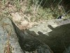
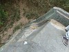
<< Our Photo Pages >> Amatsu-Iwatowake Jinja shrine - Stone Circle in Japan in Honshū
Submitted by Aska on Saturday, 06 February 2021 Page Views: 441
Site Name: Amatsu-Iwatowake Jinja shrine Alternative Name: 天津石門別神社Country: Japan
NOTE: This site is 3.737 km away from the location you searched for.
Region: Honshū Type: Stone Circle
Nearest Town: Takatori-chō (Nara prefecture) Nearest Village: Ochi 越智
Latitude: 34.464560N Longitude: 135.767150E
Condition:
| 5 | Perfect |
| 4 | Almost Perfect |
| 3 | Reasonable but with some damage |
| 2 | Ruined but still recognisable as an ancient site |
| 1 | Pretty much destroyed, possibly visible as crop marks |
| 0 | No data. |
| -1 | Completely destroyed |
| 5 | Superb |
| 4 | Good |
| 3 | Ordinary |
| 2 | Not Good |
| 1 | Awful |
| 0 | No data. |
| 5 | Can be driven to, probably with disabled access |
| 4 | Short walk on a footpath |
| 3 | Requiring a bit more of a walk |
| 2 | A long walk |
| 1 | In the middle of nowhere, a nightmare to find |
| 0 | No data. |
| 5 | co-ordinates taken by GPS or official recorded co-ordinates |
| 4 | co-ordinates scaled from a detailed map |
| 3 | co-ordinates scaled from a bad map |
| 2 | co-ordinates of the nearest village |
| 1 | co-ordinates of the nearest town |
| 0 | no data |
Internal Links:
External Links:
")
You may be viewing yesterday's version of this page. To see the most up to date information please register for a free account.
Do not use the above information on other web sites or publications without permission of the contributor.
Nearby Images from Flickr
The above images may not be of the site on this page, but were taken nearby. They are loaded from Flickr so please click on them for image credits.
Click here to see more info for this site
Nearby sites
Click here to view sites on an interactive map of the areaKey: Red: member's photo, Blue: 3rd party photo, Yellow: other image, Green: no photo - please go there and take one, Grey: site destroyed
Download sites to:
KML (Google Earth)
GPX (GPS waypoints)
CSV (Garmin/Navman)
CSV (Excel)
To unlock full downloads you need to sign up as a Contributory Member. Otherwise downloads are limited to 50 sites.
Turn off the page maps and other distractions
Nearby sites listing. In the following links * = Image available
2.0km ESE 118° Tsukamyōjin kofun* Passage Grave
2.1km ENE 71° Masuda-no-Iwafune* Not Known (by us)
2.1km E 87° Mayumi Kansuzuka Kofun* Passage Grave
2.2km E 100° Marukoyama Kofun* Passage Grave
2.3km E 85° KengoshiZuka Kofun* Passage Grave
2.8km E 87° Iwayayama Kofun* Passage Grave
3.0km E 83° Saruishi (in Asuka)* Sculptured Stone
3.0km ENE 65° Maruyama Kofun (in Kashihara city)* Long Barrow
3.0km ESE 118° Jintōseki* Sculptured Stone
3.4km ESE 105° Omiashi Jinja shrine* Ancient Temple
3.5km E 83° Oni-no Manaita* Passage Grave
3.6km E 91° Nakaoyama Kofun* Passage Grave
3.6km E 94° Takamatsuzuka Kofun* Passage Grave
3.6km ENE 69° Ueyama Kofun* Long Barrow
3.8km E 84° Noguchi Ō-no-haka Kofun* Passage Grave
3.8km ESE 113° Kitora Kofun* Passage Grave
3.9km SW 232° Muro Miyayama Kofun* Long Barrow
4.1km E 86° Ubaishi* Standing Stone (Menhir)
4.1km E 80° Kameishi* Sculptured Stone
4.6km ENE 65° Amakashi-no-Tateishi* Standing Stone (Menhir)
4.6km ENE 65° Mon-yō-ishi* Sculptured Stone
4.7km E 83° Nimenseki* Sculptured Stone
4.8km ENE 78° Asuka Palace pond garden ruin* Sculptured Stone
4.8km ENE 73° Mirokuishi* Standing Stone (Menhir)
5.1km ESE 101° Iwabashi* Ancient Trackway
View more nearby sites and additional images


 We would like to know more about this location. Please feel free to add a brief description and any relevant information in your own language.
 Wir möchten mehr über diese Stätte erfahren. Bitte zögern Sie nicht, eine kurze Beschreibung und relevante Informationen in Deutsch hinzuzufügen.
 Nous aimerions en savoir encore un peu sur les lieux. S'il vous plaît n'hesitez pas à ajouter une courte description et tous les renseignements pertinents dans votre propre langue.
 Quisieramos informarnos un poco más de las lugares. No dude en añadir una breve descripción y otros datos relevantes en su propio idioma.