


<< Our Photo Pages >> Tōkai-an temple - Modern Stone Circle etc in Japan in Honshū
Submitted by Aska on Monday, 13 May 2013 Page Views: 3155
Modern SitesSite Name: Tōkai-an temple Alternative Name: 東海庵 Tokai-anCountry: Japan Region: Honshū Type: Modern Stone Circle etc
Nearest Town: Kyōto (Kyōto pref.) Nearest Village: Kamigyō-ku 上京区
Latitude: 35.022840N Longitude: 135.720580E
Condition:
| 5 | Perfect |
| 4 | Almost Perfect |
| 3 | Reasonable but with some damage |
| 2 | Ruined but still recognisable as an ancient site |
| 1 | Pretty much destroyed, possibly visible as crop marks |
| 0 | No data. |
| -1 | Completely destroyed |
| 5 | Superb |
| 4 | Good |
| 3 | Ordinary |
| 2 | Not Good |
| 1 | Awful |
| 0 | No data. |
| 5 | Can be driven to, probably with disabled access |
| 4 | Short walk on a footpath |
| 3 | Requiring a bit more of a walk |
| 2 | A long walk |
| 1 | In the middle of nowhere, a nightmare to find |
| 0 | No data. |
| 5 | co-ordinates taken by GPS or official recorded co-ordinates |
| 4 | co-ordinates scaled from a detailed map |
| 3 | co-ordinates scaled from a bad map |
| 2 | co-ordinates of the nearest village |
| 1 | co-ordinates of the nearest town |
| 0 | no data |
Internal Links:
External Links:
")
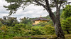
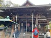
A sub-temple in Myōshin-ji zen temples complex. Though usually closed to public, only open once in a few years, worth to visit to appreciate its 3 philosophical gardens : the southern gardens features only white gravel, the western dry landscape garden features rocks and small trees and the courtyard garden features 7 stones in ripples of white gravel. Fortunately, photographing is welcomed in this temple.
You may be viewing yesterday's version of this page. To see the most up to date information please register for a free account.
")
Do not use the above information on other web sites or publications without permission of the contributor.
Nearby Images from Flickr


The above images may not be of the site on this page, but were taken nearby. They are loaded from Flickr so please click on them for image credits.
Click here to see more info for this site
Nearby sites
Click here to view sites on an interactive map of the areaKey: Red: member's photo, Blue: 3rd party photo, Yellow: other image, Green: no photo - please go there and take one, Grey: site destroyed
Download sites to:
KML (Google Earth)
GPX (GPS waypoints)
CSV (Garmin/Navman)
CSV (Excel)
To unlock full downloads you need to sign up as a Contributory Member. Otherwise downloads are limited to 50 sites.
Turn off the page maps and other distractions
Nearby sites listing. In the following links * = Image available
85m E 92° Daishin-in temple* Modern Stone Circle etc
86m ESE 104° Gyokuhō-in temple* Modern Stone Circle etc
125m WSW 258° Shōtaku-in temple* Modern Stone Circle etc
136m W 278° Reiun-in temple (in Myōshin-ji zen temples complex)* Modern Stone Circle etc
142m NNE 25° Kaifuku-in temple* Modern Stone Circle etc
145m N 357° Rinshō-in temple* Modern Stone Circle etc
182m SW 220° Taizō-in temple* Modern Stone Circle etc
192m NNE 32° Yōtoku-in temple* Modern Stone Circle etc
198m S 178° Ryōsen-an temple* Modern Stone Circle etc
268m NE 36° Keishun-in temple* Modern Stone Circle etc
289m NNW 338° Tenkyū-in temple* Modern Stone Circle etc
1.2km ESE 105° Hōrin-ji temple* Modern Stone Circle etc
1.3km N 351° Ryōan-ji temple* Modern Stone Circle etc
1.6km E 81° Ryūhon-ji temple* Modern Stone Circle etc
2.2km WSW 237° Hebizuka Kofun* Long Barrow
3.0km ENE 63° Myōren-ji temple* Modern Stone Circle etc
3.1km NE 46° Zuihō-in temple* Modern Stone Circle etc
3.1km SE 139° Mibu-dera temple* Modern Stone Circle etc
3.1km NE 46° Kōrin-in temple* Modern Stone Circle etc
3.1km NE 47° Ōbai-in temple* Modern Stone Circle etc
3.2km NE 47° Ryōgen-in temple* Modern Stone Circle etc
3.2km ENE 64° Hompō-ji temple* Modern Stone Circle etc
3.2km NE 44° Jukō-in temple* Modern Stone Circle etc
3.3km NE 45° Daitoku-ji Hombō temple* Modern Stone Circle etc
3.3km NE 42° Hōshun-in temple* Modern Stone Circle etc
View more nearby sites and additional images


 We would like to know more about this location. Please feel free to add a brief description and any relevant information in your own language.
 Wir möchten mehr über diese Stätte erfahren. Bitte zögern Sie nicht, eine kurze Beschreibung und relevante Informationen in Deutsch hinzuzufügen.
 Nous aimerions en savoir encore un peu sur les lieux. S'il vous plaît n'hesitez pas à ajouter une courte description et tous les renseignements pertinents dans votre propre langue.
 Quisieramos informarnos un poco más de las lugares. No dude en añadir una breve descripción y otros datos relevantes en su propio idioma.