


<< Our Photo Pages >> Matsuokayama Kofun - Holed Stone in Japan in Honshū
Submitted by Aska on Monday, 20 June 2011 Page Views: 4133
Early Medieval (Dark Age)Site Name: Matsuokayama Kofun Alternative Name: 松岳山古墳Country: Japan
NOTE: This site is 1.176 km away from the location you searched for.
Region: Honshū Type: Holed Stone
Nearest Town: Kashiwara (Ōsaka pref.) Nearest Village: KokubuIchiba 国分市
Latitude: 34.569820N Longitude: 135.645650E
Condition:
| 5 | Perfect |
| 4 | Almost Perfect |
| 3 | Reasonable but with some damage |
| 2 | Ruined but still recognisable as an ancient site |
| 1 | Pretty much destroyed, possibly visible as crop marks |
| 0 | No data. |
| -1 | Completely destroyed |
| 5 | Superb |
| 4 | Good |
| 3 | Ordinary |
| 2 | Not Good |
| 1 | Awful |
| 0 | No data. |
| 5 | Can be driven to, probably with disabled access |
| 4 | Short walk on a footpath |
| 3 | Requiring a bit more of a walk |
| 2 | A long walk |
| 1 | In the middle of nowhere, a nightmare to find |
| 0 | No data. |
| 5 | co-ordinates taken by GPS or official recorded co-ordinates |
| 4 | co-ordinates scaled from a detailed map |
| 3 | co-ordinates scaled from a bad map |
| 2 | co-ordinates of the nearest village |
| 1 | co-ordinates of the nearest town |
| 0 | no data |
Internal Links:
External Links:
")
This is a keyhole-shaped tumulus 130m long behind Kokubu Jinja (国分神社) shrine. On the top of the round part, flat stones are piled like a cairn and a stone coffin is placed between a pair of inclined flat rocks with holes. A hypothesis considers they are a symbol of a funeral ship of the buried person.
To climb the tumulus, registration at the shrine office required.
You may be viewing yesterday's version of this page. To see the most up to date information please register for a free account.
Do not use the above information on other web sites or publications without permission of the contributor.
Nearby Images from Flickr


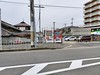
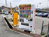
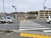

The above images may not be of the site on this page, but were taken nearby. They are loaded from Flickr so please click on them for image credits.
Click here to see more info for this site
Nearby sites
Click here to view sites on an interactive map of the areaKey: Red: member's photo, Blue: 3rd party photo, Yellow: other image, Green: no photo - please go there and take one, Grey: site destroyed
Download sites to:
KML (Google Earth)
GPX (GPS waypoints)
CSV (Garmin/Navman)
CSV (Excel)
To unlock full downloads you need to sign up as a Contributory Member. Otherwise downloads are limited to 50 sites.
Turn off the page maps and other distractions
Nearby sites listing. In the following links * = Image available
107m WSW 245° ChausuZuka Kofun* Chambered Cairn
703m WNW 298° Takaida Yokoana* Rock Cut Tomb
1.7km WSW 246° Anpuku-ji Yokoana* Rock Cut Tomb
1.7km WSW 243° Anpuku-ji Sekkan* Cist
3.3km SW 214° Hayato-ishi (in Ōsaka)* Carving
5.1km WSW 256° Yachū-ji temple* Sculptured Stone
5.8km N 8° Takayasu-no-Ki* Hillfort
6.0km SSE 157° Rokutan-ji temple* Ancient Temple
6.2km SSE 153° Iwaya temple* Ancient Temple
6.5km S 177° Yamada Takatsuka Kofun* Passage Grave
6.5km S 182° Koshimaezuka Kofun* Passage Grave
6.6km S 175° Futagozuka Kofun (in Ōsaka)* Passage Grave
7.7km N 356° Shionjiyama Kofun* Long Barrow
8.4km E 97° Nagareyama Kofun* Long Barrow
8.5km ESE 105° Mitsuyoshi-Ishizuka Kofun* Long Barrow
11.0km N 351° Hanazono Rugby Stadium* Modern Stone Circle etc
11.3km S 187° Kanayama Kofun* Passage Grave
12.2km NE 44° Yata-dera temple* Modern Stone Circle etc
13.2km WSW 251° Dotō* Pyramid / Mastaba
14.1km E 90° Karako Kagi* Ancient Village or Settlement
14.5km W 267° Daisen Kofun* Long Barrow
14.9km NNW 344° Kōnoike Shinden hall* Modern Stone Circle etc
15.1km NW 309° Shitennō-ji temple* Ancient Temple
15.1km ESE 112° Koguriishi* Not Known (by us)
16.2km SE 136° Amatsu-Iwatowake Jinja shrine* Stone Circle
View more nearby sites and additional images


 We would like to know more about this location. Please feel free to add a brief description and any relevant information in your own language.
 Wir möchten mehr über diese Stätte erfahren. Bitte zögern Sie nicht, eine kurze Beschreibung und relevante Informationen in Deutsch hinzuzufügen.
 Nous aimerions en savoir encore un peu sur les lieux. S'il vous plaît n'hesitez pas à ajouter une courte description et tous les renseignements pertinents dans votre propre langue.
 Quisieramos informarnos un poco más de las lugares. No dude en añadir una breve descripción y otros datos relevantes en su propio idioma.