


<< Our Photo Pages >> Suriusuyama Kofun - Passage Grave in Japan in Shikoku
Submitted by Aska on Friday, 23 March 2012 Page Views: 2549
Rock ArtSite Name: Suriusuyama Kofun Alternative Name: 磨臼山古墳Country: Japan
NOTE: This site is 0.312 km away from the location you searched for.
Region: Shikoku Type: Passage Grave
Nearest Town: Zentsūji (Kagawa pref.) Nearest Village: Bunkyō-chō 文京
Latitude: 34.227920N Longitude: 133.783860E
Condition:
| 5 | Perfect |
| 4 | Almost Perfect |
| 3 | Reasonable but with some damage |
| 2 | Ruined but still recognisable as an ancient site |
| 1 | Pretty much destroyed, possibly visible as crop marks |
| 0 | No data. |
| -1 | Completely destroyed |
| 5 | Superb |
| 4 | Good |
| 3 | Ordinary |
| 2 | Not Good |
| 1 | Awful |
| 0 | No data. |
| 5 | Can be driven to, probably with disabled access |
| 4 | Short walk on a footpath |
| 3 | Requiring a bit more of a walk |
| 2 | A long walk |
| 1 | In the middle of nowhere, a nightmare to find |
| 0 | No data. |
| 5 | co-ordinates taken by GPS or official recorded co-ordinates |
| 4 | co-ordinates scaled from a detailed map |
| 3 | co-ordinates scaled from a bad map |
| 2 | co-ordinates of the nearest village |
| 1 | co-ordinates of the nearest town |
| 0 | no data |
Internal Links:
External Links:
")
The stone coffin, dug from the keyhole shaped tumulus on a top of a hill called Suriusu-yama (34.21821N,133.79311E), which has luxurious swirl ornament of pillow is now placed in Zentsūji Shimin Kaikan (善通寺市民会館 = Zentsuji-city Municipal Hall). Coordinate data is for the hall.
Please compare with the pillow ornament of the stone coffin of Ishifune-zuka Kofun of Iwaseo-yama Kofun chambered cairn group.
You may be viewing yesterday's version of this page. To see the most up to date information please register for a free account.
Do not use the above information on other web sites or publications without permission of the contributor.
Nearby Images from Flickr
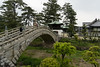
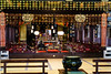
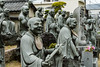
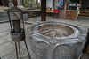

The above images may not be of the site on this page, but were taken nearby. They are loaded from Flickr so please click on them for image credits.
Click here to see more info for this site
Nearby sites
Click here to view sites on an interactive map of the areaKey: Red: member's photo, Blue: 3rd party photo, Yellow: other image, Green: no photo - please go there and take one, Grey: site destroyed
Download sites to:
KML (Google Earth)
GPX (GPS waypoints)
CSV (Garmin/Navman)
CSV (Excel)
To unlock full downloads you need to sign up as a Contributory Member. Otherwise downloads are limited to 50 sites.
Turn off the page maps and other distractions
Nearby sites listing. In the following links * = Image available
2.2km SSE 162° Oka Kofungun* Passage Grave
2.3km SSW 204° Kawaratani Kofungun* Passage Grave
2.8km SSW 210° Miyagao Kofun* Passage Grave
3.0km SSE 160° Ōsayama Kyōzuka Kofun* Chambered Cairn
3.1km SSE 161° Ōsayama Wankashizuka Kofun* Chambered Cairn
3.4km S 185° Notanoin Kofun* Chambered Cairn
4.0km WSW 252° Ōkubo Kyōzuka Kofun* Chambered Cairn
8.6km SW 226° Yaobikuni-tō* Ancient Temple
10.7km ENE 72° Jinnomaru Kofungun* Long Barrow
11.1km NNE 23° Shōtsūjiyama Kofun* Chambered Cairn
11.5km ENE 71° Yokoyama Kofungun* Chambered Cairn
12.1km NE 46° Hakarigōro Kofun* Chambered Cairn
12.2km NE 46° Jiigamatsu Kofun* Chambered Cairn
12.4km NE 52° Kiyama* Hillfort
13.5km NE 50° Daigo Kofungun* Passage Grave
15.2km NE 56° Yama-no-kami Kofungun* Passage Grave
15.4km ENE 56° Sagi-no-kuchi Kofun* Passage Grave
15.5km NE 55° Ayaorizuka Kofun* Passage Grave
15.9km SW 231° Kōshōjiyama Kofungun* Passage Grave
16.1km NE 39° Men-yama Kofungun* Chambered Cairn
18.0km NE 41° Suberiyama Kofungun* Chambered Cairn
21.5km NE 49° Yokotateyama Kyōzuka Kofun* Chambered Cairn
21.8km NE 50° Yokotateyama Tōroku Kofungun* Chambered Cairn
23.5km SSE 151° Ashiro Higashihara Iseki* Chambered Cairn
25.4km ENE 63° Iwaseoyama Kofungun* Chambered Cairn
View more nearby sites and additional images


 We would like to know more about this location. Please feel free to add a brief description and any relevant information in your own language.
 Wir möchten mehr über diese Stätte erfahren. Bitte zögern Sie nicht, eine kurze Beschreibung und relevante Informationen in Deutsch hinzuzufügen.
 Nous aimerions en savoir encore un peu sur les lieux. S'il vous plaît n'hesitez pas à ajouter une courte description et tous les renseignements pertinents dans votre propre langue.
 Quisieramos informarnos un poco más de las lugares. No dude en añadir una breve descripción y otros datos relevantes en su propio idioma.