


<< Our Photo Pages >> Kōrasan - Hillfort in Japan in Kyūshū
Submitted by Aska on Monday, 28 January 2008 Page Views: 3456
Early Medieval (Dark Age)Site Name: Kōrasan Alternative Name: 高良山 KorasanCountry: Japan
NOTE: This site is 1.88 km away from the location you searched for.
Region: Kyūshū Type: Hillfort
Nearest Town: Kurume (Fukuoka pref.) Nearest Village: Mii-machi 御井町
Latitude: 33.300690N Longitude: 130.559080E
Condition:
| 5 | Perfect |
| 4 | Almost Perfect |
| 3 | Reasonable but with some damage |
| 2 | Ruined but still recognisable as an ancient site |
| 1 | Pretty much destroyed, possibly visible as crop marks |
| 0 | No data. |
| -1 | Completely destroyed |
| 5 | Superb |
| 4 | Good |
| 3 | Ordinary |
| 2 | Not Good |
| 1 | Awful |
| 0 | No data. |
| 5 | Can be driven to, probably with disabled access |
| 4 | Short walk on a footpath |
| 3 | Requiring a bit more of a walk |
| 2 | A long walk |
| 1 | In the middle of nowhere, a nightmare to find |
| 0 | No data. |
| 5 | co-ordinates taken by GPS or official recorded co-ordinates |
| 4 | co-ordinates scaled from a detailed map |
| 3 | co-ordinates scaled from a bad map |
| 2 | co-ordinates of the nearest village |
| 1 | co-ordinates of the nearest town |
| 0 | no data |
Internal Links:
External Links:
")
One of "Kōgoishi" hillfort known from old days. Kōrasan-taisha (高良山大社) shinto shrine stands inside of this ruin, so Kōgoishi was believed as a boundary of a sacred area. The length 2.7, dimention 36.1 ha, 2 or 3 drain gates and stone walls. The fine stone wall can be observable from the roadway in front of Daigaku-inari Jinja (大学稲荷神社) shrine on the way to Kōrasan-taisha shinto.
You may be viewing yesterday's version of this page. To see the most up to date information please register for a free account.
")
Do not use the above information on other web sites or publications without permission of the contributor.
Nearby Images from Flickr
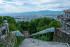
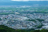
The above images may not be of the site on this page, but were taken nearby. They are loaded from Flickr so please click on them for image credits.
Click here to see more info for this site
Nearby sites
Click here to view sites on an interactive map of the areaKey: Red: member's photo, Blue: 3rd party photo, Yellow: other image, Green: no photo - please go there and take one, Grey: site destroyed
Download sites to:
KML (Google Earth)
GPX (GPS waypoints)
CSV (Garmin/Navman)
CSV (Excel)
To unlock full downloads you need to sign up as a Contributory Member. Otherwise downloads are limited to 50 sites.
Turn off the page maps and other distractions
Nearby sites listing. In the following links * = Image available
3.4km W 281° Nankun* Burial Chamber or Dolmen
4.2km NW 305° Ishimaru* Burial Chamber or Dolmen
6.5km NE 41° Tsukajima* Burial Chamber or Dolmen
7.8km S 184° Iwatoyama Kofun* Sculptured Stone
7.9km S 169° Toyofuku* Sculptured Stone
8.0km S 184° Tsurumiyama Kofun* Sculptured Stone
8.0km SSW 207° Kōkadani Kofun* Passage Grave
8.1km SSW 209° Sekijin-san Kofun* Sculptured Stone
9.6km WNW 291° Shirakabe Tenmangū shrine* Burial Chamber or Dolmen
10.9km N 2° Ōitai* Burial Chamber or Dolmen
12.0km WNW 299° Himekata* Ring Cairn
13.2km WNW 291° Funaishi* Burial Chamber or Dolmen
13.6km N 359° Mitsusawa* Burial Chamber or Dolmen
13.8km SSW 209° Mizuta* Burial Chamber or Dolmen
15.5km WNW 284° Se-no-o* Burial Chamber or Dolmen
15.6km SSW 196° Zoyama* Hillfort
15.7km NE 36° Hatada* Burial Chamber or Dolmen
16.2km NNW 346° Kiinoki* Hillfort
16.4km W 280° Yoshinogari* Ancient Village or Settlement
16.5km W 281° Hiyoshi Jinja shrine* Burial Chamber or Dolmen
16.6km WSW 242° Nobori* Burial Chamber or Dolmen
16.8km N 356° Gorōyama Kofun* Passage Grave
16.9km W 280° Magui* Burial Chamber or Dolmen
17.7km ENE 72° Kiyomune Jinja shrine* Burial Chamber or Dolmen
18.9km WSW 239° Isoraishi* Burial Chamber or Dolmen
View more nearby sites and additional images


 We would like to know more about this location. Please feel free to add a brief description and any relevant information in your own language.
 Wir möchten mehr über diese Stätte erfahren. Bitte zögern Sie nicht, eine kurze Beschreibung und relevante Informationen in Deutsch hinzuzufügen.
 Nous aimerions en savoir encore un peu sur les lieux. S'il vous plaît n'hesitez pas à ajouter une courte description et tous les renseignements pertinents dans votre propre langue.
 Quisieramos informarnos un poco más de las lugares. No dude en añadir una breve descripción y otros datos relevantes en su propio idioma.