

<< Our Photo Pages >> Yoshinogari - Ancient Village or Settlement in Japan in Honshū
Submitted by DrewParsons on Tuesday, 22 June 2010 Page Views: 4545
Iron Age and Later PrehistorySite Name: Yoshinogari Alternative Name: 吉野ヶ里 遺跡 Yoshinogari isekiCountry: Japan
NOTE: This site is 0.258 km away from the location you searched for.
Region: Honshū Type: Ancient Village or Settlement
Nearest Town: Yoshinogari-chō (Saga pref.) Nearest Village: Tade 田手
Latitude: 33.325060N Longitude: 130.384740E
Condition:
| 5 | Perfect |
| 4 | Almost Perfect |
| 3 | Reasonable but with some damage |
| 2 | Ruined but still recognisable as an ancient site |
| 1 | Pretty much destroyed, possibly visible as crop marks |
| 0 | No data. |
| -1 | Completely destroyed |
| 5 | Superb |
| 4 | Good |
| 3 | Ordinary |
| 2 | Not Good |
| 1 | Awful |
| 0 | No data. |
| 5 | Can be driven to, probably with disabled access |
| 4 | Short walk on a footpath |
| 3 | Requiring a bit more of a walk |
| 2 | A long walk |
| 1 | In the middle of nowhere, a nightmare to find |
| 0 | No data. |
| 5 | co-ordinates taken by GPS or official recorded co-ordinates |
| 4 | co-ordinates scaled from a detailed map |
| 3 | co-ordinates scaled from a bad map |
| 2 | co-ordinates of the nearest village |
| 1 | co-ordinates of the nearest town |
| 0 | no data |
Internal Links:
External Links:
I have visited· I would like to visit
DrewParsons has visited here
")
Yoshinogari is a Yayoi era ancient settlement occupied from at least the 3rd century BC to the 3rd century AD (although there is some recent AMS radio carbon dating evidence that it may even date to before 400 BC). Located near Saga City this 40 hectares Special National Historic Site was created a National Park in 1992 and has undergone extensive excavations and a replica village has been constructed to illustrate how the villlage would once have appeared.
The earliest settlement was in the Early Yayoi era between the 3rd and 2nd centuries BC when a moated village was established. In the Middle Yayoi era a large circular moat was dug. Burial mounds and cemeteries with more than 1200 burial jars have been excavated from this period. Pottery related to Korean styles and bronze castings are typical of the Middle Yayoi era excavations whilst the village's defences were strengthened indicative that fighting had escalated. The Late Yayoi period from the 1st to 3rd centuries AD saw Yoshinogari emerge as the largest moated settlement in the country with distinct northern and southern enclosures within its perimeter. Large buildings were constructed particularly in the northern sector at this time.
As well as the burial mounds and burial jars other finds have included copper/bronze knives, glass beads, pottery, bronze mirrors from China, coins, halberds, iron and wooden tools and prehistoric human hair.
The site is of national importance as it is considered to be from here that the Nation State emerged. Indeed the ancient Chinese chronicles "Gishi Wajinden" mention a site which corresponds both in location and era with Yoshinogari.
References:
Yoshinogari National Archaeological Park Booklet 1993
Wikipedia: http://en.wikipedia.org/wiki/Yoshinogari_site
Yoshinogari National Archaeological Park Site: http://www.yoshinogari.jp/en/
You may be viewing yesterday's version of this page. To see the most up to date information please register for a free account.
")
")
")
Do not use the above information on other web sites or publications without permission of the contributor.
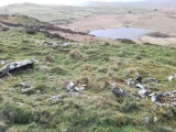
Nearby Images from Flickr


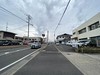
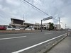


The above images may not be of the site on this page, but were taken nearby. They are loaded from Flickr so please click on them for image credits.
Click here to see more info for this site
Nearby sites
Click here to view sites on an interactive map of the areaKey: Red: member's photo, Blue: 3rd party photo, Yellow: other image, Green: no photo - please go there and take one, Grey: site destroyed
Download sites to:
KML (Google Earth)
GPX (GPS waypoints)
CSV (Garmin/Navman)
CSV (Excel)
To unlock full downloads you need to sign up as a Contributory Member. Otherwise downloads are limited to 50 sites.
Turn off the page maps and other distractions
Nearby sites listing. In the following links * = Image available
461m N 6° Hiyoshi Jinja shrine* Burial Chamber or Dolmen
527m WNW 290° Magui* Burial Chamber or Dolmen
1.6km NE 47° Se-no-o* Burial Chamber or Dolmen
3.1km WSW 242° Fusube Ōishi* Burial Chamber or Dolmen
4.3km ENE 63° Funaishi* Burial Chamber or Dolmen
4.7km W 278° Obukumayama* Hillfort
5.6km W 264° Muratokunaga* Burial Chamber or Dolmen
6.4km ENE 62° Himekata* Ring Cairn
6.9km W 276° Kuboizumi-Maruyama* Burial Chamber or Dolmen
7.2km E 85° Shirakabe Tenmangū shrine* Burial Chamber or Dolmen
7.8km SSW 209° Kibettō Jinja shrine* Burial Chamber or Dolmen
8.1km WSW 252° Tofusa* Burial Chamber or Dolmen
8.5km W 272° Nishikuma Kofun* Passage Grave
10.7km S 171° Nobori* Burial Chamber or Dolmen
12.6km S 180° Isoraishi* Burial Chamber or Dolmen
12.8km E 91° Ishimaru* Burial Chamber or Dolmen
13.0km E 99° Nankun* Burial Chamber or Dolmen
13.4km S 185° Kobo Hachiman Jinja shrine* Burial Chamber or Dolmen
15.6km S 174° Mishima Jinja shrine (in Fukuoka)* Burial Chamber or Dolmen
15.7km SE 128° Sekijin-san Kofun* Sculptured Stone
15.9km WSW 252° Saori* Burial Chamber or Dolmen
16.0km SE 128° Kōkadani Kofun* Passage Grave
16.2km S 175° Ōgi-no-uchi* Burial Chamber or Dolmen
16.4km E 99° Kōrasan* Hillfort
17.7km SSE 147° Mizuta* Burial Chamber or Dolmen
View more nearby sites and additional images


 We would like to know more about this location. Please feel free to add a brief description and any relevant information in your own language.
 Wir möchten mehr über diese Stätte erfahren. Bitte zögern Sie nicht, eine kurze Beschreibung und relevante Informationen in Deutsch hinzuzufügen.
 Nous aimerions en savoir encore un peu sur les lieux. S'il vous plaît n'hesitez pas à ajouter une courte description et tous les renseignements pertinents dans votre propre langue.
 Quisieramos informarnos un poco más de las lugares. No dude en añadir una breve descripción y otros datos relevantes en su propio idioma.