 with our Megalithic Portal iPhone app")


<< Our Photo Pages >> Kureishibaru - Stone Circle in Japan in Kyūshū
Submitted by Aska on Thursday, 08 January 2009 Page Views: 3604
Neolithic and Bronze AgeSite Name: Kureishibaru Alternative Name: 礫石原Country: Japan
NOTE: This site is 4.771 km away from the location you searched for.
Region: Kyūshū Type: Stone Circle
Nearest Town: Shimabara (Nagasaki pref.) Nearest Village: Kureishibaru-machi 礫石
Latitude: 32.803530N Longitude: 130.308500E
Condition:
| 5 | Perfect |
| 4 | Almost Perfect |
| 3 | Reasonable but with some damage |
| 2 | Ruined but still recognisable as an ancient site |
| 1 | Pretty much destroyed, possibly visible as crop marks |
| 0 | No data. |
| -1 | Completely destroyed |
| 5 | Superb |
| 4 | Good |
| 3 | Ordinary |
| 2 | Not Good |
| 1 | Awful |
| 0 | No data. |
| 5 | Can be driven to, probably with disabled access |
| 4 | Short walk on a footpath |
| 3 | Requiring a bit more of a walk |
| 2 | A long walk |
| 1 | In the middle of nowhere, a nightmare to find |
| 0 | No data. |
| 5 | co-ordinates taken by GPS or official recorded co-ordinates |
| 4 | co-ordinates scaled from a detailed map |
| 3 | co-ordinates scaled from a bad map |
| 2 | co-ordinates of the nearest village |
| 1 | co-ordinates of the nearest town |
| 0 | no data |
Internal Links:
External Links:
")
Maybe the southernmost stone circle in Japan, lie on a slope of the Unzen volcano. A signpost and a fence indicate the site but overgrown ferns spread over and conceal it.
You may be viewing yesterday's version of this page. To see the most up to date information please register for a free account.
")
Do not use the above information on other web sites or publications without permission of the contributor.
Nearby Images from Flickr
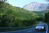
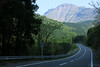
The above images may not be of the site on this page, but were taken nearby. They are loaded from Flickr so please click on them for image credits.
Click here to see more info for this site
Nearby sites
Click here to view sites on an interactive map of the areaKey: Red: member's photo, Blue: 3rd party photo, Yellow: other image, Green: no photo - please go there and take one, Grey: site destroyed
Download sites to:
KML (Google Earth)
GPX (GPS waypoints)
CSV (Garmin/Navman)
CSV (Excel)
To unlock full downloads you need to sign up as a Contributory Member. Otherwise downloads are limited to 50 sites.
Turn off the page maps and other distractions
Nearby sites listing. In the following links * = Image available
4.7km ENE 58° Keikaen* Burial Chamber or Dolmen
10.7km S 187° Saruishi (in ex-Arie town)* Sculptured Stone
12.4km WNW 283° Saruishi (in ex-Azuma town)* Sculptured Stone
12.4km S 184° Miminashi Jizō* Sculptured Stone
13.0km S 172° Kiba Resseki-Suimon* Hillfort
13.9km S 183° Kirishitan Shiseki Kōen* Sculptured Stone
13.9km S 183° Myōkō Kofun Sekijin* Sculptured Stone
14.6km S 181° Nagata Sekijin* Sculptured Stone
14.7km S 181° Yadonashi Jizō* Sculptured Stone
15.8km S 180° Kumano Sekijin* Sculptured Stone
16.1km S 177° Nishi-Onzuka* Burial Chamber or Dolmen
16.2km S 181° Enokida Sekijin* Sculptured Stone
16.7km SW 215° Harayama* Burial Chamber or Dolmen
17.8km NW 323° Izaki Burial Chamber or Dolmen
22.9km ENE 59° Benzaiten Kofun* Passage Grave
23.9km ENE 57° Toshi-no-Kami* Burial Chamber or Dolmen
24.6km NNE 30° Manda Itsukushima Jinja shrine* Burial Chamber or Dolmen
26.6km NNE 34° San-no-miya* Sculptured Stone
26.8km ENE 63° Jōgasaki* Burial Chamber or Dolmen
26.9km NE 34° Hagi-no-O Kofun* Passage Grave
27.4km ENE 58° Sugawara Jinja shrine (in Tamana)* Burial Chamber or Dolmen
27.7km ENE 65° Ikura-kita Hachiman shrine* Burial Chamber or Dolmen
28.8km WNW 286° Fūkandake* Burial Chamber or Dolmen
30.1km NE 52° Ishinuki-Anakannon* Rock Cut Tomb
30.1km NE 52° Ishinuki-Nagino* Rock Cut Tomb
View more nearby sites and additional images


 We would like to know more about this location. Please feel free to add a brief description and any relevant information in your own language.
 Wir möchten mehr über diese Stätte erfahren. Bitte zögern Sie nicht, eine kurze Beschreibung und relevante Informationen in Deutsch hinzuzufügen.
 Nous aimerions en savoir encore un peu sur les lieux. S'il vous plaît n'hesitez pas à ajouter une courte description et tous les renseignements pertinents dans votre propre langue.
 Quisieramos informarnos un poco más de las lugares. No dude en añadir una breve descripción y otros datos relevantes en su propio idioma.