


<< Our Photo Pages >> Wariishi - Burial Chamber or Dolmen in Japan in Kyūshū
Submitted by Aska on Monday, 11 January 2016 Page Views: 916
Iron Age and Later PrehistorySite Name: Wariishi Alternative Name: 割石Country: Japan
NOTE: This site is 3.456 km away from the location you searched for.
Region: Kyūshū Type: Burial Chamber or Dolmen
Nearest Town: Karatsu (Saga pref.) Nearest Village: Kashiwazaki 柏崎
Latitude: 33.412000N Longitude: 130.003020E
Condition:
| 5 | Perfect |
| 4 | Almost Perfect |
| 3 | Reasonable but with some damage |
| 2 | Ruined but still recognisable as an ancient site |
| 1 | Pretty much destroyed, possibly visible as crop marks |
| 0 | No data. |
| -1 | Completely destroyed |
| 5 | Superb |
| 4 | Good |
| 3 | Ordinary |
| 2 | Not Good |
| 1 | Awful |
| 0 | No data. |
| 5 | Can be driven to, probably with disabled access |
| 4 | Short walk on a footpath |
| 3 | Requiring a bit more of a walk |
| 2 | A long walk |
| 1 | In the middle of nowhere, a nightmare to find |
| 0 | No data. |
| 5 | co-ordinates taken by GPS or official recorded co-ordinates |
| 4 | co-ordinates scaled from a detailed map |
| 3 | co-ordinates scaled from a bad map |
| 2 | co-ordinates of the nearest village |
| 1 | co-ordinates of the nearest town |
| 0 | no data |
Internal Links:
External Links:
")
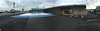
6 dolmens lie on the top of the eastern branch of the 'Y' shaped hill. One of the dolmen group around Uki delta.
You may be viewing yesterday's version of this page. To see the most up to date information please register for a free account.
Do not use the above information on other web sites or publications without permission of the contributor.
Nearby Images from Flickr
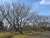
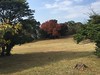
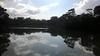

The above images may not be of the site on this page, but were taken nearby. They are loaded from Flickr so please click on them for image credits.
Click here to see more info for this site
Nearby sites
Click here to view sites on an interactive map of the areaKey: Red: member's photo, Blue: 3rd party photo, Yellow: other image, Green: no photo - please go there and take one, Grey: site destroyed
Download sites to:
KML (Google Earth)
GPX (GPS waypoints)
CSV (Garmin/Navman)
CSV (Excel)
To unlock full downloads you need to sign up as a Contributory Member. Otherwise downloads are limited to 50 sites.
Turn off the page maps and other distractions
Nearby sites listing. In the following links * = Image available
865m SE 137° Setoguchi* Burial Chamber or Dolmen
957m SE 127° Uki-Kunden* Burial Chamber or Dolmen
1.0km SE 138° Morita* Burial Chamber or Dolmen
1.7km E 97° Hayamajiri* Burial Chamber or Dolmen
5.5km NW 321° Kinshō-ji temple* Modern Stone Circle etc
5.9km NW 314° Nabatake* Ancient Village or Settlement
18.9km NE 51° Ishizaki-Magarita* Burial Chamber or Dolmen
20.6km ENE 59° Nagano-Miyanomae* Burial Chamber or Dolmen
20.9km SE 128° Teraura Haiji* Burial Chamber or Dolmen
21.0km NE 35° Shinmachi* Burial Chamber or Dolmen
22.2km ENE 64° Raizan* Hillfort
24.9km SE 125° Saori* Burial Chamber or Dolmen
25.4km NE 55° Hirabaru* Barrow Cemetery
25.7km S 177° Mifune-yama Rakuen* Modern Stone Circle etc
25.9km NE 55° Ishigasaki* Burial Chamber or Dolmen
26.5km NE 49° Shito* Burial Chamber or Dolmen
26.5km NE 55° Ita Sansho Jinja shrine* Burial Chamber or Dolmen
26.6km S 170° Otsuboyama* Hillfort
27.5km ENE 58° Itojō* Hillfort
27.5km NE 53° Senri Tobiishi* Burial Chamber or Dolmen
28.6km ESE 109° Nishikuma Kofun* Passage Grave
30.0km ESE 107° Kuboizumi-Maruyama* Burial Chamber or Dolmen
30.3km ESE 114° Tofusa* Burial Chamber or Dolmen
31.6km ESE 109° Muratokunaga* Burial Chamber or Dolmen
32.1km ESE 106° Obukumayama* Hillfort
View more nearby sites and additional images


 We would like to know more about this location. Please feel free to add a brief description and any relevant information in your own language.
 Wir möchten mehr über diese Stätte erfahren. Bitte zögern Sie nicht, eine kurze Beschreibung und relevante Informationen in Deutsch hinzuzufügen.
 Nous aimerions en savoir encore un peu sur les lieux. S'il vous plaît n'hesitez pas à ajouter une courte description et tous les renseignements pertinents dans votre propre langue.
 Quisieramos informarnos un poco más de las lugares. No dude en añadir una breve descripción y otros datos relevantes en su propio idioma.