


<< Text Pages >> Schlanteberg Huegelgrab - Round Barrow(s) in Germany in Mecklenburg-Western Pomerania
Submitted by holger_rix on Wednesday, 18 July 2012 Page Views: 1550
Neolithic and Bronze AgeSite Name: Schlanteberg Huegelgrab Alternative Name: FürstengräberCountry: Germany Land: Mecklenburg-Western Pomerania Type: Round Barrow(s)
Nearest Town: Bergen Nearest Village: Bisdamitz
Latitude: 54.567917N Longitude: 13.564974E
Condition:
| 5 | Perfect |
| 4 | Almost Perfect |
| 3 | Reasonable but with some damage |
| 2 | Ruined but still recognisable as an ancient site |
| 1 | Pretty much destroyed, possibly visible as crop marks |
| 0 | No data. |
| -1 | Completely destroyed |
| 5 | Superb |
| 4 | Good |
| 3 | Ordinary |
| 2 | Not Good |
| 1 | Awful |
| 0 | No data. |
| 5 | Can be driven to, probably with disabled access |
| 4 | Short walk on a footpath |
| 3 | Requiring a bit more of a walk |
| 2 | A long walk |
| 1 | In the middle of nowhere, a nightmare to find |
| 0 | No data. |
| 5 | co-ordinates taken by GPS or official recorded co-ordinates |
| 4 | co-ordinates scaled from a detailed map |
| 3 | co-ordinates scaled from a bad map |
| 2 | co-ordinates of the nearest village |
| 1 | co-ordinates of the nearest town |
| 0 | no data |
Be the first person to rate this site - see the 'Contribute!' box in the right hand menu.
Internal Links:
External Links:
Round Barrow in Mecklenburg-Western Pomerania
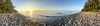
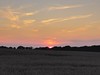
Round Barrow with a famous view.
103m above sea level.
You may be viewing yesterday's version of this page. To see the most up to date information please register for a free account.
Do not use the above information on other web sites or publications without permission of the contributor.
Nearby Images from Flickr

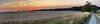
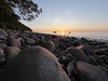
The above images may not be of the site on this page, but were taken nearby. They are loaded from Flickr so please click on them for image credits.
Click here to see more info for this site
Nearby sites
Click here to view sites on an interactive map of the areaKey: Red: member's photo, Blue: 3rd party photo, Yellow: other image, Green: no photo - please go there and take one, Grey: site destroyed
Download sites to:
KML (Google Earth)
GPX (GPS waypoints)
CSV (Garmin/Navman)
CSV (Excel)
To unlock full downloads you need to sign up as a Contributory Member. Otherwise downloads are limited to 50 sites.
Turn off the page maps and other distractions
Nearby sites listing. In the following links * = Image available
827m SSE 152° Quoltitz Opferstein* Rock Art
1.3km NNE 12° Nardevitz Findling Natural Stone / Erratic / Other Natural Feature
1.9km ESE 120° Wesselin Steingrab* Burial Chamber or Dolmen
2.6km E 100° Jaegerhof Grabhuegel Round Barrow(s)
3.3km SSE 147° Promoisel Grabhuegel Round Barrow(s)
3.4km E 80° Nipmerow Steingrab* Chambered Tomb
3.6km ESE 114° Barrten Grabhuegel Round Barrow(s)
3.6km ENE 57° Schwanenstein Lohme* Natural Stone / Erratic / Other Natural Feature
4.1km E 88° Hagen-Stubnitz Steingrab 2* Chambered Tomb
4.2km ENE 78° Ranzow Grabhuegel Round Barrow(s)
4.4km E 88° Hagen-Stubnitz Steingrab 1* Chambered Tomb
4.5km E 98° Hagen Grabhuegel Round Barrow(s)
4.6km ENE 72° Ranzow Steingrab* Chambered Tomb
4.8km ENE 69° Hankenufer Grabhuegel Round Barrow(s)
5.5km SSW 192° Dobberworth Huegelgrab* Round Barrow(s)
5.6km SE 141° Dargast Grabhuegel Round Barrow(s)
5.7km ESE 118° Trenzer Berg Grabhuegel 2 Round Barrow(s)
5.8km ESE 114° Kieler Bach Grabhuegel 1* Round Barrow(s)
6.2km E 94° Kollicker Ort Grabhügel 2 Round Barrow(s)
6.2km SE 130° Buddenhagen Grabhuegel 2 Round Barrow(s)
6.2km ESE 114° Kieler Bach Grabhuegel 2 Round Barrow(s)
6.2km ESE 122° Trenzer Berg Grabhuegel 1 Round Barrow(s)
6.3km SE 130° Buddenhagen Grabhuegel 1 Round Barrow(s)
6.3km E 82° Waschstein Stubbenkammer* Natural Stone / Erratic / Other Natural Feature
6.4km SE 133° Stubnitz Buddenhagen Steingrab* Chambered Tomb
View more nearby sites and additional images


 We would like to know more about this location. Please feel free to add a brief description and any relevant information in your own language.
 Wir möchten mehr über diese Stätte erfahren. Bitte zögern Sie nicht, eine kurze Beschreibung und relevante Informationen in Deutsch hinzuzufügen.
 Nous aimerions en savoir encore un peu sur les lieux. S'il vous plaît n'hesitez pas à ajouter une courte description et tous les renseignements pertinents dans votre propre langue.
 Quisieramos informarnos un poco más de las lugares. No dude en añadir una breve descripción y otros datos relevantes en su propio idioma.